Death Valley area ideal for spying short-lived desert blooms

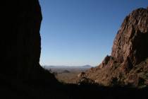
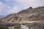
One of the great advantages of living in this region is being able to enjoy nature up close and privately, along the many uncrowded back roads. In the next couple of weeks, for instance, you can already enjoy spring in the lower parts of Death Valley. My favorite route for this time of year is the West Side Road, a 40-mile route skirting Badwater Basin along the base of the Panamint Mountain Range.
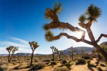
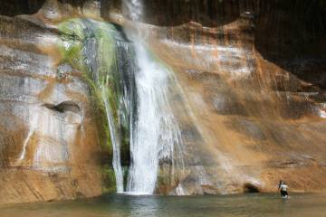
This year is turning out to be a banner one for wildflowers, and you're bound to find some good color on side trips up the canyons from West Side Road. Earlier this month, there were carpets of color along the West Side and Badwater Road. I found desert gold, periwinkle colored desert five-spot, brown-eyed evening primrose and purple caltha-leaved phacelia. Since Mother Nature is unpredictable, be sure to check the park service wildflower update before your visit to find the best places to see them at nps.gov/deva.
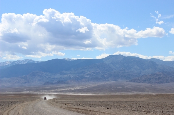
West Side Road also boasts historic sites and opportunities to explore one or more of the six side-canyon roads. The main route offers a mix of hard salt pan, sandy and rocky areas, and can usually be traveled with any high-clearance vehicle as long as it has very good off-road tires. But if you intend to explore the side canyons of Trail, Hanaupah, Johnson, Galena, Queen of Sheba and Warm Springs, I strongly recommend a four-wheel drive vehicle and some previous experience operating one.
Starting in the Furnace Creek area on California state Route 190, take the Badwater Road (California state Route 178) south for about 6.2 miles, and go right onto the signed West Side Road.
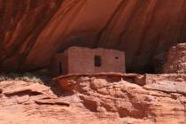
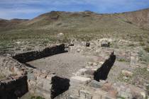
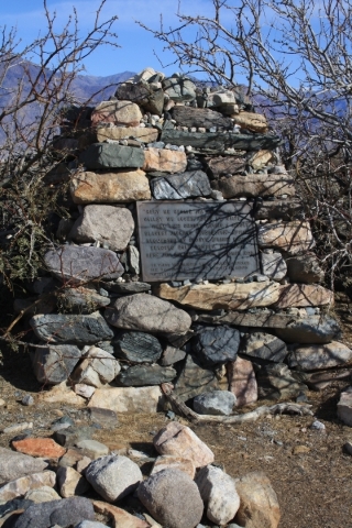
Frank "Shorty" Harris, one of the most famous gold prospectors in the region, is buried here. The grave is about 9 miles down the road, on your left, and is marked by a sign. Other highlights along the West Side Road are the ruins of the Eagle Borax Works, the first borax refinery in Death Valley, which operated from 1882 to 1884, and the area where Bennetts Long Camp was located.
If you don't choose to explore any of the side canyons after exiting West Side Road, returning to the Furnace Creek area via the paved Badwater Road will constitute a 44-mile round trip.
For an additional back-road experience, you can exit West Side Road, head south on Badwater Road for 3 miles, and go straight to take the Harry Wade Road through to the south end of the park. (The more usual route in this direction, continuing on Badwater Road up through Jubilee and Salisbury Pass to Shoshone, is temporarily closed.)
Harry Wade Road is 31 miles of gravel that brings you out the extreme southern part of the park to California state Route 127. From there, you can head north about 24 miles back to Shoshone and then go right onto California state Route 178 (which turns into Nevada state Route 372 at the Nevada boundary) for about 19 miles to Pahrump.
The Harry Wade Road is usually dry, but earlier this month, where the road crosses the Amargosa River, and about 13 miles into the drive, I had to ford a stream about 1 foot deep and 10 feet wide. But the Amargosa is an underground river most of the time, and this crossing should be dry when you go, unless it has rained quite recently.
Cell phones do not get reception on the West Side or Harry Wade roads, and it is common to spend an entire day driving these roads without seeing another vehicle, so you are definitely on your own. Therefore, be sure to bring plenty of extra water and food, in case you get stranded, as well as spare tires, tools for changing them, warm clothes, flashlights, matches, etc.
I make it a habit to visit the park website at nps.gov/deva before starting a trip to Death Valley, and it's also a good idea to make your first stop at the physical visitor center in Furnace Creek.
The center will have a copy of the daily morning report, which will give you up-to-date information about weather, road conditions and such. This is where you pay the entry fee to the park or show your park pass, and they will give you a park newspaper and map. Also available here is a backcountry road map published by the company that manufactures Jeep vehicles; however, you must ask for it. This offers basic information on some of the most popular gravel roads in the park.
— Deborah Wall is the author of "Great Hikes, A Cerca Country Guide" and "Base Camp Las Vegas: Hiking the Southwestern States," published by Stephens Press. She can be reached at deborabus@aol.com.
How to get there
From Las Vegas, take Interstate 15 south to Nevada state Route 160. Drive about 53 miles west to Pahrump. Turn left onto State Road 210, and drive 27 miles to Death Valley Junction. Go right, and then take an immediate left to California state Route 190 west for about 29 miles to Furnace Creek.