Naming Las Vegas: Bridge Mountain
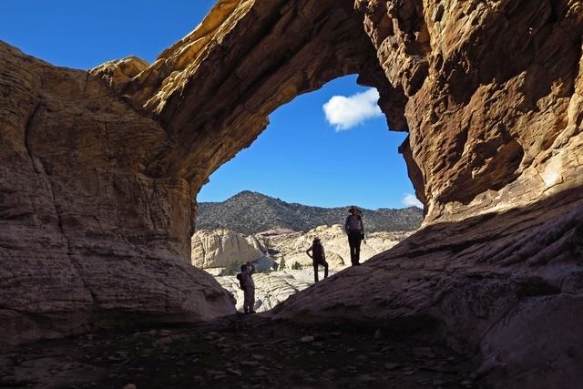
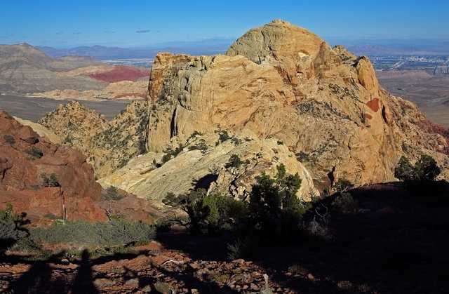
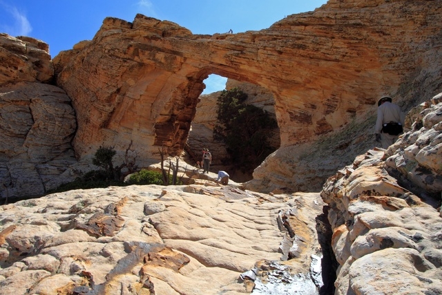


Bridge Mountain is one of the peaks surrounding Red Rock Canyon. Part of the Spring Mountains, it gets its name from the bridge-like natural sandstone arch — resembling those found in Arches National Park in Moab, Utah — which can be found near the summit.
The bridge is the remains of a tinaja — in English, a water tank — that eroded and left a remnant behind.
“There are a few places where we have arches in Red Rock. They’re just far between,” said Nick Saines, an interpretive naturalist and geologist at Red Rock Canyon Interpretive Association. “(It) just means you had erosion in one place where it was more easily eroded, and the rock above it was more tightly cemented, and the stuff below is eroded out. It’s called differential erosion, a difference in erosion rates. … It takes thousands of years to do.”
The Sierra Club lists Bridge Mountain as one of 99 peaks that qualify one for its Desert Peaks Section. Membership in the section is available to Sierra Club members who have climbed any six peaks on the list.
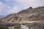
Experienced hikers can follow the marked trail along the crest, which descends to the sandstone escarpment via elements such as climbing down a chimney and a steep, difficult ridge and using a crack in the rock for climbing. It eventually leads up to the natural bridge for which the mountain is named.
Kay Blackwell, a member of the Around the Bend Friends Hiking Club of Las Vegas, has done the hike three times.
“It’s kind of steep, and you kind of have to hang off the side of the mountain,” she said, estimating the arch to be about 20 feet tall on the inside, but “when you’re standing on top of it, you’re probably about 30 feet off the ground.”
The arch is about 4 or 5 feet wide where one stands on it. Blackwell said photographing it was tricky because of the well in the middle, which is usually in shadow.
“Now, I did see a picture; it was hanging at the (Red Rock Canyon) Visitors Center. I think it won an award from Friends of Red Rock or something,” she said. “Oh, my goodness, it was so gorgeous. The water in the well, the tinaja, was reflecting the arch, and it was a sunrise. The reflection was so clear, and the sky … it was really pretty. I think someone had to camp up there to get that shot.”
Bridge Mountain’s elevation is listed as 6,955 feet. The east-side approach is via Red Rock Canyon’s Scenic Loop Drive. Go more than halfway around the loop and take the right turn to the Willow Springs Picnic Area.
Those who reach the top can add their name to a notebook found inside a small box. Breathtaking views of the Las Vegas Valley can be seen from the eastern side of a small ponderosa pine forest in a depression near the top.
Chris Dempsey is a former board member of Friends of Red Rock Canyon and now volunteers as a hike program coordinator for Around the Bend. He hiked Bridge Mountain once about eight years ago.
“But I’ve done North Creek, which is right across from it, on about 40 occasions, and you can see it from there, across Ice Box Canyon,” he said. “It’s pretty spectacular. When you look across, you wonder how anybody can get up there. They have to climb up through this crack, and it’s not for the faint of heart.”
For more information about accessing Bridge Mountain’s trailheads and planning a hike, visit alltrails.com/trail/us/nevada/bridge-mountain-trail.
Contact Summerlin/Summerlin South View reporter Jan Hogan at jhogan@viewnews.com or 702-387-2949.
Naming Las Vegas
The history behind the naming of various streets, parks, schools, public facilities and other landmarks in the Las Vegas Valley will continue to be explored in a series of feature stories appearing in View editions published on the first Tuesday of every month. If you’re curious about how or why something got its name, post a comment on our Facebook page, facebook.com/viewnewspapers, or email sblust@viewnews.com.