
Explore scenic route near historic Caliente
The little railroad town of Caliente welcomes travelers along U.S. Highway 93, a portal to eastern Nevada’s many scenic and historic attractions. Its tree-lined streets mark a change after miles dominated by sage-covered desert.
To reach Caliente, 150 miles north of Las Vegas, drive north on Interstate 15. At the Apex exit, about 20 miles from town, turn onto U.S. 93. Follow this route north into Lincoln County, passing the beautiful Pahranagat lakes and verdant ranch country around Alamo. The highway then cuts through sage-covered flats and climbs a couple of summits in areas wooded with pinyons and junipers. The highway descends into the Meadow Valley Wash at Caliente.
Take a little time to explore the former railroad service center. It was just a crossroads in a ranching area before the railroad arrived. Caliente was founded in 1901. It took its name, Spanish for “hot,” from nearby hot springs. The Union Pacific trains still roll through the area, but they no longer pause for water or stop at Caliente’s handsome mission-style depot, built in 1923. The repurposed building now serves the community in other ways.
Caliente straddles the railroad tracks. The highway, businesses and most residential streets are west of the tracks, and the old commercial district and more residences lie to the east. Many commercial buildings date from a period of reconstruction in 1928 following devastating fires. A row of two-story homes, built for railroad employees in 1905, lines U.S. 93 where it makes a bend downtown. The sturdy, craftsman-style homes still house Caliente families.
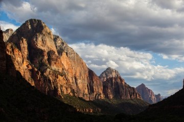
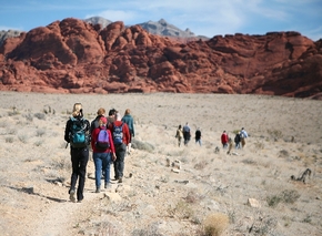
Caliente is within 50 miles of several state parks and historic towns such as Pioche, a former mining boomtown, and Panaca, the oldest community in eastern Nevada. Most attractions are north of Caliente, luring campers, boaters, anglers, hikers, horsemen and off-highway vehicle enthusiasts. Fewer visitors explore south of Caliente, where a small state park and a scenic backcountry drive provide opportunities for picnicking, camping, hiking, perusing ancient rock art sites and enjoying pastoral ranches and colorful canyons.
Rainbow Canyon Road, state Route 317, heads south from U.S. 93 as it enters Caliente. A couple of miles from the turnoff, watch for the short access road into a side canyon where Kershaw-Ryan State Park is located. The site of gardens and orchards planted in the late 1800s, the box canyon became a Nevada state park in 1935 and is named for early ranching families.
Never far from the sound of running water, visitors can picnic, camp, hike and splash in a pond fed by springs dripping from a weeping cliff. Most facilities were destroyed or damaged by flash floods in 1984. The park was closed for reconstruction until 1997 and then reopened only for day use.
Campers can now stay overnight at Kershaw-Ryan in a new 15-unit RV and tent campground. Nevadans pay a $5 entry fee and a campsite fee of $15. Nonresidents pay $7 to enter and $17 to camp.
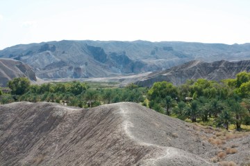
State Route 317 runs south for 21 scenic miles through a canyon with soaring cliffs and stands of cottonwoods along a stream. Rainbow Canyon has a history of flash floods, which wiped out the railroad in the early days. The well-watered canyon attracted native cultures, who left behind ancient rock art sites. You can find a listing of several sites along the route at lincolncountrynevada.com.
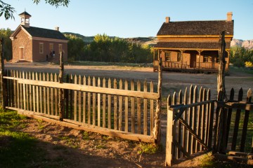
The pavement ends at the site of old Elgin. Pause to walk around the grounds of the Elgin Schoolhouse State Historic Site, a one-room school that served area children for decades. Take Kane Springs Wash Road, a good graded route, to return to U.S. 93 south of Alamo.
Margo Bartlett Pesek’s Trip of the Week column appears on Sundays.