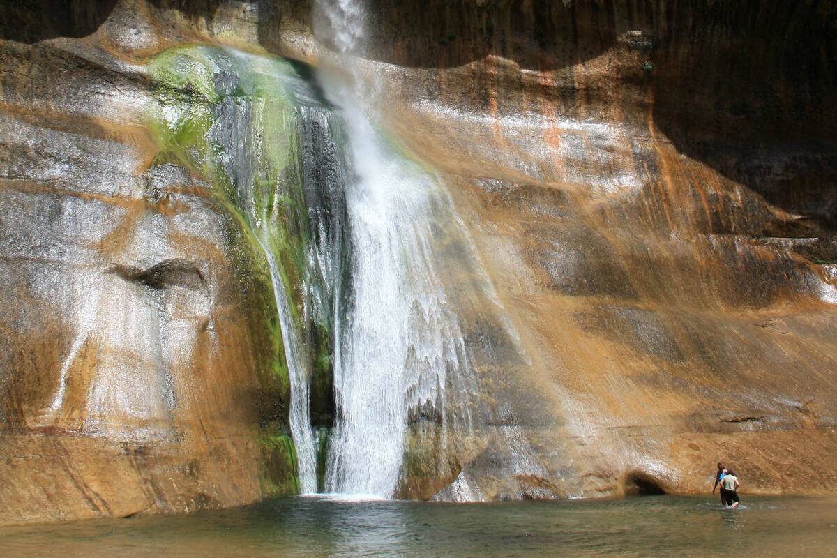
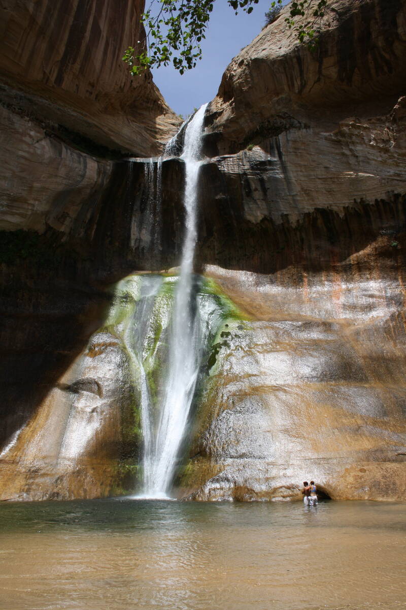
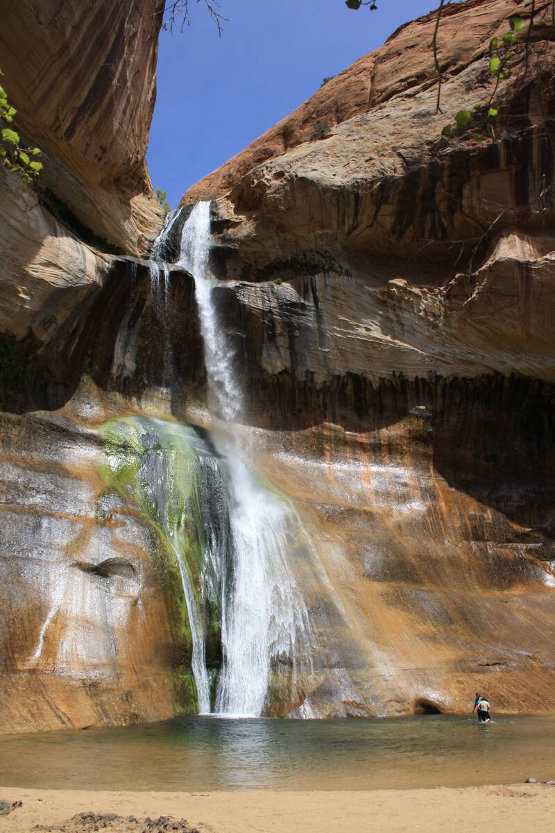
Hiking Utah’s Calf Creek: 126-foot waterfall and riparian habitat


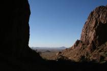
While it would take a lifetime to see all the extraordinary wonders of the 1.87 million-acre Grand Staircase- Escalante National Monument in Utah, even on a short visit you can hike to some of the highlights. One of the standouts most people are eager to visit is Lower Calf Creek Falls.
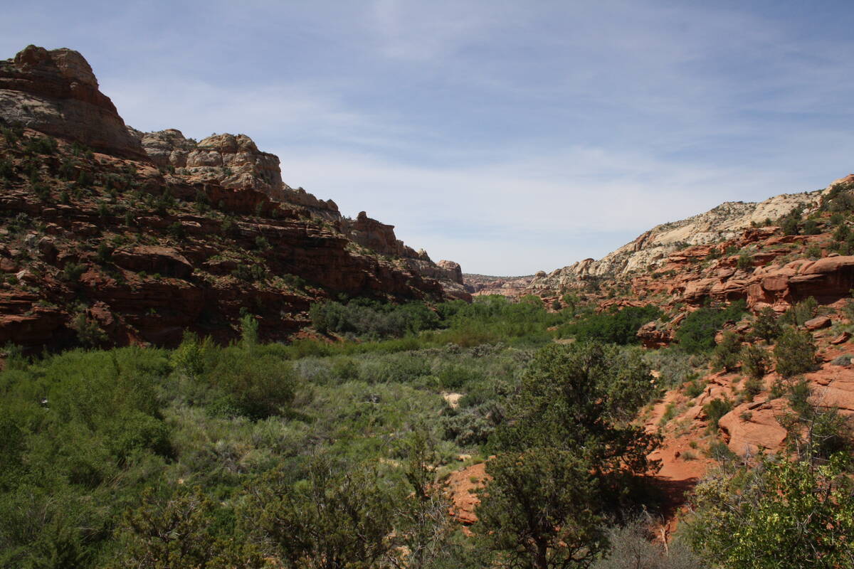
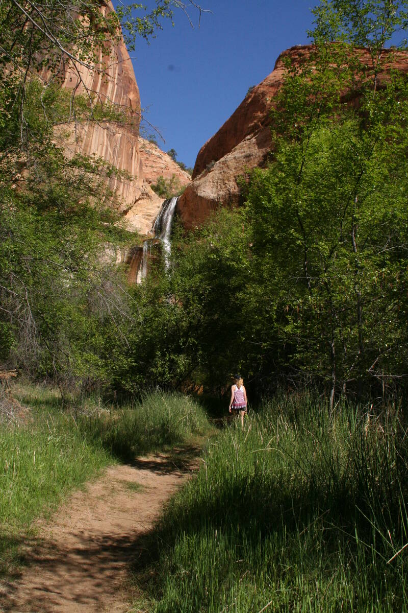
For many, the hike is all about getting to the 126-foot waterfall, where they can swim or soak in the crystal-clear water, or just sit on the natural sandy beach in the shade. But you’ll also find the entire trail will keep you interested. Along the way, you’ll encounter pre-historic pictographs and granaries, geological formations such as alcoves, arches, and water pockets, throughout a healthy riparian habitat that supports a variety of wildlife and water-loving vegetation.
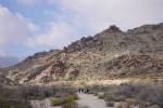
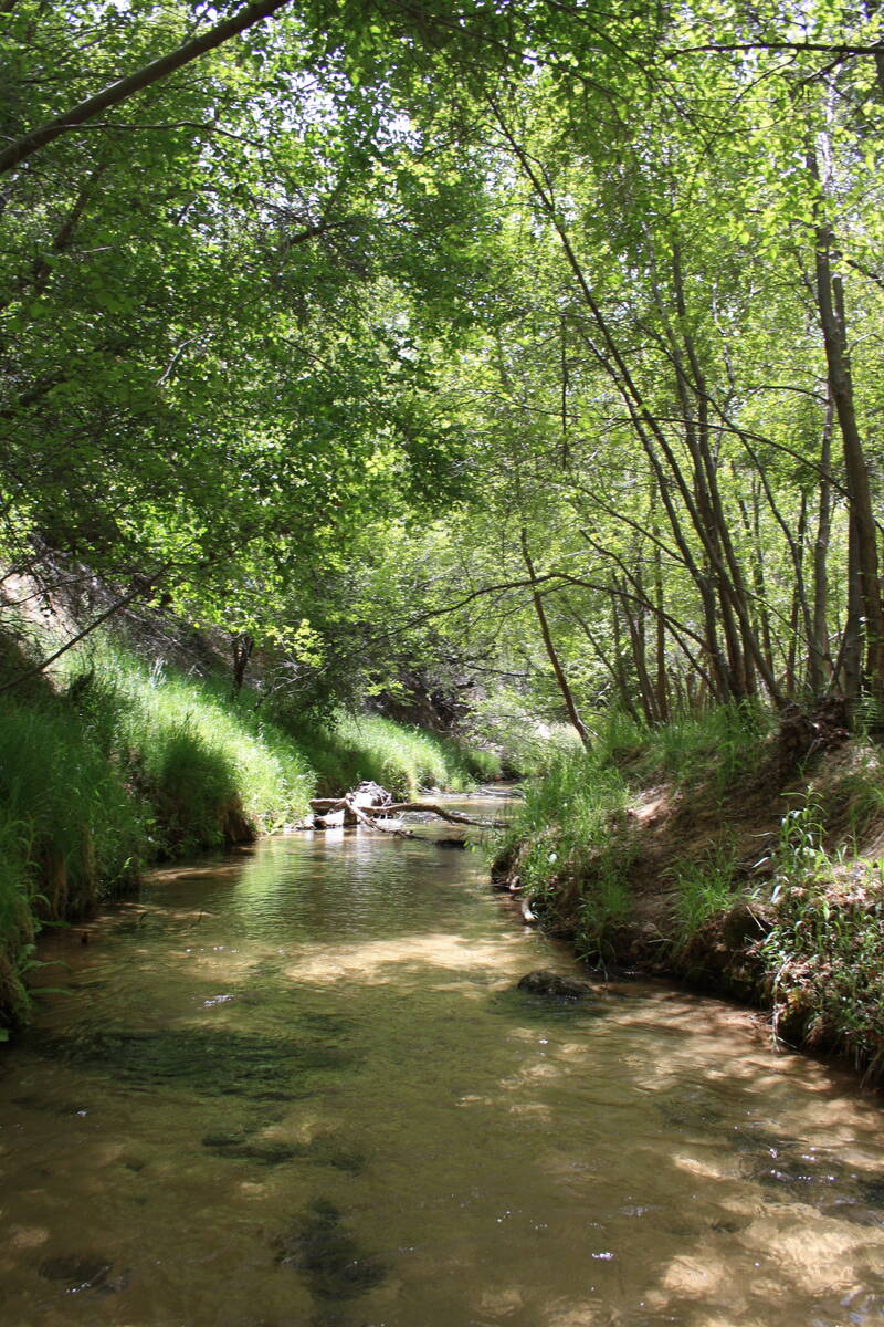
The trail starts at the north end of the Calf Creek Recreation Area campground at an elevation of 5,346 feet. At the trailhead, be sure to pick up a brochure that will help you find the points of interest. Calf Creek is a perennial stream that has carved a deep canyon through red and orange Navajo sandstone. The trail is six miles roundtrip and includes a bit of rocky terrain, but it’s a moderate hike with an elevation gain of only 190 feet.
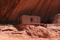
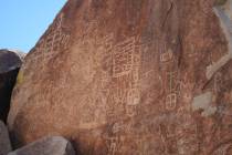
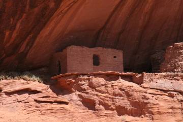
Bring your binoculars on this trail to get a closer look at some of the archaeological sites. Tucked into small alcoves you can find a couple of pre-historic granaries, constructed more than 800 years ago by people of the Fremont culture. They grew corn, beans and squash here and gathered native plants such as pinyon nuts and berries. The canyon also supplied them with fish, deer and small mammals.
Warrior pictographs can be seen across the canyon on the east side. Look on the smooth-faced wall for three large figures painted in red pigment. Their trapezoidal shape with legs and arms along with headdresses are a good representation of Fremont-style rock art. Like all archaeological sites, one should never touch or otherwise disturb these fragile drawings.
In more modern times, pioneers used a few of the box canyons to fence in their weaned calves, hence the name Calf Creek. In the 1900s, settlers grew watermelons, which flourished in this rich environment.
In the last half mile or so from the waterfall, you will feel the temperature drop as the trail becomes canopied by mature trees. Soon you will be able to hear the falls before seeing them. Box elder and other water-loving trees, such as river birch, cottonwood and willow, thrive here. Listen and look for spotted towhees, hummingbirds and robins darting around. One early morning about 20 years ago I came upon newly hatched wild turkeys (poults) frolicking about their mother hen. An eye to the sky might treat you to the sight of peregrine falcons and golden eagles.
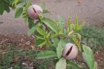
Where the waterfall cascades down the cliff faces, many lovely plants thrive. Look for alcove columbines, scarlet monkey flower, Easter flower and maidenhair fern, which all flourish in the mist and the seepage on the cliff walls.
The ideal times to hike this trail are from May to mid-June and then mid-September to November. The month of May usually boasts high temperatures in the 70s and low 80s, dipping down to the 40s overnight. Start on the trail at the crack of dawn as it can get crowded by midday. With an early start, you can have the waterfall and pool to yourself and be back at the trailhead before noon, ready for your next adventure. Bring food and all your own drinking water, and wear quick-drying clothes or a swimsuit and water shoes such as Chacos or Tevas. If you are going in the water, choose only waterproof sunscreen, to minimize water contamination of this aquatic ecosystem.
The trip is well worth your time, but a five-hour drive from Las Vegas means advance planning is in order.
Particularly useful is the Escalante Interagency Visitor Center website. This center’s location is also worth a visit at 755 West Main Street in Escalante. The phone is 435-826-5499.
To reach the trailhead from the town of Escalante, drive east on Utah Route 12 for about 16 miles and go left into BLM Calf Creek Recreation Area and parking area.