DRI to partner with Google on global water usage mapping project

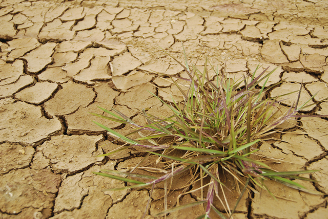


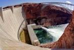
As part of an Obama administration climate-change initiative, Nevada’s Desert Research Institute has partnered with Google to map and monitor droughts in the United States, and water consumption worldwide.
The administration this week launched the Climate Data Initiative, which releases federal government climate data in hopes of sparking entrepreneurship to promote climate-change preparedness.
The maps and tools created by the initiative will concern heat, drought, flooding and sea-rise and will be available at www.climate.data.gov.
The initiative aims to prepare Americans for climate change and free up government data to be used for planning by builders, farmers, hospital officials and business owners. Land developers, for example, could use sea-level rise predictions to decide where to build. Utilities could use maps to identify threats to water supplies.
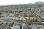
Google will donate a petabyte, equivalent to 1,000 terbytes, of cloud storage to host high-resolution maps, as well as 50 million hours of cloud computing on the Google Earth Engine environmental monitoring platform. Google Earth Engine was notably used to create satellite-collected aerial timelapses of changing landscapes, including that of Las Vegas.
“A petabyte is signicant,” said Jim Thomas, executive director of hydrologic sciences at DRI. “You have to have that kind of capacity to store this data.”
The partnership will allow DRI to access the program for free. Thomas said DRI is also in the process of applying for Google research grants.
DRI, the environmental research arm of the Nevada System of Higher Education, and the universities of Idaho and Nebraska were chosen by Google to participate in the project.
“We were honored when Google reached out to us to help them produce high-impact products in support of President Obama’s climate data initiative,” said DRI President Stephen G. Wells. “This is exactly the kind of public-private-sector partnership that will foster innovation in the higher-education research community and allow us, as scientists, to create data-driven solutions for businesses, communities, resource managers and policy makers.”
Assistant research professor Justin Huntington and staff research scientist Charles Morton will lead the DRI project.
The scientists will use Google Earth Engine to analyze Landsat satellite images since 1984. Landsat images are clear enough to show when land was wet or dry.
The Climate Data Initiative includes a number of government commitments, including coastal preparedness and the continued release of information. Tech companies such as Intel and Microsoft, among others, are hosting hackathons and donating cloud storage.
The Climate Data Initiative is part of the president’s July 2013 Climate Change Action plan to reduce carbon pollution and address climate change.
DRI studies air, land and life, climate change, renewable energy and water on every continent with the goal of understanding environmental change and improving human life. It employs more than 500 people, works on every continent and has campuses at the University of Nevada, Las Vegas and in Reno.
Contact reporter Kristy Totten at ktotten@reviewjournal.com or 702-477-3809. Follow her on Twitter @kristy_tea.