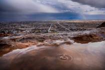
Flash-flood warning issued for Mount Charleston


The excessive-heat warning blanketing the Las Vegas Valley will hold until Wednesday night, the National Weather Service said.
The forecast high on the last day of the heat warning, expected to end at 8 p.m. Wednesday, will hit 107 degrees.
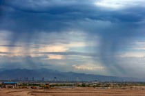
Tuesday’s high of 110 degrees tied the day’s record high, last reached in 1948 and 1944, meteorologist Jim Harrison said. He said southern parts of the valley had wind gusts of about 40 mph, with weakening winds farther north in the valley. He attributed the gusts to rapidly deteriorating thunderstorms over the Spring Mountains.
A flash-flood warning for Mount Charleston was canceled early, Harrison said. The Weather Service had previously warned the public of debris flowing through Kyle Canyon and Lee Canyon roads.
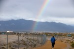
Harrison said there was still a chance on Wednesday and Thursday for isolated and scattered thunderstorms over the Spring Mountains and possibly the Sheep Range.
“We could see something trying to sneak into the valley,” he said.
Above-normal temperatures in the lower 100s will linger through the weekend. Harrison said the forecast highs for Thursday, Friday and Saturday were 103, 105 and 104 degrees, respectively.
The average forecast high for this time of year is 99 degrees, according to the weather service.
COOLING STATIONS NOW OPEN thru Wednesday during EXCESSIVE HEAT WARNING in LAS VEGAS thru 8PM Wednesday. pic.twitter.com/7FH1hkqDc2
— Las Vegas FireRescue (@LasVegasFD) August 29, 2017
Contact Rio Lacanlale at rlacanlale@reviewjournal.com or 702-383-0381. Follow @riolacanlale on Twitter.
Review-Journal staff writer Mike Shoro contributed to this story.
Cooling stations open
Clark County opened additional cooling stations for homeless people Monday. The stations will be open through Wednesday.
• Walnut Recreation Center, 3075 N. Walnut Road; 702-455-8402
• Pearson Community Center, 1625 W. Carey Ave.; 702-455-1221
• Stupak Community Center, 251 W. Boston Ave.; 702-229-2488
• Dula Gymnasium, 441 E. Bonanza Road; 702-229-6307
• Hollywood Recreation Center, 1650 S. Hollywood Blvd. 702-455-0566
• Cambridge Recreation Center, 3930 Cambridge St.; 702-455-7169
• Whitney Ranch Recreation Center, 1575 Galleria Dr.; 702-267-5850
• Downtown Recreation Center, 105 W. Basic Road; 702-267-4040
• Black Mountain Recreation Center, 599 Greenway Road; 702-267-4070
• Veterans Village, 1150 Las Vegas Boulevard South; 702-222-1680