Abandoned but not forgotten: 5 ghost towns in Southern Nevada


The remnants of Nevada’s abandoned boomtowns and settlements are scattered across the desert, if you know where to look.
Experts say that Nevada has up to 600 ghost towns throughout the state. Many have left no traces other than historical records and a set of coordinates leading to a barren patch of land with discarded building foundations.
Most in-tact ghost towns are concentrated in central and northern parts of Nevada where mining was more abundant in the late 1800s and early 1900s, said Megg Mueller, who has co-authored a book on ghost towns and is the content development director for the Nevada Division of Tourism.
But there are still several historic and abandoned communities near Southern Nevada that have left traces behind.
“They won’t last forever, these ghost towns will eventually fade,” she said. “…Time, weather, will take them down.”
Mueller said there’s not an agreed-upon, official definition of a ghost town, but basically “it’s a town where people used to live that don’t anymore, and there are remnants of it.”
Here are some ghost towns in and around Southern Nevada:
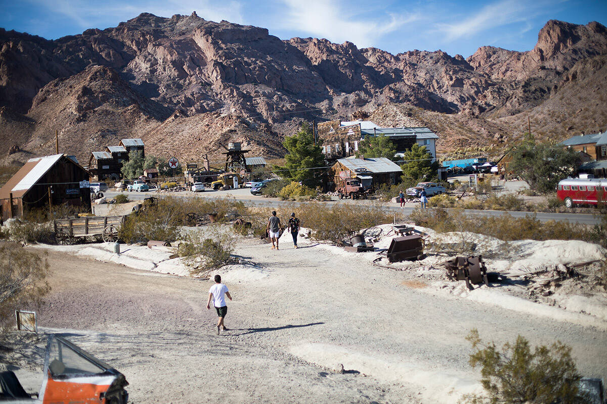
Nelson
Coordinates: 35.70987911297017, -114.8029108551516
Nelson is less than an hour from the center of Las Vegas, and is more commercialized than other ghost towns. A short drive from the small town of Nelson lies the El Dorado Mine, which is open to tours. Near the mine is a collection of restored buildings that are used as backdrops for weddings and movies.
St. Thomas
Coordinates: 36.4658102, -114.3702536
Members of the Church of Jesus Christ of Latter Day Saints formed this settlement in 1865. It was once the county seat of Arizona’s former Pah Ute County, according to information from the U.S. Geological Survey. The town was abandoned and submerged underwater when the Hoover Dam was constructed, but some ruins have been exposed to the elements as Colorado River levels have decreased. Other small settlements and camps in the area covered by the Colorado River include Kaolin, Fort Callville and Junction City.
Elgin
Coordinates: 37.3519112, -114.5358261
The town of Elgin was settled in 1882 south of Caliente, along the Muddy River. The community was focused on ranching instead of mining, so Elgin is more of a historic site rather than a traditional ghost town. All that remains is the one-room Elgin Schoolhouse built in 1922, which operated for 45 years. The schoolhouse is now run by the Nevada State Park system and is open for tours the first Saturday of the month or by appointment.
Delamar
Coordinates: 37.4580195, -114.7700032
Delamar is located about 140 miles north of Las Vegas, down an unpaved road off U.S. Highway 93. There are well-preserved remains in this ghost town, which had more than 3,000 residents during its heyday, according to the Nevada Department of Tourism. The town was known for gold and silver mining, and was nicknamed “The Widowmaker” because of toxic silica dust produced in the mining process. Most mining efforts were shut down by 1909 following a fire that partially destroyed the town a decade prior.
Rhyolite
Coordinates: 36.9038338, -116.8292274
Just outside of Beatty and near the entrance to Death Valley National Park lies the ghost town of Rhyolite. Prospectors found quartz near the town in 1904, prompting several settlements to form in the Bullfrog mining district. Electricity to the once thriving town was turned off in 1916, five years after the nearby mine and mill closed down. The land is now controlled by the Bureau of Land Management and includes ruins of the town’s bank, jail and train depot. The Goldwell Open Air Museum displays several sculptures in an art gallery near the entrance to the ghost town.
Contact Katelyn Newberg at knewberg@reviewjournal.com or 702-383-0240.