
Google’s new ‘River View’ carries web surfers through the Grand Canyon
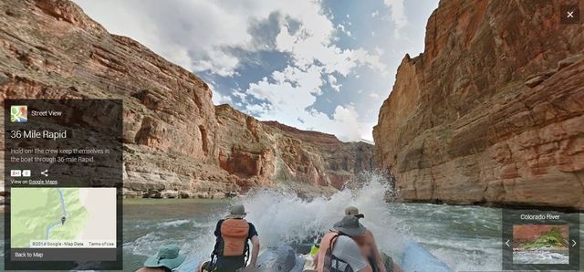
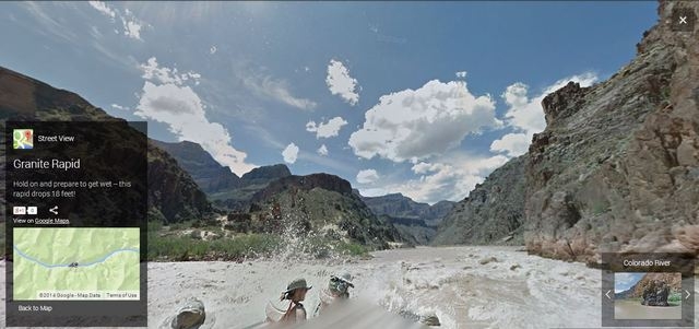


If you’ve always wanted to take a trip through the Grand Canyon on the Colorado River, now you can do it from the comfort of your own home.
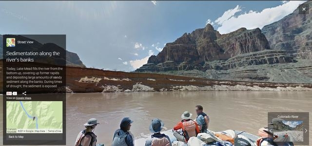
And you’ll even feel like you’re exploring the river from a raft with paddles in hand, without the inconvenience of getting soaked and possibly drowning.
Google and American Rivers added 286 miles of the 1,450-mile Colorado River to Google Maps Street View Thursday. It is the first major stretch of whitewater in the United States to be included in Google Map Views, according to American Rivers.
“Making Street View imagery available of the Colorado River is a tremendous opportunity for us to drive interest for this historical and natural landmark,” Google’s Karin Tuxen-Bettman told USA Today. “We hope this inspires viewers to take an active interest in preserving it.”
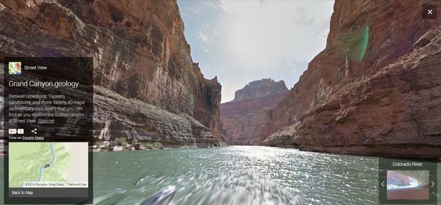
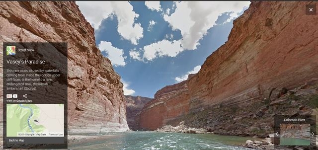
The additions to Street View give you a plethora of different views of the Colorado River through Grand Canyon National Park.
According to the Los Angeles Times, the Google Earth Outreach Team used two Trekker cameras, each with 15 lenses, to capture every direction and snap photos every 2.5 seconds.
“We collected photos when the sun was the highest,” Karin Tuxen-Bettman, leader of the Colorado River Street View Project, told the Times. “The canyon is narrow in places, and we didn’t want shadows overtaking (the shots).”
The new Colorado River additions also include 360-degree images of hikes on side canyons within the Grand Canyon, including Fern Glen Canyon and North Canyon.
Street View provides 360-degree images along more than 5 million miles in more than 50 countries and seven continents.


