
Storms dump rain in Spring Mountains; lightning sparks wildfires


Lightning fires and flash floods are sure signs of summer in Southern Nevada. Tuesday brought both.
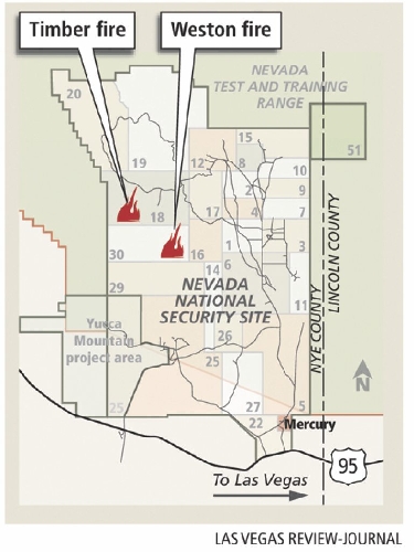
Two wildfires, probably sparked by lightning, burned more than 2,000 acres within the Nevada National Security Site, the former Nevada Test Site, 65 miles northwest of Las Vegas.
The fires are in a remote section of the 1,360-square-mile government test site, and no structures were threatened, spokeswoman Dona Merritt of the U.S. Department of Energy said. Firefighters from the security site and the Bureau of Land Management were battling the blazes, and officials were waiting for field reports revealing whether the fires were contained or spreading late Tuesday, Merritt said.
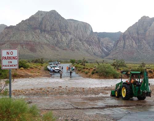
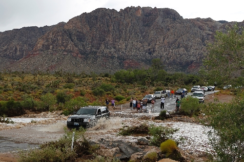
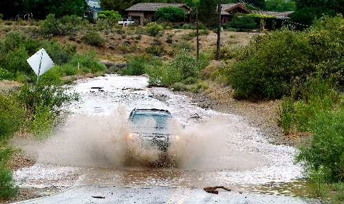
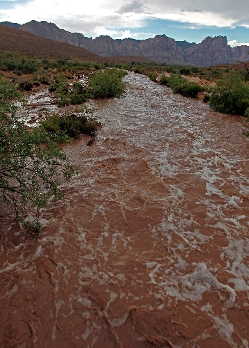
The stormy weather dumped up to 5 inches of rain in two hours in Red Rock Canyon and caused some flash flooding in the area, a National Weather Service official said.
The rain and runoff forced officials to close the scenic loop in the Red Rock National Conservation Area. And it stranded several drivers on nearby Bonnie Springs Road after a wash flooded and covered the road in water and dirt.
Most of the storm had dissipated by 4:30 p.m., and higher-clearance vehicles were able to cross the wash at Bonnie Springs. The scenic drive was scheduled to reopen today .
The National Weather Service had posted flash flood warnings for parts of Clark County, including Mountain Springs, Spring Mountain Ranch and Highway 160, throughout the afternoon.
Southern Nevada could see plenty more monsoonal moisture this week, said Justin Gibbs, a meteorologist with the National Weather Service.
"There's a one in three chance you're going to get rained on at some point over the next four or five days" in the Las Vegas Valley, he said.
The combination of heat and moisture will produce scattered thunderstorms around Clark County through Saturday, he said.
"We'll have some fairly active weather for the next several days."
Partly sunny skies were forecast for today in Las Vegas, with a high near 102. There's up to a 30 percent chance of showers and thunderstorms in the valley Thursday through Saturday.
A severe thunderstorm about 13 miles southwest of Primm prompted a warning Tuesday, but that storm weakened by late afternoon, according to the weather service. As the storm developed earlier, there were warnings of hail and 60 mph winds.
Earlier, a stationary storm cell about 14 miles north of Mount Charleston dumped heavy rain.
The weather service on Tuesday also issued several flood watches in Northern Nevada for a number of mountain streams and swollen rivers stretching from the Sierra to Elko County.
A flash flood watch is in effect through tonight for much of Mineral County and southern Lyon County, including Hawthorne, Yerington and Smith Valley, and across the California line in Bridgeport, Mammoth Lakes, Coleville and Topaz Lake.
The service said a series of thunderstorms that developed in the Sierra on Tuesday afternoon could bring heavy rainfall to the region into today.
In Elko County, Lamoille Creek moved slightly above flood stage and was expected to continue to rise until late Thursday night. The Humboldt River also continued to flow above flood stage, which could affect lowlands in Winnemucca.
The Associated Press contributed to this report. Contact reporter Lynnette Curtis at lcurtis@reviewjournal.com or 702-383-0285. Contact reporter Trevon Milliard at tmilliard@reviewjournal.com or 702-383-0279.


