
‘Shared sense of history’: Mapping Nevada’s historic markers in Clark County


Along Nevada’s highways and dusty desert trails stand monuments to the past, marking historical moments across the state.
Nevada has more than 260 historic markers, and about two dozen are located in Clark County. Most markers are large, bright blue signs that stand out against the desert landscape and are shaped like the state’s boundaries. The iconic design began in the 1970s, and before then, historic markers were often large concrete or stone structures. Other locations are denoted by plaques on the sides of buildings.
Historic markers originate from Nevada’s State Historic Preservation Office and often start as suggestions from the public, said Art Krupicz, Nevada’s state historic preservation officer. The final version of each sign is approved by the Nevada Board of Museums and History.
The markers differ from locations on state or national historic registries, which can have rigid qualifications. Instead, the markers often designate more “ephemeral” locations such as trails, valleys or old mining towns that lack noticeable walls or borders, Krupicz said.
“I’d like to think it creates a shared sense of history and place,” Krupicz said. “The markers, I guess I’m saying, are a little part of what makes someone a Nevadan.”
While the Nevada State Historic Preservation Office maintains a map and list of the markers, several in Clark County have been reported missing. The Nevada Division of State Parks received funding last year to take over maintenance of the signs and repair damaged markers, said Chris Johnson, a park and recreation program manager for the parks division.
Anyone who notices a missing or damaged marker can reach out to the parks division at stparks@parks.nv.gov.
Krupicz said the state is looking into creating more historic markers, particularly ones focused on recent Las Vegas history from the 20th century. Current markers often focus on the area’s early European history or Nevada’s pioneer roots.
The markers have become notable landmarks throughout Nevada. Las Vegas resident Shelly Morris has been intentionally visiting the markers for several years, planning day trips to drive to new locations and document her journeys on social media.
Morris said that because she didn’t grow up in Nevada, she enjoys visiting the locations to learn about the state’s history. She estimates that she’s traveled to nearly 50 markers so far.
“I fell in love with taking pictures of weird, old things,” Morris said.
Want to plan your own trip through Southern Nevada’s history? Here are eight notable markers located in Clark County:
Arrowhead Trail
This marker is inside the boundaries of Valley of Fire State Park and designates an early automobile route across unpaved desert roads that connected Los Angeles and Salt Lake City. A section of the route between Las Vegas and St. Thomas was constructed in 1915.
“You look out there, and there’s little to no sign of a road today,” Johnson said.
Powell of the Colorado
This marker is inside the Echo Bay picnic area and lower campground within Lake Mead National Recreation Area. The sign is 12 miles north of where explorer John Wesley Powell landed at the Virgin River in 1869, after completing the first U.S. government-sponsored expedition through the Grand Canyon.
Tule Springs
Located near Tule Springs Lake and Floyd Lamb Park, this marker designates one of the few places in the U.S. where people have found evidence of human presence before 11,000 B.C. Fossil evidence has been found of extinct animals, including the ground sloth, mammoth and prehistoric horses.
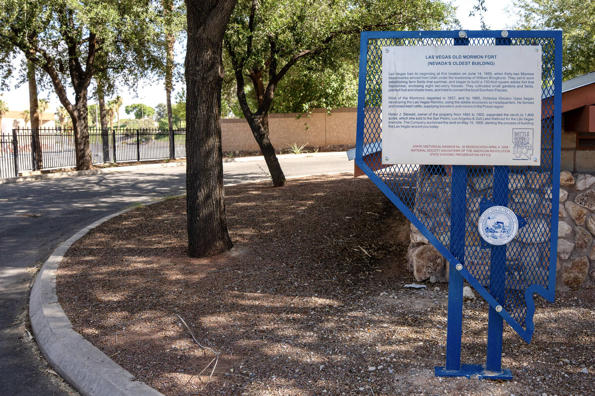
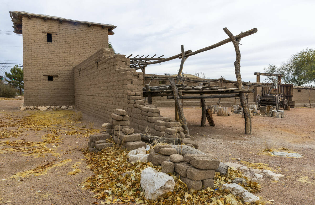
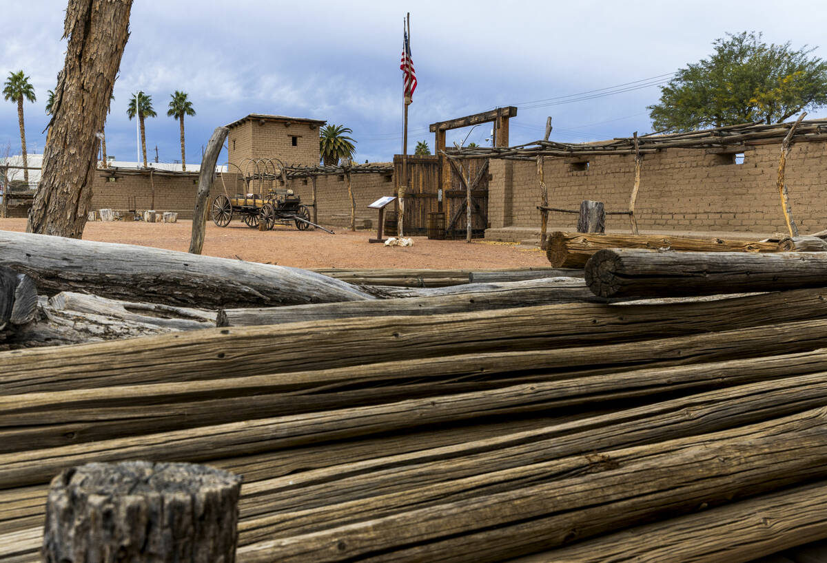
Las Vegas Old Mormon Fort
This marker, located at the fort in the middle of downtown Las Vegas, designates the first permanent, non-native settlement in the Las Vegas Valley. Members of the Church of Jesus Christ of Latter-day Saints settled at the location in 1855 and built the adobe fort that enclosed eight two-story homes.
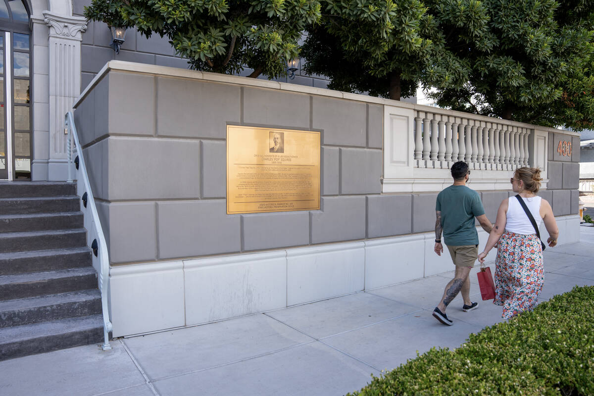
Original home of ‘Pop’ Squires
Instead of a large blue sign, this marker takes the form of a metal plaque on the side of a law office building off of Seventh Street in downtown Las Vegas. The marker designates where Charles “Pop” Squires lived from 1931 until his death in 1958. Squires, a prominent businessman and publisher of the Las Vegas Age newspaper, was known as the “Father of Las Vegas.”
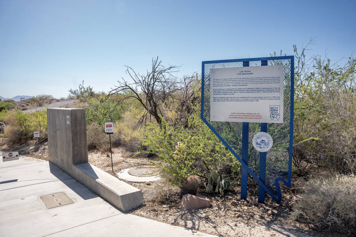
Las Vegas (The Meadows)
This marker is located within the Las Vegas Springs Preserve, near the start of the preserve’s trails. Spanish-speaking travelers journeying through the area noted streams of water that created meadows in the valley, leading to the area’s name of “Las Vegas,” which translates to “The Meadows.”
Old Spanish Trail
Clark County has several markers designating different spots on the Old Spanish Trail, a historic horse trail that connected Santa Fe, New Mexico, and Los Angeles when the area was controlled by Mexico. The trail marker that is the most centrally located is near Lake Las Vegas, off of Lake Mead Parkway. Krupicz said the Old Spanish Trail markers are some of his favorites in the area because of how “integral” the trail was to early transportation routes and the formation of European settlements in Southern Nevada.
The Garces Expedition
Located off of Needles Highway and across from Big Bend of the Colorado State Recreation Area, this marker designates where Spanish missionary Fray Francisco Hermenegildo Garces first entered the present boundary of Nevada in 1776. Garces was the first European to enter the area as Native American guides helped him travel between communities.
Contact Katelyn Newberg at knewberg@reviewjournal.com or 702-383-0240.


