
Taking the back way to Jerome


Williams, Ariz., a small town along Interstate 40 in northern Arizona, bills itself as the "Gateway to the Grand Canyon" and that is true. You can head north to Arizona's largest and most famous canyon, the Grand Canyon. But, you'll miss most of the tourists and have a unique drive if you go south to Sycamore Canyon, Arizona's second largest, and end up in Jerome, an old mining town still slightly populated with people and ghosts.
Although the 55,937-acre Sycamore Canyon Wilderness Area is not open to motorized vehicles, there are still plenty of dirt roads, trails and spreading vistas. Plus, you'll probably have it all to yourself. In places, Sycamore Canyon is seven miles wide, cutting a 21-mile-long gash into the southern edge of the Mogollon Rim. It starts in the largest ponderosa pine forest in the world, dropping down to the rare and wonderful desert riparian area of the Verde River Valley.
Photographer Bernadette Heath and I, along with our husbands, started out in Williams by turning south on Fourth Street. The locals call this South Road or the Perkinsville Road but Coconino County labels it Highway 73. To further confuse matters, at times the road may be labeled any of the three names or a Forest Road Number. A good Forest Service map of the Prescott Forest (which shows the southern portion of the Kaibab Forest) is available at the Williams Ranger Station or the Williams Visitors Center and is helpful.
Just one-half mile out of Williams, we spotted our first sign of history. On the right is the Santa Fe Dam and Reservoir constructed of red sandstone back when trains still ran on steam and thus needed to fill their boilers. The railroad was, and still is, an important part of Williams, although tourist dollars bring in more income.
After we were 3.34 miles from Williams, we turned left on Forest Road 140, a good dirt track. Three miles later it forks, and we went left to Dogtown Lake and campground. Surrounded by pines and lava rock, the lake was built in 1934-35 as a water supply for Williams. It catches the snowmelt from Bill Williams Mountain, visible across the lake, and other nearby highlands. If you feel like stretching your legs, the 1.8-mile loop, Dogtown Trail, starts at the picnic area and follows the shores around the lake. It's an easy hike and we spotted an osprey, a bald eagle and a great blue heron.
The lake gets its name not from canines but from the rodents called prairie dogs, which used to populate large colonies called "towns," usually guarded by a number of alert residents standing on their haunches. They're cute to watch but destructive to farms, and sometimes carry bubonic plague, so prairie dogs have been decimated or wiped out through much of their original habitat. We saw no sign of any at Dogtown Lake. But a Forest Service source said many live at Sevier Flat, about a mile-and-a-half southwest of the lake.
After backtracking to our multinumbered, multinamed road, we turned left, heading on south (7.14 miles from Williams) through open meadows to the junction of Forest Road 139 and Forest Road 173 (the current name of the main road.) Near this intersection the main road crosses a remnant of the Overland Trail that was laid out in 1863 to link Flagstaff with newly discovered gold mines around Prescott. The Overland Trail probably followed one made centuries earlier by the ancestors of the Hopi Indians.
During the Great Depression, Camp Boyce stood here but only a sign, pits and foundation are left to mark a place that was once home to 200 members of the Civilian Conservation Corp. These men earned $1 per day, plus room and board, while working on conservation projects. Much of the CCC work can still be seen in national parks today.
In less than a mile (eight miles from Williams) we took the Forest Road 110 left to White Horse Lake and Sycamore Point. This was our longest side trip, but offered three stops and the best scenery. Plan two to three hours for this detour.
A good dirt road, Forest Road 110 provides great views of the San Francisco Peaks north of Flagstaff. After 3.5 miles watch for a small sign on the left labeled Forest Road 747. Turn left for 0.5 miles then right (another small sign Forest Service Road 14) and one more mile to J.D. Homestead.
J.D. Douglas, a local rancher, died in 1884 at the age of 64. The sign indicates that his grave is nearby but we couldn't locate it. Here a couple of old cabins and a primitive toilet are near a round corral with a sagging gate.
We backtracked to Forest Road 110 and continued southeast almost two miles to where the road forks. Turn left on Forest Road 109 for only 0.3 miles to the Sycamore Rim Trail Head. There are three trails leading off, but we chose the shortest one right next to the primitive toilet and signboard. This quarter-mile hike is steep in a few spots and ends at Sycamore Falls. The falls only run during spring snow melt and they were dry when we visited. We could see water pools below, though.
Don't throw rocks over the edge, because this is a favorite rock-climbing spot. We met up with Brian Boyd from Scottsdale and Phillip Swiney and Elizabeth Tai from Las Vegas, who were practicing their rappelling skills. This spot is also called Paradise Forks and a point nicknamed "The Prow" is a classic climbing route.
It's a quick backtrack to Forest Road 109 again, then left another two miles to a junction.
We noticed "No Camping" signs for a short distance along the road and wondered why until we spot, on the left, an eagle's nest in the top of a dead pine tree.
At the junction, the left road leads to White Horse Lake Campground. After one mile, we turned left on an unmarked campground road, then took a short walk to White Horse Lake. Here was a developed campground and boat launch and the lake was stocked with trout, bluegill and catfish.
From the lake, we met up with Forest Road 12 and turned right for 3.9 miles; the road Ts and we went left for 5.2 miles to Sycamore Vista. The road is rougher and slowly drops down out of the pines into open areas with large alligator-bark juniper.
At the Sycamore Vista sign, we walked to an overlook. This is an impressive view seen by very few visitors. Notice the vivid red rocks on the far side of the canyon. These are part of the rock formation that erodes into the beautiful cliffs and buttes of Sedona. The lighter-colored rock is limestone that is topped by the black basalt lava flows from the surrounding volcanic mountains.
The map shows that we can loop our way back to the multinamed paved highway we left several hours ago, but the road proved too rough, so we simply backtracked on Forest Roads 12, 109, and 110 until we reached our main route, called Coconino County Road 73 here. The paved road felt good and we enjoyed the scenery as we dropped off the Mogollon Rim near Mile Post 174.
Twenty-nine miles from Williams, the road split and we went left on the Perkinsville Road - Coconino County Road 71 - Yavapai County Road 70 that quickly turned to a dirt road. Start looking north to catch glimpses of Sedona's famous red rocks. To the left at MP 25, we spotted a pretty valley with red mountains. This is Perkinsville. Although called the Perkinsville Road, the road doesn't actually go through Perkinsville.
Perkinsville is named for Marion Perkins, a Texas rancher who purchased a ranch here in 1899. Between 1925 and 1939, Perkinsville boasted a post office, but now it is the turn-around point on the scenic Verde Canyon Railroad.
Thirty-six miles from Williams, we crossed the Verde River. Verde means "green" in Spanish and it forms a welcome green riparian area through central Arizona. The single-lane bridge here has quite a history. Originally built it 1913, it crossed the Gila River about 200 miles southwest of here. It only lasted two years until a flood washed it out. The wreckage was hauled to the Verde and rebuilt. The bridge is listed as "technologically noteworthy " on the Historic American Buildings Survey.
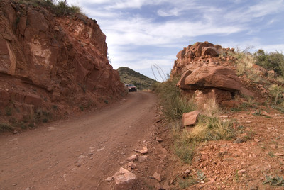
We were on the last lap of the journey, so we followed all signs to Jerome. The road is red dirt and it billowed up behind our vehicles as a fine dust, and when it settled on us, we looked not only dirty but also rusty.
We wound up the hillside in a series of switchbacks and through steep cuts at only 25 mph. Soon remains of old mines appeared. At the bottom of a steep canyon is the Gold King Mine and Ghost Town.
Finally, 47 miles from our start, we reached Jerome. The town clings to the side of Cleopatra Hill, but it is slowly slipping downhill to the Verde Valley. A small artist's community, old buildings and the Jerome State Historic Park make this a fun place to explore. The town is small, so park and enjoy the walk.
As for us, we checked into a hotel, whether it's haunted by a ghost or not. It was time to see if we could wash some of that red dirt off our tired bodies.
GETTING THERE Location: Trip starts at Williams, Ariz., 221 miles southeast of Las Vegas. Jerome, Ariz., is 47 miles farther, plus the mileage of optional side trips. (Backroad mileage is measured after leaving Williams via Fourth Street; side trip mileages given separately. Directions: From "Spaghetti Bowl" intersection of Interstate 15 and U.S. 95 in Las Vegas, take U.S. 93 south for 26 miles to Boulder City, bear left and continue 79 miles (crossing Hoover Dam into Arizona) and merge left onto Interstate 40 toward Flagstaff and Phoenix. After 112 miles take Exit 161 (Historic Route 66) toward Williams. Go 0.5 miles, then turn right onto West Bill Williams Ave for 1.4 miles Turn left on Fourth Street to begin back road trip. Best time to visit: Generally, April through October. Snow will close road in winter. Monsoons come in July and August, making afternoon rains possible. Caveats: Some of route is paved and some dirt; all passable by passenger cars driven carefully in good weather, but high-clearance vehicles are recommended. Four-wheel-drive isn't necessary. No facilities on the route; carry everything you might need. For information: Williams-Grand Canyon Chamber of Commerce, (also has US Forest Service information) 200 W. Railroad Ave, Williams, (928) 635-1418 or (800) 863-0546, www.williamschamber.com. U.S. Forest Service, Williams Ranger Station, 742 S. Clover Road, Williams, 928-968-2676. Accommodations: Fire Light B&B, 175 W. Mead Ave, Williams, (888) 838-8218, www.FireLightBedandBreakfast.com. Best Western Inn of Williams, 2600 W. Route 66, Williams (800) 635-4445, www.bestwesternwilliams.com Connor Hotel of Jerome, (historic with nice amenities) 164 Main St., Jerome, (928) 634-5006, www.connorhotel.com. Dining: Twisters, 417 E. Route 66, Williams; Poncho McGillidcuddy's, 141 Railroad Ave, Williams; Grapes, 111 Main St., Jerome.


