Rain arrived late Saturday in Las Vegas for the first time in 79 New Year’s Eves. Fortunately, winds in the 30s diminished enough for fireworks to be ignited.
Rain arrived late Saturday in Las Vegas for the first time in 79 New Year’s Eves. Fortunately, winds in the 30s diminished enough for fireworks to be ignited.

A string of storm fronts moving through Southern Nevada may put a damper on the New Year’s Eve celebration.

While most of the nation faces bone-chilling and life-threatening cold from a bomb cyclone, Las Vegas will bask in sunshine and warmth this holiday weekend.

Sunshine and highs in the mid-60s will follow a cloudy Thursday in the Las Vegas Valley, according to the forecast.

From Alamo Field to Harry Reid International Airport, the airport has undergone many name changes in its 80-year history.

Las Vegas officially recorded its first freeze of the season, hitting 32 degrees just after 6 a.m. Friday at Harry Reid International Airport.

Sunny and chilly conditions are forecast for Las Vegas through the weekend, says the National Weather Service.

From the 12-inch snow record set in 1909 to the memorable snow day of 2008, Las Vegans have found themselves bewildered by heavy snow days.
There’s a solid chance of rain in the valley and snow in the mountains over the weekend before winter temperatures settle into Southern Nevada for an extended stay.

High temperatures are forecast be close to normal the Las Vegas Valley before skies cloud up and a chance of rain arrives late in the weekend.

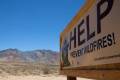
The National Park Service said, in a newsletter, that removing boat launch ramps at five lake locations remains an option.

Winds will be much lighter across the Las Vegas Valley on Friday, says the National Weather Service.

Wind gusts could reach up to 55 mph in the Spring Mountains and Sheep Range tonight, says the National Weather Service.