Keyhole Canyon offers a glimpse at archaeological wonders
Considered a significant archaeological site, Keyhole Canyon boasts both petroglyphs and pictographs, as well as other signs left by ancient cultures. The steep-walled cleft in the Eldorado Mountains south of Nelson contains an intermittent water source where a tiny pool gathers runoff at the bottom of a dry waterfall. It was enough to attract the nomadic hunters and gatherers who made the desert their home centuries before European settlers reached the continent.
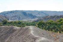
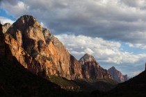
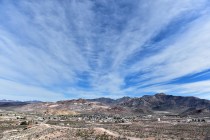
A narrow niche in the granite of the mountains, Keyhole Canyon is a blind or box canyon. Crated by erosion, it is no place to be during a heavy rain. Steep rock walls enclose the gravely canyon bottom. For those early travelers, the spot provided shade and cooler temperatures during the hot months, protection from winds and storms all year and defensive position when needed.
Although it seems a world away from busy modern life in Southern Nevada, Keyhole Canyon lies little more than a half-hour's drive from Las Vegas. To reach it, drive south on U.S. 95 from Railroad Pass as if heading toward Searchlight and Laughlin. Note the turnoff toward Nelson and Eldorado Canyon 10 miles from Railroad Pass. Drive past this junction a little more than four miles to a turnout in the highway median six-tenths of a mile south of mile marker 41. Cross the northbound lanes of U.S. 95 to reach a cattle guard across a graded road headed east toward the mountains. In the distance, three sets of transmission lines march toward California atop tall metal towers like gigantic Erector Set structures.
Although it may be rough from flash flooding and wear and tear from other vehicles, this is not a bad road by desert dirt road standards. However, don't attempt it in your low-slung sports car. A vehicle with a little clearance driven judiciously will do just fine. Four-wheel drive is not necessary if you stay on the best traveled route, keep out of the sand and avoid potholes.
After about two miles, the road goes under two of the three sets of power lines. Turn south on a power line access road marked by a white sign. This road runs straight south between the second and third sets of towers, except where it encounters a couple of washes. After about a mile, start taking note of the numbers on the towers. You want to turn on a smaller dirt road at the tower numbered 23E3.
This side road heads directly toward the mountains where you see a distinctive light-colored rock formation marking the entrance to Keyhole Canyon. A spur takes you to a small parking and turn-around area near a rustic fence. The Bureau of Land Management aims to limit access to foot traffic only. There is no gate, just an entrance between parallel fence sections. Other development at the site includes signs and a vault toilet some distance from the fence.
BLM signs at the site detail the importance of preserving the cultural treasures from the past at Keyhole Canyon. Please observe, photograph and admire, but don't touch or mar the rock art and other artifacts. The rock art here and elsewhere constitutes open-air art museums, displays worthy of esteem and respect left by people of prehistory. Today they belong to us all, part of our national heritage.
Most of the petroglyphs were incised upon rock faces on either side of the entrance. The more you look, the more pictures and symbols you see.
Those closest to the bottom of the rocks show the wear of the centuries. You'll spot better-defined symbols at eye level. Keep looking upward, for rock art appears wherever the ancient artists could find a place to stand.
Pictographs, rock art created by using pigments, occur on the protected undersides of boulders. Where cliffs or slabs of stone provided shelter, you'll see the black residue of cooking fires. A few flat stones bearing pockmarks created by tools, perhaps grinders or fire sticks, mark ancient campsites.
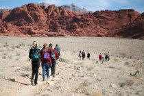
Visitors walk a few hundred yards to reach the dry waterfall, scrambling around fallen boulders to get there. Gazing up, they notice metal anchors left by rock climbers.
Keyhole Canyon provides climbers with experience on granite surfaces and in crevices. Untrained climbers should stay off the cliffs.
Margo Bartlett Pesek's column appears on Sundays.