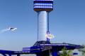
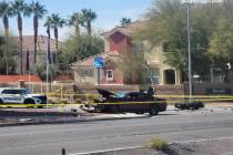
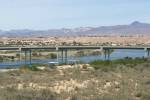
Bridge woes fewer when wind blows
Boulder City officials made it clear last week they are less than thrilled that the O'Callaghan-Tillman Memorial Bridge opened without the widening of U.S. Highway 93 approach to the span. Boulder City Mayor Roger Tobler has requested that truckers be diverted through Laughlin until the problem is resolved. We'll kick off today with a couple of bottleneck-related questions.
This from Patrick: On Thursday, Nevada Highway Patrol was pulling truckers off Highway 93 and making them take Highway 95 to Laughlin. Are trucks no longer allowed to use the bridge?
Yes, they are permitted to use the bridge. As a side note, other callers that day thought Tobler had taken things into his own hands. That is not the case. Tobler said he plans to play by the rules and wait for the Federal Highway Administration to make a ruling on whether trucks can be diverted to Laughlin until Highway 93 is widened.
This is what I did find out: On Thursday, the wind was howling in Boulder City and high-profile vehicles are not permitted on the bridge when wind gusts are projected to reach 45 mph. The bridge has sensors that read wind speeds. A day earlier, the electronic message sign that typically warns truckers of high winds on the bridge was malfunctioning. On Thursday, troopers were making sure that the trucks did not cross the bridge, but it was for safety reasons only.
Ben asks: Why don't they put an electronic sign with traffic information from Boulder City near Railroad Pass? That way people can head down through Laughlin when there are delays.
The Regional Transportation Commission is searching for solutions to the traffic backup leading to the bridge, but it contends erecting electronic message signs is not feasible at this time. According to the transportation agency's spokeswoman Tracy Bower, the fiber optic technology is not in place along that stretch of highway to calculate traffic speeds and estimated travel times.
The agency is, however, planning to install three cameras leading into Boulder City to allow motorists to log onto the commission's website and see live shots of traffic flow. They can then decide whether they want to cross the bridge or head toward Laughlin. But that won't necessarily be a foolproof solution either because of the next question.
Jim is frustrated: FAST cameras are not available online right now. In fact, if you go to the site now, you'll find fewer than five of them working. This has been the case since mid-August. The list shows 31 links to "available" cameras, but only four or five work at any given time, at the most. About a year ago, more than 100 cameras were available online and most of them worked.
Jim is correct. The FAST (Freeway & Arterial System of Transportation) has been having problems with its cameras on Interstate 15 along the resort corridor and near the Las Vegas Beltway. Initially, engineers blamed the design-build construction project for outages, saying that on occasion, the work was interrupting the communication from the fiber optic cables.
Apparently, the problem is more widespread. Transportation division officials believe more than one factor is leading to the outages. The agency is upgrading its cameras from analog to digital so that might play a role but it is not the sole cause. Also uncertain is when they will be up and running again consistently.
Now onto other projects. Joan asks: Why does it appear that someone is building a pedestrian bridge across Cheyenne Avenue, just east of the Tenaya Way intersection? So far all it's just a metal framework. It seems to connect Doc Romeo Park on the south with parking lots for a funeral home and restaurant to the north. Have there been fatalities there because pedestrians attempt to cross in mid-block?
This is indeed a pedestrian bridge and it is part of a larger trail system being developed by the city of Las Vegas. The Lone Mountain Trail is being built on the west side of the Buffalo drainage channel between Buffalo Drive and Tenaya Way and north of Cheyenne Avenue up to Atwood Avenue.
The $4.7 million project includes two pedestrian bridges, one at Cheyenne and one at Lake Mead Boulevard. This funding for the project comes from the Bureau of Land Management through the sales of public lands.
The trail is part of the city's ambitious plan to construct a 240-mile trail network that will link Red Rock Canyon to outlying residential areas in the northwest, downtown and eastern portion of Las Vegas.
If you have a question, tip or tirade, call Adrienne Packer at (702) 387-2904, or send an e-mail to roadwarrior@reviewjournal.com. Include your phone number.
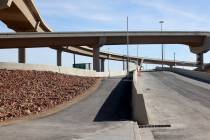
• The right auxiliary lane on northbound Interstate 15 between the Sunset Road bridge and Russell Road will be closed for an unknown period of time. For six months, traffic on Russell at I-15 will be routed to the north side of the bridge with two lanes in each direction.
• For the next several weeks, watch for lane restrictions on the Russell Road bridge over Interstate 15.
• Hinson Street between Charleston and Oakey boulevards will be closed to through traffic through Sunday for installation of storm drains.
• The intersection of Mountain View Boulevard and Hinson also will be closed.
LAS VEGAS REVIEW-JOURNAL