The Raiders are escaping the summer heat of Las Vegas for the coastal climate of Costa Mesa after coming to terms on a one-year agreement to hold training camp there.


The Raiders are escaping the summer heat of Las Vegas for the coastal climate of Costa Mesa after coming to terms on a one-year agreement to hold training camp there.

The Oakland Athletics plan to build a ballpark on the site of the Tropicana, but Bally’s says where the stadium will sit on that site is still being determined.

Las Vegas police released recordings of the 911 calls related to a man who police allege later ate parts of a man’s face.

Former President Donald Trump called several potential vice presidential candidates onstage with him at a Republican National Committee fundraiser at Mar-a-Lago.

The Raiders are escaping the summer heat of Las Vegas for the coastal climate of Costa Mesa after coming to terms on a one-year agreement to hold training camp there.
Red Rock Resorts says it will first focus on developing a California casino and then look at the second phase of its new resort in the southwest Las Vegas Valley.
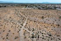
A controversial proposal for a Church of Latter Day Saints temple near Lone Mountain still has a ways to go in its quest for approval, city officials said Tuesday.

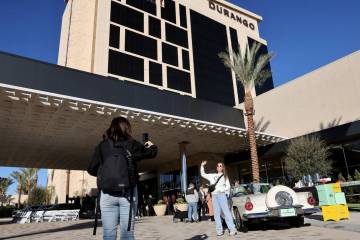
Management of the now-closed 67-year-old resort on the Strip told the County Board of Commissioners the request relates to the construction timeline for the Oakland Athletics’ $1.5-billion ballpark plan.
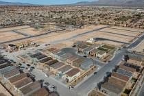
Clark County commissioners voted to award nine applicants a total of $66.25 million from a county housing fund.

Clark County received just one sidewalk vending license application during the first six days the ordinance was in effect.

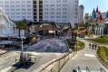
The Sphere, which opened in 2023, has been the home to dazzling productions by U2 and Phish.

The Golden Knights should do what’s best for the organization when it comes to pending free agent Jonathan Marchessault. That means re-signing him.

The Aces continue to make waves off the court this offseason, as their best player landed a major endorsement deal Tuesday.

The hotel-casino on the north Las Vegas Strip says the new promotion is meant to make the property more accessible.

Generosity: Any act of kindness or support given without expectation of exchange or return from the recipient(s). The game’s biggest stars remain active one month into the NFL offseason. They may not be running drills on the field, but they practice something more important: generosity. Hall of Fame quarterback Troy Aikman and 2022 NFL Man […]


A CCSD substitute teacher punched a student at Valley High School in Las Vegas after the student called him a racial slur, according to an arrest report.

Commercial real estate experts weighed in on how much the property co-owned by Donald Trump and Phil Ruffin might sell for if it were put on the market.

The restaurant is owned by a big-name Vegas hospitality company with several other outlets in its portfolio.

Country superstar Keith Urban has announced a new residency on the Las Vegas Strip.