Retrace Nevada history along Old Spanish Trail


Most Nevadans don't realize, when they drive many of the state's highways, they're following historic trails.
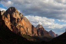
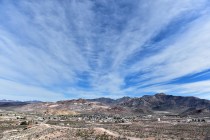
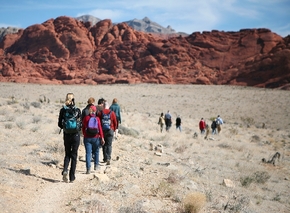
Travel Interstate 15 from Las Vegas toward Utah, or head west into the Red Rock Canyon National Conservation Area and then follow the highway over the mountains to Pahrump, and you're retracing the Old Spanish Trail
In 2001, 152 miles of the state's oldest transportation route was listed as a historic district on the National Register of Historic Places. Portions of the Old Spanish Trail are visible from today's highways, if you know where to look.
Unknown except to native cultures, Nevada's remote distances lay unmapped when the United States was young. Controlled by the Spanish, the unknown regions sat beyond the reach of several exploratory expeditions sent to find overland routes linking interior settlements with those along the coastlines.
The Spanish kept a tight grip on trade. In 1821, newly independent Mexico opened trade with other countries, including the developing United States. Meanwhile, the fur trade encouraged English and American trappers and traders to push westward along rivers and streams in search of beaver and other animals. In 1826, American trapper and trader Jedediah Smith followed waterways, including the Colorado River, across Nevada's southern tip and charted a way to reach Mexican California, the first American to approach overland from the east.
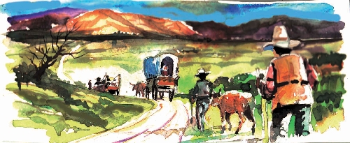
During the winter of 1829-30, Santa Fe trader Antonio Armijo blazed an overland route using a network of old trails heading north and then southwest to avoid chasms such as the Grand Canyon. He led 60 men and a pack train loaded with woolen goods 1,120 miles to California to trade for horses and mules. Various offshoot routes developed over time, known collectively as the Old Spanish Trail.
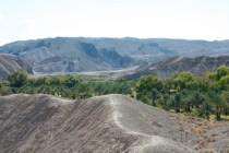
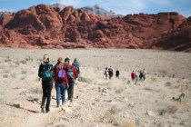
Armijo's route entered Nevada near Mesquite, climbed from the Virgin River, crossed the Mormon Mesa and dropped into the Moapa area for the last water for 50 miles. While the party recovered from the longest waterless stretch of the trail at an oasis in the Mojave Desert, young Rafael Rivera dubbed the place Las Vegas.
The trail then headed west toward the mountains, where every canyon had water, climbed 2,000 feet through Mountain Springs Pass, then dived down into Pahrump Valley. The trail linked a series of springs south into California to the Mojave River. It reached the San Gabriel Valley through Cajon Pass.
In 1830-31, American traders William Wolfskill and George C. Yount followed Armijo's route, the first transportation corridor used by Euro-Americans across Nevada. Despite its length and hardships, the trail remained busy with legitimate traders, as well as rustlers and slave traders.
John C. Fremont followed the Old Spanish Trail east from California in 1844, mapping and noting available water and pasture. Published within a year or two of his return, Fremont's maps and notations assisted future travelers, including the Mormon Battalion that marched to California from Utah and returned in 1847-48. When the battalion came back, it drove the first wagon on the trail. Widened and improved for use by wagons, the Old Spanish Trail across Southern Nevada carried so much traffic between Utah and California, it became known as the Mormon Road.
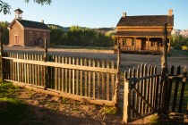
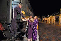
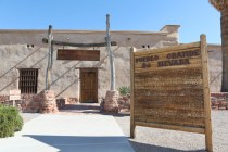
The Mormons sent a group to establish the Las Vegas Mission in 1855, the first permanent non-native settlement in Southern Nevada. The colony lasted two years, leaving behind an adobe fort, orchards, fields and the area's first mines. You can visit the site at the Old Mormon Fort State Historic Park downtown. Trace the history of the area and the old trail in a small urban park on Tara Avenue south of Sahara Avenue, where wagon tracks cut ruts across a desert flat.
As other trails developed, portions of the Old Spanish Trail fell into disuse. Railroads changed transportation completely in the late 1800s, as did the automobile in the 1900s.
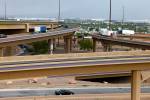
The Old Spanish Trail/Mormon Road into the Las Vegas Valley became variously the Arrowhead Trail or Arrowhead Highway, then U.S. Route 91 and later Interstate 15. The highway through Red Rock and the Pahrump road, Nevada Route 160, over the mountains parallel the old trail. Sharp eyes will still spot it.
Margo Bartlett Pesek's column appears on Sundays.