Pine Creek Canyon hike beautiful, historically relevant


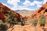
You don’t have to travel more than an hour, from anywhere in the Las Vegas Valley, to reach Red Rock Canyon National Conservation Area, which boasts some of the finest canyon hikes in our region. One in particular — Pine Creek Canyon — is not only pleasing to the eye but offers historical interest.
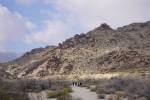
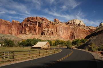
Like most popular trails in Red Rock, Pine Creek Canyon is along the 13-mile Scenic Drive. This involves extra driving and an entrance fee, but this loop road offers some of the finest views in the park.
Pine Creek is often done as a 2½-mile round-trip hike, which includes a loop portion, but it can be shortened or extended.
From the trailhead, at about 4,053 feet in elevation, follow the well-worn path west toward the canyon. It is pretty easy hiking here, and you might see some wildlife, especially if you are out in the first light of morning. Look for white-tailed antelope squirrels, cottontail rabbits, jackrabbits and, once in a while, burros. Plants here consist of blackbrush, Mojave yucca and cholla cactus, but you will soon start seeing scrub oak, willow and juniper.
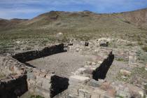
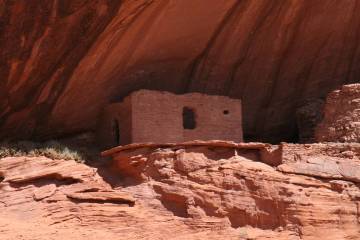
About three-quarters of a mile from the trailhead, to the south of the trail, you will find a worn spur trail that leads to the foundation of a 1920s homestead. There, Horace and Glenda Wilson built a two-story house with a fireplace and planted an apple orchard. They sold it eight years later but stayed on the property for eight more as caretakers. When the Wilsons moved to Las Vegas, the house remained empty, fell into disrepair and was vandalized. In the mid-1970s the Division of State Parks took control of the property.
Just after the homestead you will find the turn that begins the 0.9-mile loop portion of the hike. Go left, travel through the open meadow and you will find yourself going over the Pine Creek drainage itself. Through spring, you might find a steady flow of water. Mud can be a problem, so wear shoes or boots that you won’t mind getting dirty.
Follow the path as it ascends a hill and travels along the creek’s south side. This area is highly vegetated, there are drop-offs and footing becomes more uneven, making it more difficult and even dangerous for children. The trail swings right and descends slightly, making another crossing of the creek. Here, after perhaps another wet and muddy crossing, you go right to continue the loop back to the trailhead.
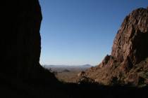
For more adventure you can travel up the canyon as far as you are comfortable. A monolith, called Mescalito, divides the canyon into two forks, both worth exploring. The south fork is easier to ascend, but they both involve rock-scrambling and route-finding.
Deborah Wall is the author of “Great Hikes, A Cerca Country Guide” and “Base Camp Las Vegas: Hiking the Southwestern States,” published by Stephens Press. She can be reached at deborabus@aol.com.
Directions
From Red Rock Canyon National Conservation Area's main entrance, take the 13-mile Scenic Drive 10.2 miles to the well-signed parking area and trailhead on the right.