Amboy offers a look at history and ancient lava crater

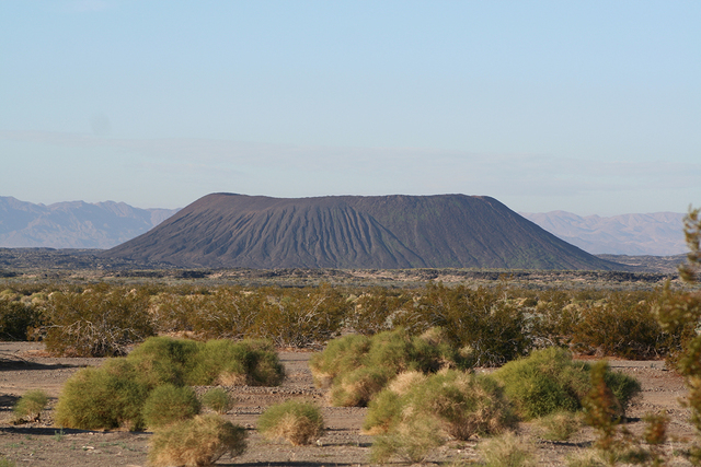

For some reason doubtless buried in our prehistoric past, most humans find volcanos interesting, as long as they’re not spewing molten rock and poison gas. If you’d like to visit one that has behaved itself for about 10,000 years but still shows the interesting geologic features acquired in its flaming youth, Amboy Crater makes a fine day trip this time of year. The temperature will be 5 to 10 degrees warmer than the same day in Las Vegas, and the route I suggest will take you through the Mojave National Preserve, an agreeable place in early winter.
Turning off the preserve’s Kelbaker Road onto Historic Route 66, you’ll find yourself on one of the Mother Road’s least-used remaining sections. Driving west, you’ll soon see a looming black trapezoid in front of you, and in 10 or 15 minutes, you will be at the parking lot at the trailhead where you’ll be able to reach it on foot.
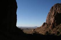
From the parking area, at an elevation of about 660 feet, follow the official trail toward the cone and the crater inside it. The trail is about 3 miles round trip. The side of the cone that is visible at the beginning of the trail looks so steep nobody could climb it, but don’t be fooled into turning back. About 30 minutes of hiking will bring you to the west side, where you’ll find a breach in the lava, and this is where you will enter the crater. From there, it will take you about five or 10 minutes to hike about 300 feet to the rim on a very rocky surface.
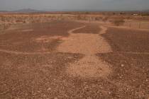
The crater is approximately 1,500 feet in diameter. The crater is actually a collection of four coaxially nested cones, which means there were at least four eruptions there, but all have the same center. Don’t worry about another eruption during your visit; the last is believed to have predated civilization.
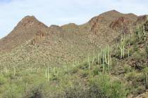
Though not a tall cone, the vantage point on its rim offers great views. To the north, you will see the Old Dad and Granite Mountains in the Mojave National Preserve, and to the east, the Old Woman Mountains. Don’t venture to the west of the crater, as this is the eastern boundary of the Twentynine Palms Marine Corps Base. Surrounding the base of the crater is an immense 43-square-mile lava field, one that has even been used to test the Mars Rover.
Besides the permanent scenery, this is also a great place to watch trains that seem to pass through every few minutes on the busy Burlington Northern Santa Fe tracks, which parallel Route 66 in this area.
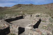
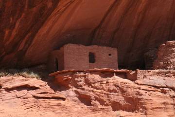
As you drove to Amboy Crater along Route 66, you would have passed through Amboy, which is pretty much a ghost town. Its appearance probably hasn’t changed much in the last 50 years, which makes it a great place to look around. A mining community in the 1880s, Amboy became noted, after Route 66 was built, as the site of Roy’s Motel and Cafe, an iconic stop on the Mother Road. Since Interstate 40 drained the road’s lifeblood of traffic, Roy’s has operated sporadically. The entire town serves as a good photographic subject. It’s an example of what building buffs call Mid-Century Modern Googie Architecture, a style influenced by the futuristic dreams of the ’50s.
In 1883, the railroad then called the Southern Pacific laid down tracks between Needles and Barstow, Calif. The railroad built water stations and small depots along the route, all named in alphabetical order from Amboy east. If you travel east of Route 66, you will see the signs for these small, mostly forgotten towns: Amboy, Bolo, Cadiz, Danby, Essex, Fenner, Goffs and so on, now familiar only to those who drive this somewhat overlooked segment of Route 66.
One funny note: I wrote about Amboy years ago and told readers that I had heard back in the first decade of the 20th century, a bunch of railroad workers from the nearby town of Bagdad piled up on the rim as much brush and other flammable material as they could gather. When a passenger train was coming through they lit it and scared the living daylights out of the travelers.
After I wrote this, I received a letter from a man who was from the area, who confessed that in the 1970s, he and some of his buddies took part in a similar practical joke. They worked hard and brought as many old tires to the rim as possible. They rigged up a timer to set the tires afire after they had left. When the resulting column of black smoke made the crater appear ready to blow again, townspeople and tourists alike panicked and started to evacuate. Authorities quickly caught on, and the young tricksters got a big tongue-lashing out of it. But as Peck’s Bad Boy used to say, “A country boy has to make his own fun.”
DIRECTIONS
From Las Vegas, take Interstate 15 south 47 miles and take the Nipton Road exit, going east. Drive 3 miles and turn right onto Ivanpah Road for 3 miles, then turn right onto Morningstar Mine Road. Drive about 15 miles to Cima and stay left onto the Kelso-Cima road. Continue about 14 more miles to the Kelso Depot. Turn left onto Kelbaker Road. Continue south for 32 miles (crossing under Interstate 40) and turn right on Historic Route 66. Drive 7.7 miles and go left into the Amboy Crater access road. Drive a half-mile to the parking area and trailhead.
Deborah Wall is the author of “Great Hikes, A Cerca Country Guide” and “Base Camp Las Vegas: Hiking the Southwestern States,” published by Stephens Press. She can be reached at deborabus@aol.com.