Hurricane Lee unleashes heavy swell on northern Caribbean


Associated Press
Eds: UPDATES: Links audio. With AP Photos.
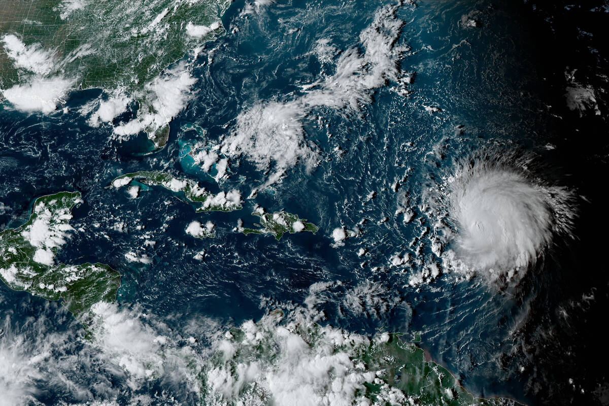
SAN JUAN, Puerto Rico — Hurricane Lee barreled Sunday through open waters just northeast of the Caribbean, unleashing heavy swell on several islands.
The Category 2 storm is not forecast to make landfall and is expected to stay over open waters through Friday. On Sunday morning, it was centered about 270 miles north-northeast of the northern Leeward Islands. It had winds of up to 110 mph (175 kph) and it was moving west-northwest at 8 mph.
Last week, Lee strengthened from a Category 1 storm to a Category 5 storm in just one day.
“We had the perfection conditions for a hurricane: warm waters and hardly any wind shear,” said Lee Ingles, a forecaster with the National Weather Service in San Juan.
Lee is expected to regain some strength in upcoming days and will then weaken again, according to the National Hurricane Center.
Breaking waves of up to 20 feet were forecast for Puerto Rico and nearby islands starting early this week, with authorities warning people to stay out of the water. Coastal flooding also was expected for some areas along Puerto Rico’s north coast and the eastern portion of St. Croix in the U.S. Virgin Islands, according to the National Weather Service in San Juan.
The National Hurricane Center noted that dangerous surf and rip currents were expected to hit most of the U.S. East Coast starting Sunday, but that the hurricane’s impact beyond that is still unclear.
“It is way too soon to know what level of impacts, if any, Lee might have along the U.S. East Coast, Atlantic Canada, or Bermuda … especially since the hurricane is expected to slow down considerably over the southwestern Atlantic.” the center said.
Lee was forecast to take a northward turn by Wednesday. However, its path after that remained unclear.
Lee is the 12th named storm of the Atlantic hurricane season, which runs from June 1 to Nov. 30 and peaked on Sunday.
Tropical Storm Margot became the 13th named storm after forming Thursday evening, but was far out in the Atlantic and posed no threat to land. It was located about 1,145 miles west-northwest of the Cabo Verde Islands on Sunday. Its winds had risen to 50 mph and it was forecast to strengthen into a hurricane early next week. It was moving north-northwest at 9 mph.
The National Ocean and Atmospheric Administration in August forecast between 14 and 21 named storms this season. Six to 11 of them are expected to become hurricanes, and of those, two to five might develop into major hurricanes.
In the Pacific, Jova weakened to a tropical storm as it whirled over open waters far from Mexico’s southwest coast and posed no threat to land.
It was about 1,080 miles west of the southern tip of Baja California on Sunday and moving northwest at 8 mph with winds up to 45 mph.