Four Corners mistake recalls long border feud between Nevada, California


Surveyors acknowledged last week that the Four Corners monument is not located at the exact spot where Arizona, Colorado, New Mexico and Utah come together, but disappointed tourists can look on the bright side: No one is likely to get shot over the discrepancy.
The same cannot be said of the Silver State's longest and most infamous surveying dispute.
As recently as 1980, Nevada and California were still fighting over their roughly 600-mile border, which runs due south from Oregon to Lake Tahoe, then angles southeast to the Colorado River like watch hands set on 4 o'clock.
The dispute dates to 1850, when California became a state and a survey set the original boundary from Lake Tahoe north. Some California officials would later claim that an error by the survey team caused the line to be drawn as much as one-third of a mile too far west.
In 1862, Nevada officials tried to get California legislators to cede all territory east of the Sierra Nevada. When that didn't work, Nevada simply laid claim to a portion of the Honey Lake Valley, northwest of Reno, as part of the newly formed Roop County.
What followed was a series of escalating jurisdictional disputes, as lawmen and judges on both sides of the disputed line were arrested and dragged off to jail, only to be freed by groups of their armed supporters.
The inevitable gunfight finally broke out on Feb. 15, 1863, leaving several people wounded but none dead.
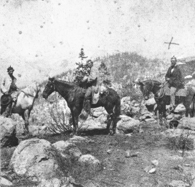
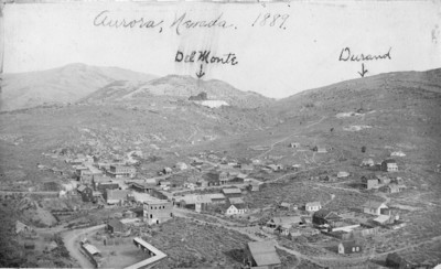
Meanwhile, some 130 miles to the south, residents of the mining camp of Aurora found a peaceful resolution to the border dispute: They simply picked a full slate of Nevada officials and a full slate of California officials in an election that featured separate polling places but the same voters.
The arrangement seemed to work just fine. For a brief time, Aurora served as the seat of government for both Esmeralda County, Nev., and Mono County, Calif. The town's choice for the California Assembly quickly became speaker, while its choice for the Nevada Territorial Legislature was named president of that body.
Aurora eventually went to Nevada after a joint boundary survey was conducted as part of the armistice that ended the so-called Roop County War. Much of the disputed area around Honey Lake ended up in California, though Nevada would continue to lobby for a western border along the Sierra summit line for the next 50 years.
The border between the two states shifted a number of times during that period. An 1868 survey moved the line north of Lake Tahoe two miles west, prompting a call for a full survey of the border in 1872.
That measurement, by Allexey Von Schmidt, changed the north-south segment again and charted an oblique line to the Colorado River that still shows up on maps, if only as a historical curiosity. The so-called Von Schmidt line raised enough doubts in Washington to prompt yet another survey in 1892, this time by the U.S. Coast and Geodetic Survey, precursor to today's National Geodetic Survey.
Of course, such errors and corrections aren't surprising given the limited tools surveyors had to work with, said former Nevada State Archivist Guy Rocha.
"Today, with satellite technology, you could reconfigure the whole thing and you'd be a little bit off all over the place I think," he said. "There would have to be errors. The question is, would there be gross errors?"
The state border dispute flared again in the late 1970s, when the California Lands Commission made issue of that moldy old survey error of 1850 along the border north of Lake Tahoe.
California eventually filed a lawsuit to settle the issue, and the U.S. Supreme Court ruled that the boundary should remain where both states had long recognized it to be.
"If the court had ruled to move the line, there would have been all sorts of disruptions," Rocha said.
Most significantly, the casinos just inside the Nevada border at Lake Tahoe suddenly could have found themselves out of business in California, he said.
Using the Supreme Court decision as its guide, Congress took up legislation in 1985 that cleared title to more than 11,000 acres along the border and effectively put an end to the 125-year-old dispute.
So what of the Four Corners monument, where thousands of tourists have grinned foolishly for snapshots with their hands and feet in four different states at the same time?
Initial reports last week suggested the marker might be off by as much as two and a half miles.
Since then, officials from the National Geodetic Survey have said that the marker is 1,807.14 feet east of where it should have been placed. That's about the length of six football fields, which is phenomenally accurate by 19th century standards, said Dave Doyle, chief geodetic surveyor for the National Geodetic Survey.
In any case, the measurement differences don't matter anymore, Doyle told The Associated Press, because the states have adopted the monument as the legal definition of the Four Corners.
The Associated Press contributed to this report. Contact Henry Brean at hbrean @reviewjournal.com or 702-383-0350.