
Expect changes, restrictions in Spring Mountains


The Spring Mountains west of Las Vegas have always offered respite from the desert’s relentless summer heat. However, because of last summer’s disastrous Carpenter 1 fire, subsequent floods and an ongoing schedule of improvements, visitors to the mountain retreat this summer should expect some changes and restrictions.
The fire last year burned about a tenth of the 316,000 acres included within Spring Mountains National Recreation Area, which is part of the Humboldt-Toiyabe National Forest. Hot spots in inaccessible terrain continued to smolder for weeks after most of the fire had been contained. The heavy rains that followed in late summer extinguished the hot spots but generated devastating runoff on denuded slopes and in canyons. Runoff carrying fire debris swept down the mountain to flood areas of the northwestern Las Vegas Valley.
Mountain residents were evacuated when the fire threatened populated areas such as Kyle Canyon, Harris Springs and Carpenter Canyon. Access to some parts of the recreation area was restricted while the fire was active. Because still-standing burned trees pose hazards, some access roads and parts of the area’s trail system remain closed even now, pending assessment by the U.S. Forest Service.
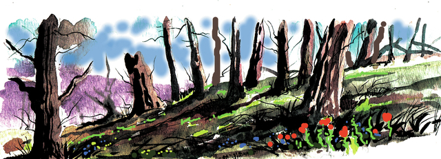
As horrific as the smoke appeared during the blaze, filling the valley and creating surreal sunsets for several days, visitors this summer will be surprised that the visible damage in Kyle Canyon is not much worse. The fire swept up to the high ridges separating Carpenter Canyon on the Pahrump side of the mountains from Kyle Canyon, a principal recreation center and home to about 700 residents. There it destroyed ancient stands of bristlecone pine, the longest-lived conifer on Earth.
When you drive up state Route 157 toward Kyle Canyon, you pass burned trees and brush where the fire raged through forested back country and then jumped the highway in a couple of places. In the canyon itself, you can’t miss the spot where the fire jumped the ridge and swept down a wooded side canyon toward the village. Firefighters succeeded in saving homes, community buildings, utilities and businesses such as the hotel and lodge.
Nature is already trying to heal these burned areas with new greenery, and the scars will fade more with each passing year.
Visitors will find limited hiking opportunities in Kyle Canyon as only three trails have been open since the fire: the trails exploring Mary Jane Falls, Fletcher Canyon and Trail Canyon. Trails still closed include the South Loop, Cathedral Rock, Echo and Little Falls, as well as the Griffith Peak Trail, because the access road was seriously damaged by flooding. Trails starting from Deer Creek Road and in Lee Canyon remain open.
Under a multiyear construction and rehabilitation plan that began in 2012, picnic areas, campgrounds, trailheads, parking areas and access roads are being improved. A new visitor center is scheduled to open in 2015. Although many projects have been completed, work continues this summer on several others. Expect occasional road delays.
As you head up Route 157, pull over to peruse the bulletin board just after you exit U.S. Highway 95. It will note current construction sites and possible delays. For details on facilities affected by the work, contact the U.S. Forest Service at 702-515-5400 or the visitor center in Kyle Canyon at 702-872-5486. The website for Spring Mountains National Recreation Area lists all projects and schedules.
Margo Bartlett Pesek’s column appears on Sundays.


