
Storms move away from Vegas; 1 tornado confirmed, another pending


The heaviest of a line of storms has moved to the east of the Las Vegas Valley.
The National Weather Service tweeted that winds of up to 70 mph, pea-sized hail, heavy rain and lighting were forecast for North Las Vegas, Nellis Air Force Base, Henderson and Boulder City until 8:15 p.m.
A Severe Thunderstorm Warning has been issued for part of eastern Clark and central Mohave Counties until 815PM.
Severe thunderstorms continue to push south, producing strong winds around 60 mph and heavy rain. When thunder roars, go indoors! #NVwx #AZwx #vegasweather pic.twitter.com/JLOvGkErUz
— NWS Las Vegas (@NWSVegas) August 22, 2022
Earlier, a thunderstorm warning was issued for eastern Clark County and western Mohave County until 7 p.m.
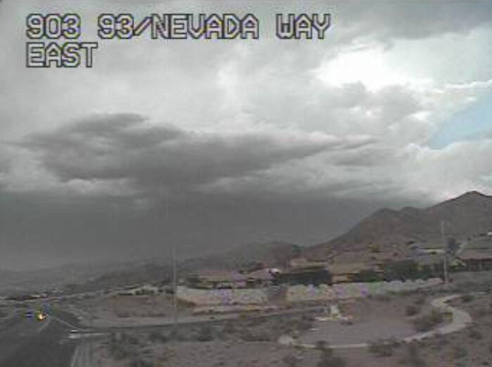
As of 6:55 p.m., two small storm cells were dropping rain on the Sheep Range while most of the heavier storm activity was over the Lake Mead area.
The same site just measured a wind gust of 70 mph! These winds are heading towards the northeast valley. #NVwx #vegasweather https://t.co/1zsZeqficL
— NWS Las Vegas (@NWSVegas) August 22, 2022
Earlier, two land spout tornadoes were caught on video near Littlefield, Arizona. At least one touched down about 4:47 p.m. No damage was reported.
A tornado warning was issued for northern Mohave County until 5:15 p.m.
🌪️We've received multiple reports of tornadoes today.
✅The tornado SE of Littlefield in AZ has been confirmed.
⌚We are waiting on confirmation of tornado touchdown NW of Mesquite in NV.
As of right now we are not planning on performing damage surveys. #NVwx #AZwx https://t.co/gTCiPBsQAl
— NWS Las Vegas (@NWSVegas) August 22, 2022
The weather service said it had confirmed a tornado touchdown near Littlefield, Arizona, and was awaiting confirmation of a touchdown of one near Mesquite.
Footage of the landspout tornado(s) in northern Mohave County! #AZwx https://t.co/QINTLE8qyr
— NWS Las Vegas (@NWSVegas) August 21, 2022
The weather service outlined an area that may see heavy winds on Sunday evening, including Las Vegas east to Lake Mead and into Arizona.
As of 5:25 p.m., radar showed the major storms appeared to be moving east toward Arizona and away from Las Vegas.
Here's where we are watching for the potential of severe wind gusts this evening and tonight. Stay weather aware! #NVwx #AZwx #CAwx #vegasweather pic.twitter.com/tHfYtCL9Sl
— NWS Las Vegas (@NWSVegas) August 21, 2022
“Severe thunderstorms continue to move south,” the weather service warned. “Wind gusts up to 60 mph and quarter-sized hail are possible. Expect impacts on I-15 near Mesquite.”
Mesquite, Elgin, Carp and Bunkerville are likely to be affected if the storms continue to move south.
A Severe Thunderstorm Warning has been issued for parts of southeast Lincoln and northeast Clark Counties until 5PM.
Severe thunderstorms continue to move south. Wind gusts up to 60 mph and quarter-sized hail are possible. Expect impacts on I-15 near Mesquite. #NVwx pic.twitter.com/xy9wfvIa4R
— NWS Las Vegas (@NWSVegas) August 21, 2022
Storms over Lincoln County and near St. George, Utah, could pose threats to Las Vegas on Sunday evening, says forecasters.
3:35PM Update:
Confidence is increasing for the possibility of severe thunderstorms across parts of Clark, Mohave, and Lincoln Counties.
Keep an eye to sky this evening and stay weather aware! #NVwx #AZwx #vegasweather https://t.co/gruxBcwwQe
— NWS Las Vegas (@NWSVegas) August 21, 2022
As of 3:50 p.m., radar showed a small cell was approaching the Sheep Range from the north while four larger cells west of St. George over Lincoln County were headed south toward Las Vegas.
We're watching storms in southwest Utah and Lincoln County move south this afternoon.
If these hold together, we could see impacts in eastern Clark County and the Las Vegas area this evening. Main concerns would be strong winds, heavy rain, and lightning. #NVwx #vegasweather pic.twitter.com/90UQPkHKBJ
— NWS Las Vegas (@NWSVegas) August 21, 2022
The weather service tweeted shortly before 3 p.m. that it was watching the storms.
“If these hold together, we could see impacts in eastern Clark County and the Las Vegas area this evening,” the tweet said. “Main concerns would be strong winds, heavy rain, and lightning.”
Higher elevations around Las Veags did receive some rain around noon with about a half-inch reported just east of Mount Charleston.
The Monday low is expected to be around 81 before rising to 102 with winds of 5-8 mph.
Lake Mead keeps on rising
A rare summer rise in the depth of Lake Mead has continued for nearly a month, thanks in part to heavy rainfall around the region.
The lake was at a depth of 1,043.26 feet (above sea level) at 1 p.m. Sunday, a rise of 2.55 feet from its low so far this year at 1040.71 feet on July 27.
Heavy rain Friday along the Virgin River watershed — including a reading of nearly 11 inches near Rockville, Utah, just south of Zion National Park — will result in much of the floodwaters making it into Lake Mead.
Contact Marvin Clemons at mclemons@reviewjournal.com. Follow @Marv_in_Vegas on Twitter.


