Boulder Highway pedestrian safety project in Las Vegas underway
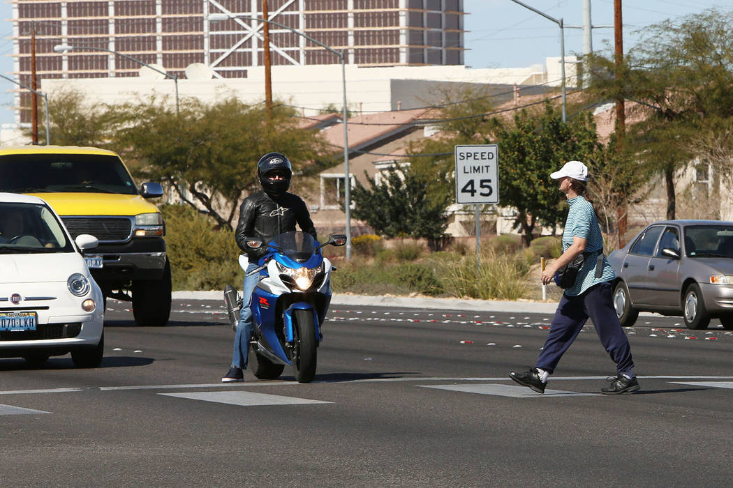


A project aimed at increasing the safety of pedestrians on a busy valley roadway is underway.
The $1.5 million Boulder Highway upgrade project, which began last month, is designed to improve eight designated trouble areas along a 14-mile stretch of the highway with features that address pedestrian safety in the valley, the Nevada Department of Transportation announced Thursday.
Included in the six-month project, slated to finish in the summer, is adding midblock crossings with overhead rapid flashing beacons, median enhancements and advance pedestrian warning signs and new crosswalks.
The eight areas set for improvement are:
Oakey Boulevard: Overhead rapid flashing beacons in both directions, with pedestrian crossing warning signs and lights, and a new crosswalk.
Boulder Palms Senior Community (4350 Boulder Highway): Overhead rapid flashing beacons, in both directions, with pedestrian crossing warning signs and lights, plus a new Danish offset median and a new sidewalk.
Whitney Avenue, Hamilton Avenue, Corn Street, Foster Avenue, Lowery Street, and Veterans Affairs Southeast Clinic (1020 S. Boulder Highway): Overhead rapid flashing beacons in both directions, with pedestrian crossing warning signs and lights, plus a new Danish offset median reconfiguration and a new crosswalk.
The S-shaped Danish offset forces pedestrians to turn to the right when they reach a median between traffic lanes. Because pedestrians briefly face oncoming traffic, they can better see and avoid cars.
Since 2006, Boulder Highway has seen 52 pedestrian deaths, according to the Department of Public Safety.
The number represents almost 9 percent of all pedestrian deaths in the state over that time frame, department stats revealed.
Boulder Highway was in a largely rural area when constructed in 1931 as part of the construction of Hoover Dam. Initially the highway served as the area’s only freeway, carrying State Route 5, and later U.S. Routes 93, 95 and 466 near Boulder City, through Henderson and into downtown Las Vegas.
“Boulder Highway was built when the valley still consisted of sparsely populated pockets of desert land, said Tony Illia, NDOT spokesperson. “Southern Nevada’s boom growth, however, has since altered the make-up of the highway, adding densely-knit subdivisions, schools and businesses where previously there were none, resulting in greater street-level interaction.”
That boom saw 20,000 homes, apartments and condominiums and over 970 commercial lots pop up within a half-mile radius of Boulder Highway. The area also sees 10,000 Regional Transportation Commission of Southern Nevada transit riders and 36,000 vehicles traveling on it daily.
“We are retrofitting Boulder Highway to reflect its current usage, Illia said. “However, these are interim safety improvements until a full corridor makeover can occur.”
The full makeover will come out of the Re Imagine Boulder Highway study. The study includes a public survey, where residents can provide their input on what they think the area needs in order to be more pedestrian friendly.
Contact Mick Akers at makers@reviewjournal.com or 702-387-2920. Follow @mickakers on Twitter.