
Radar back in operation for Las Vegas weather service


The National Weather Service has at least temporarily repaired its tracking radar for the Las Vegas area that went out Friday night.
“It appears as though it has been fixed for now,” meteorologist Morgan Stessman said. “It was a problem with a high-voltage cable and one has been ordered.”
Until the part is received and put into place at the radar site some 15 miles south of Boulder City near Nelson Peak, the radar could go out again, Stessman said.
A meteorologist said late Friday night the radar appeared to have been hit by lightning. The weather service’s radar also went down in May.
“It’s back up for now and we are keeping our fingers crossed,” she said, noting a crew was at the site for 6 to 7 hours Saturday and was able to get the radar working shortly after 4 p.m.
Stessman said they are assuming it was a lightning strike that knocked out the radar on Friday evening because of heavy storm activity and an error message indicating a power issue right before the radar stopped working.
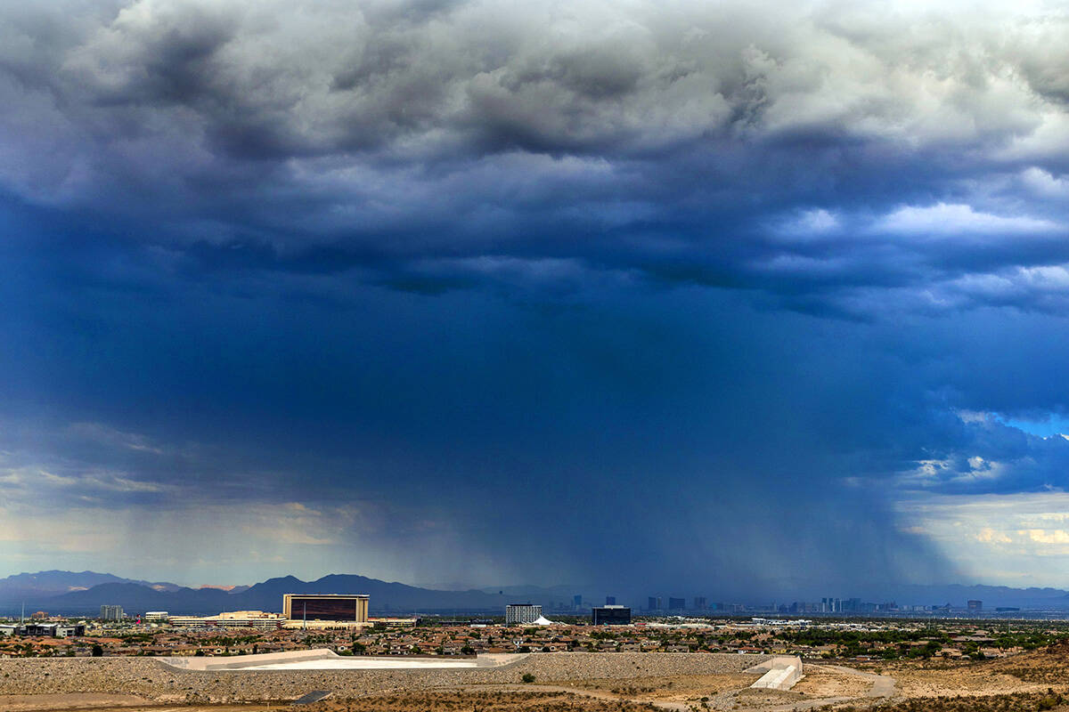
With the the radar down, the Las Vegas office had “less than ideal coverage” of its assigned region during a period of intense storms. Meteorologists can use satellite and other nearby radar facilities to gauge rainfall and wind speeds.
Having radar operational will be useful as expected higher winds and rain from Hurricane Hilary are expected to enter the region late Saturday and Sunday morning.
Saturday mostly quiet
Saturday has been mostly dry until late in the afternoon.
“We expect to see more light rain and that might get more intense overnight and into tomorrow,” Stessman said when stronger activity is expected as Hilary moves closer.
Heavy rains are expected in the valley through Monday as Hilary is also impacting parts of southern California with potentially dangerous flash flooding.
Hilary is estimated to decline to a tropical storm and end up stretching into southern and central Nevada, bringing strong winds Sunday night, the weather service reported.
The hurricane, located west of Baja California as of Saturday afternoon, will push clouds heavy with precipitation into the Las Vegas Valley through Sunday and Monday, bringing from 1 to 2.5 inches of rain, Stessman said.
For an area that normally has only about 4.16 inches of rain all year, that means up to “50 percent of the annual precipitation over the next three days,” she said.
Plenty of moisture
That would be higher than average for Las Vegas’ monsoon season — which runs from June 15 to Sept. 30 — when only about 1.03 inches fall, according to Stessman.
“There is much more moisture in the atmosphere than normal,” she said.
Flooding in areas of the valley is most likely to occur due to the heavy rain, as there won’t be enough time for the soil to absorb the water from the deluge, she said.
In Southern California, the weather service early Saturday afternoon issued a “life-threatening” flash flood warning for sections of south central Inyo County and other south central portions of the state due to thunderstorms.
Flash flood warnings were also issued for parts of Los Angeles and Long Beach.
A tropical storm warning was released with winds reaching up to 35 knots near and east of Santa Barbara and Catalina Islands toward coastal Ventura and Los Angeles counties, with heavier showers Sunday afternoon into Sunday night and sea waves of 5 to 8 feet “when conditions are worst,” the service reported.
Contact Jeff Burbank at jburbank@reviewjournal.com or 702-383-0382. Follow him @JeffBurbank2 on Twitter. Review-Journal digital producer Marvin Clemons contributed to this story.


