NDOT: I-15 flood repairs will take weeks


MOAPA — It will be several weeks before the portion of Interstate 15 north of Las Vegas that was devastated by floods is back up and running at full speed, Nevada Department of Transportation officials said Tuesday.
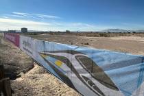
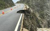
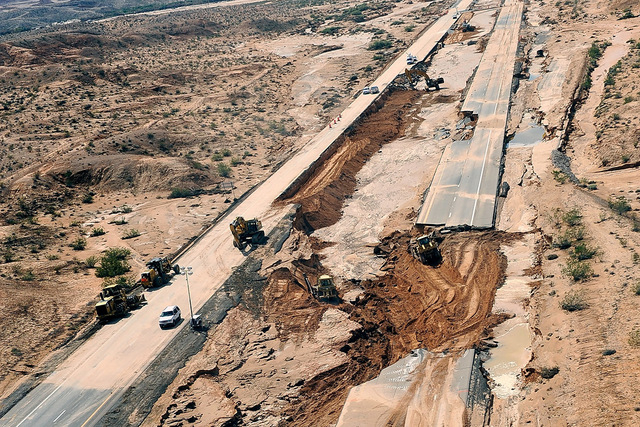
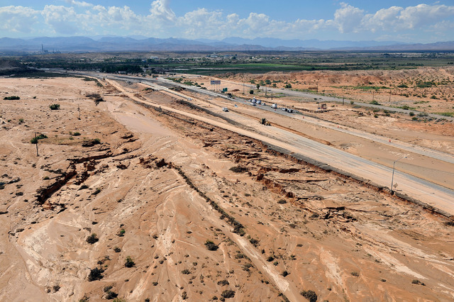
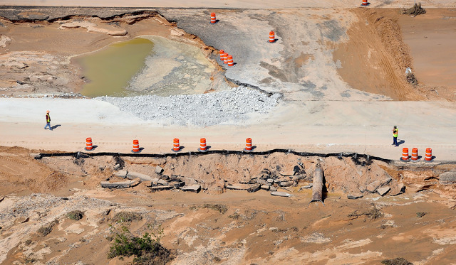
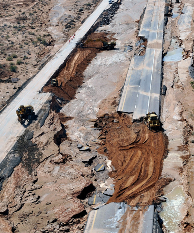
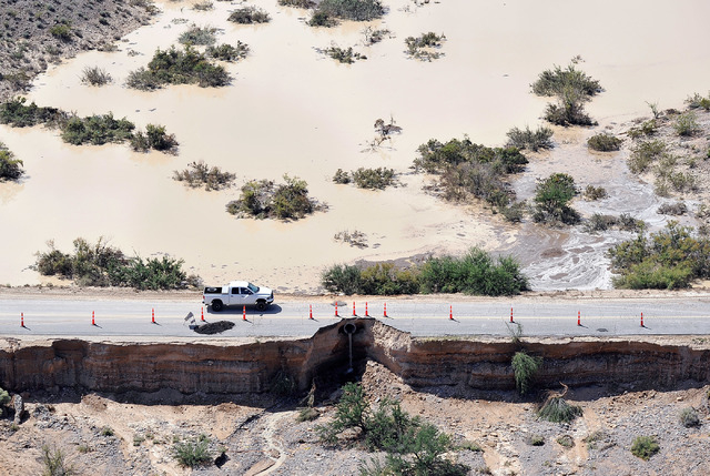
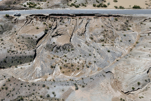
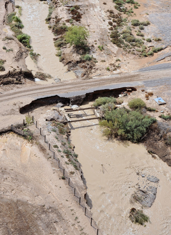
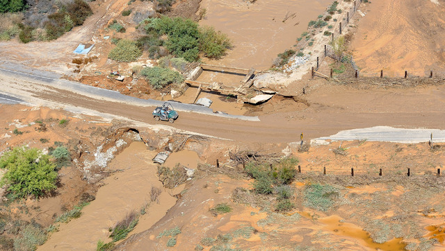
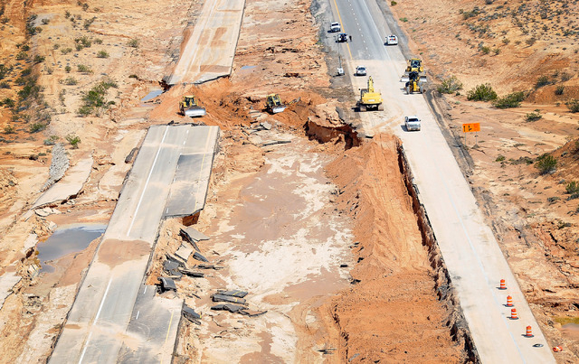
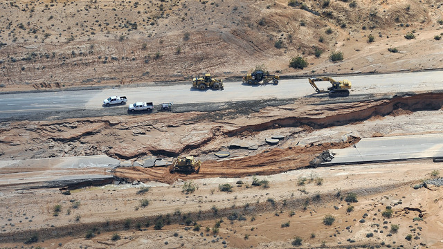
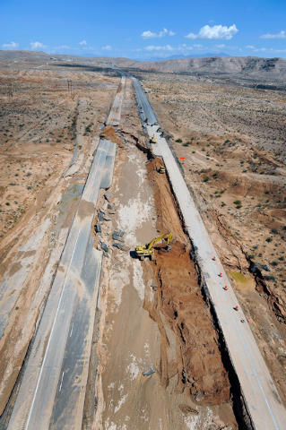
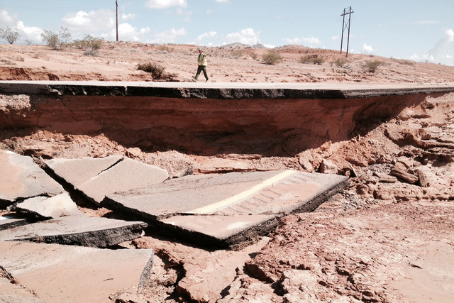
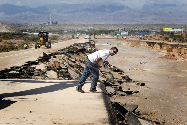
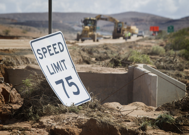
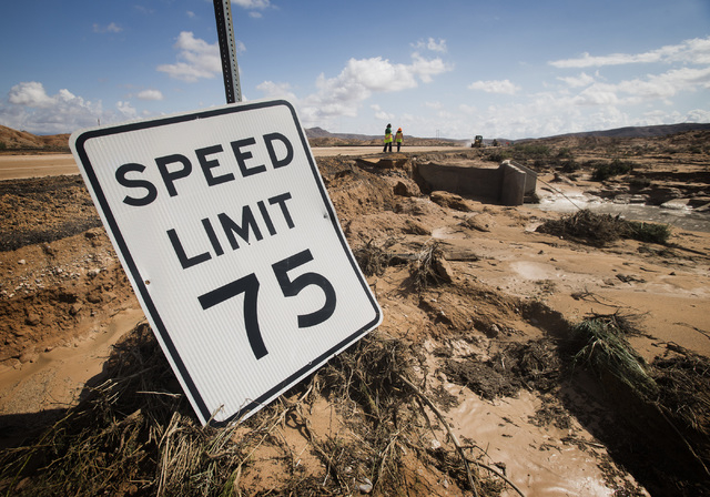
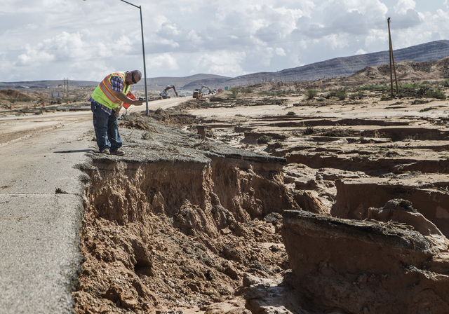
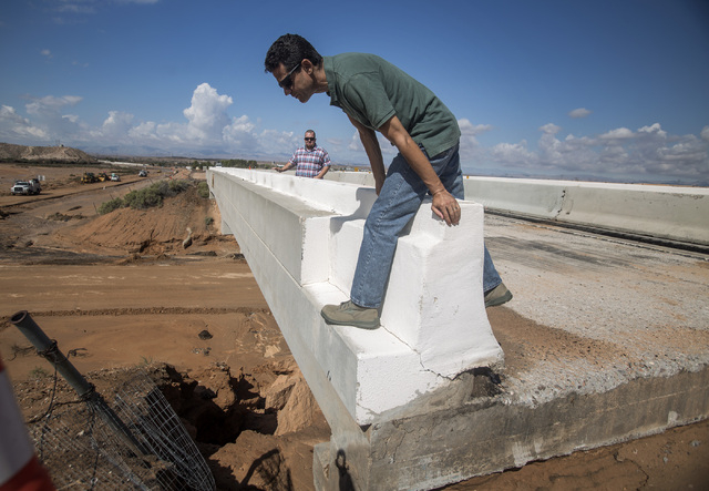
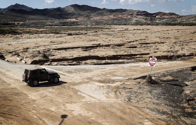
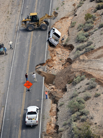
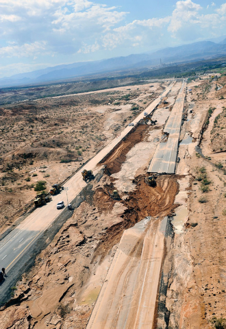
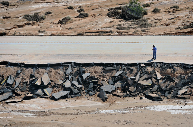
Several portions of I-15 north of Moapa were ripped away by floodwaters that tore through Southern Nevada on Monday afternoon during a once-in-a-century storm, rendering several parts of the freeway impassable to traffic.
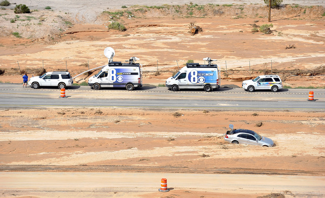
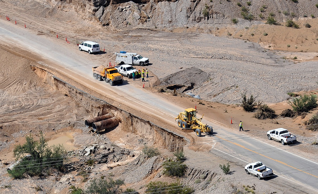
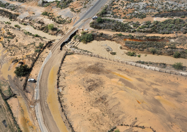
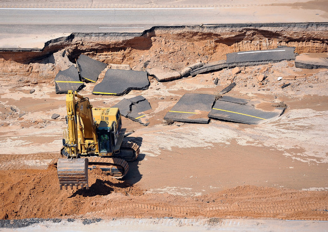
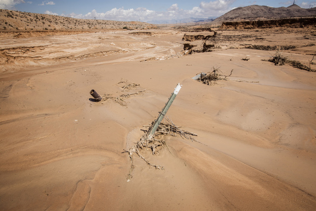
The two-mile stretch of highway ruptured by the flood hardly resembles what is typically one of the Southwest’s major arterials for transportation.
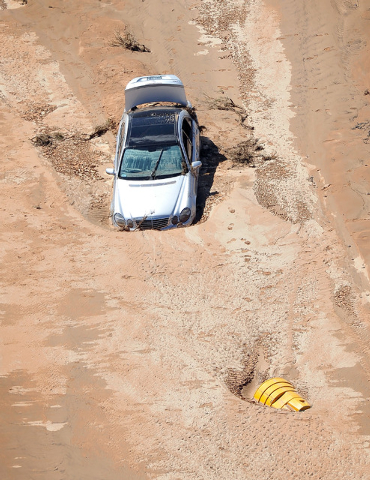
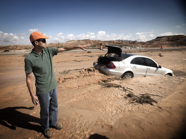
What used to be the median between north and southbound lanes just north of Moapa is now a chasm that is nearly 20 feet deep in spots. Farther south, a Mercedes E350 is buried up to its wheelwells in mud. Just off the road, much of the landscape ravaged by the flood resembles a miniature Grand Canyon.
“This is something beyond our expectations,” NDOT Assistant District Engineer Mohamed Rouas said of the flooding.
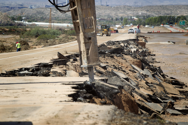
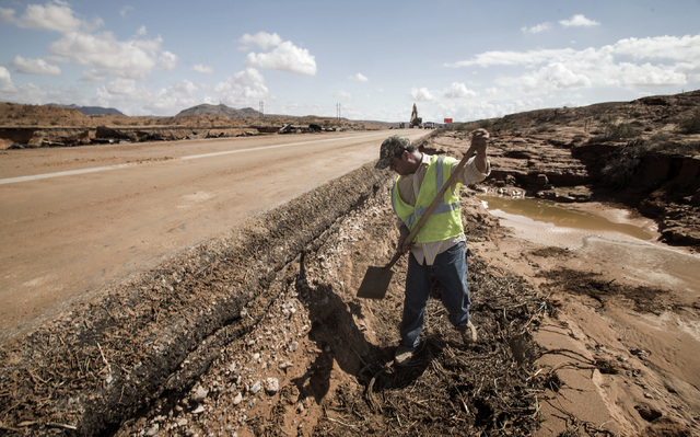
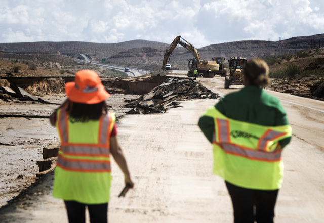
While officials assess the damage, crews are working around the clock in the hopes of having at least one lane of traffic in each direction open by the weekend, Rouas said.
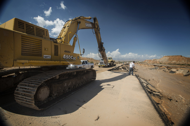
Since crews and heavy equipment were already working on repaving the portion of the interstate that washed away, NDOT didn’t need to draw up an emergency contract, said department spokeswoman Meg Ragonese. Making up a new contract could have delayed repairs by a day or two.
NDOT and Las Vegas Paving agreed on a multi-million dollar change order, and crews have been working to repair and reopen the road since early Tuesday.
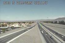
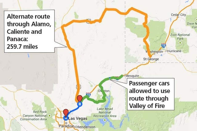
I-15 DETOURS
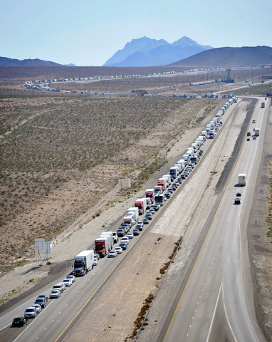
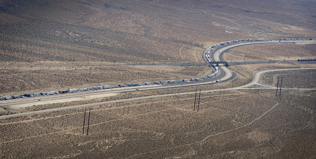
But as workers continue to repair the interstate for travel, authorities are rerouting travelers through lesser-used roads.
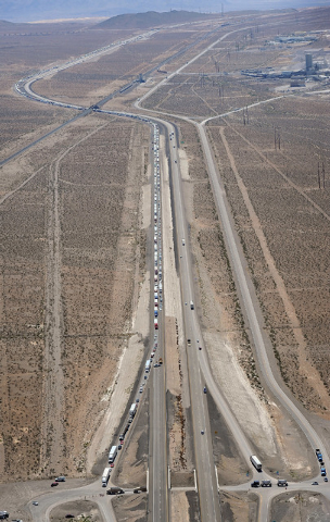
The Nevada Highway Patrol opened a new, shorter detour Tuesday afternoon for passenger cars looking for a way around the flood damaged section of Interstate 15 north of Las Vegas.
The interstate is now open as far north as the Valley of Fire State Park exit, about 35 miles northeast of Las Vegas. There, motorists are being diverted through the state park and onto state Route 169, which loops through the northern end of Lake Mead National Recreation Area and through the towns of Overton and Logandale before rejoining I-15 north of the washed out stretch.
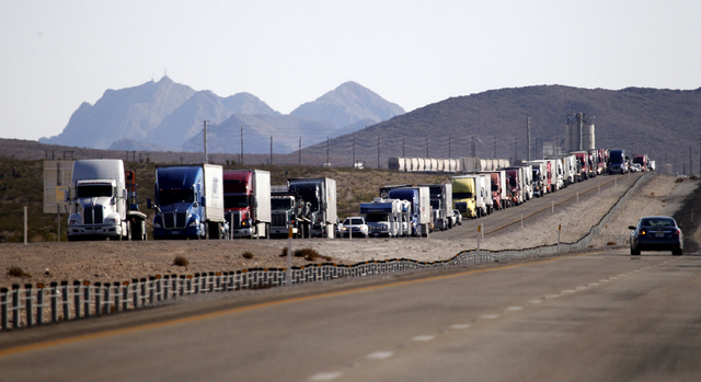
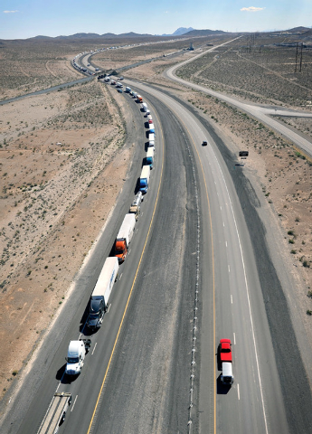
Small vehicles headed south on I-15 from Utah to Las Vegas will also be able to use state Route 169 to skirt the damaged interstate, but the new detour is off limits to commercial vehicles.
Tractor-trailers will still have to use the longer detour through Lincoln County. That route diverts northbound I-15 traffic from Las Vegas onto U.S. Highway 93 and north from there all the way to the town of Panaca, then east on state Route 319, which becomes Utah Route 56 and connects to I-15 at Cedar City.
Commercial vehicles headed south on I-15 between Utah and Las Vegas also will be diverted through Panaca and south on U.S. 93.
Transportation officials expect I-15 to remain closed for several days between the exits for Valley of Fire and state Route 169.
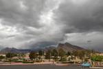
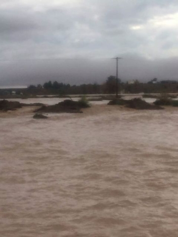
Enough rain fell in several parts of the Moapa Valley area Monday to trigger a 100-year flood event, said Chris Stumpf, meteorologist for the National Weather Service in Las Vegas.
One rain gauge on the Moapa Indian Reservation logged about 2 inches of rain in one hour. Another gauge, this one on Weiser Wash north of the town of Moapa, recorded nearly 5 inches of rain in just a few hours — more precipitation than the Las Vegas Valley receives in an average year.
Stumpf said the dry desert soil simply isn’t built to absorb that much water at once, so it begins to run downhill as quickly as it falls.
“If half an inch falls over a couple square miles and it all funnels down into one place, that’s where you’re going to have problems,” he said.
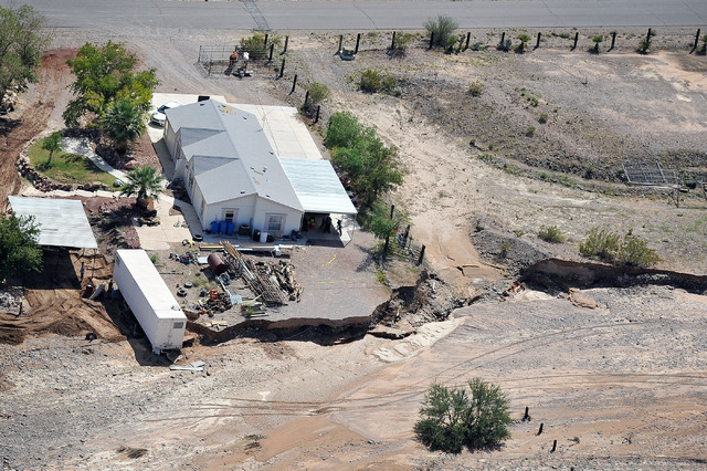
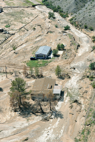
FLOODS WRECKED HOMES
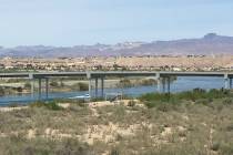
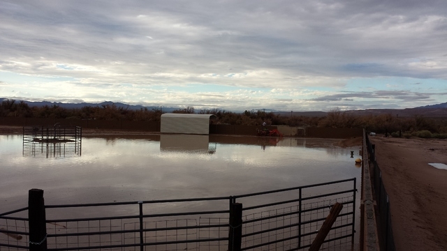
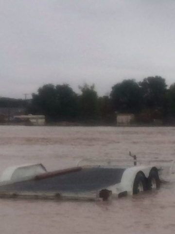
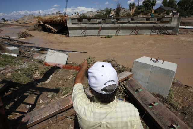
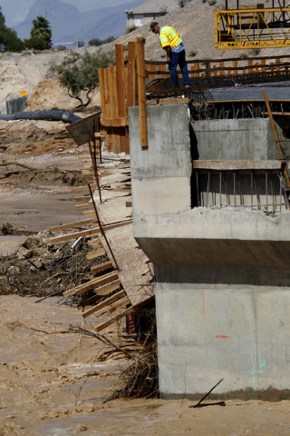
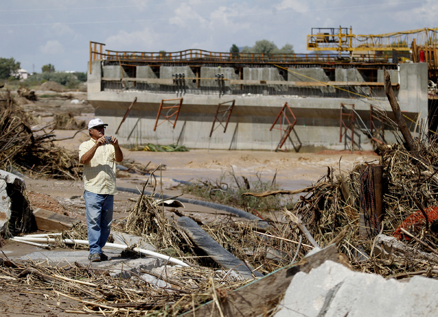
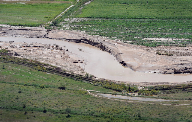
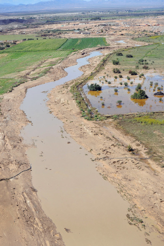
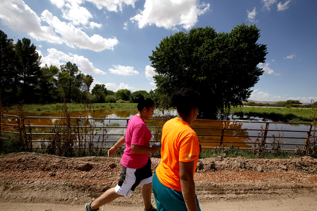
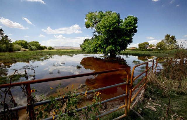
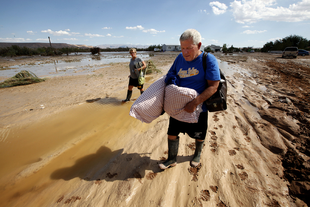
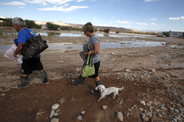
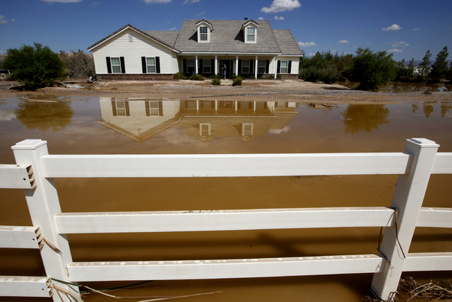
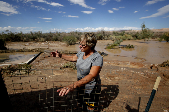
The roiling floodwaters that buckled the interstate eventually found their way into the Muddy River, which jumped its banks and damaged homes in the towns of Logandale and Overton.
Area residents said the Muddy River is usually no more than about 6 feet wide. On Tuesday afternoon it carried an expanse of mocha-colored water several hundred yards wide.
In the backyards of some homes closest to the river, the water was more than two feet deep.
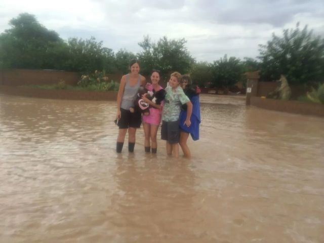
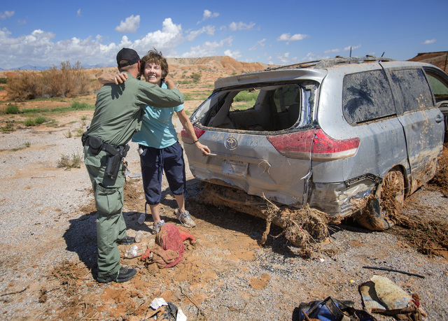
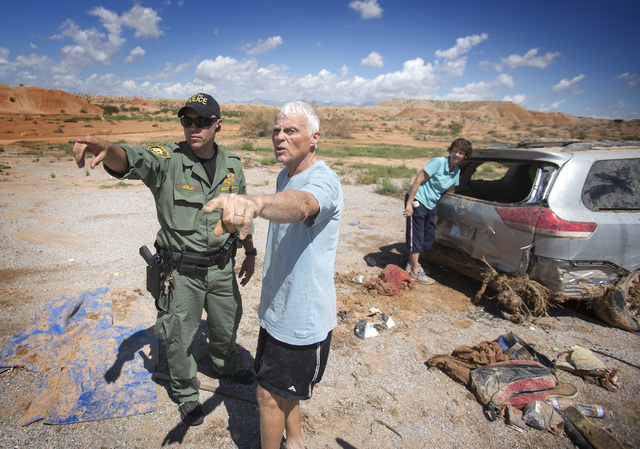
Jim and Melanie Vallet live in one of the hardest hit neighborhoods along the river at the southeastern edge of Overton. They said they decided to evacuate at about 8:30 p.m. Monday, as volunteer firefighters were knocking on doors and telling their neighbors to get out. They spent the night in their Suburban in the parking lot of Moapa Valley High School because it was the highest ground they could find.
They’ve lived in Overton for 13 years, and this was the worst of the three floods they’ve seen — worse even than the January 2005 deluge that inundated dozens of homes in the community and prompted talk of disaster relief and more flood-control work.
“When we left the neighborhood, the water was in places we’ve never seen it before,” Melanie Vallet said. “We’ve got three kids in college. We don’t need this.”
Lois Hall is vice president of the Moapa Valley Chamber of Commerce and owns an auto repair shop with her husband in Overton.
She said a senior living facility where her 87-year-old mother resides had to be evacuated Monday night. Hall was headed back to the Carefree Living Apartments late Tuesday morning in hopes of collecting her mother’s pills.
“A lot of homes flooded” in Overton, including one belonging to a mechanic at their repair shop, Hall said, “but everybody is safe.”
Overton’s new Cooper Street bridge under construction over the Muddy River was badly damaged by the flooding, she said.
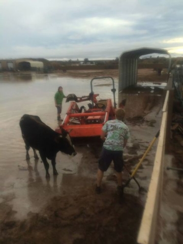
Tuesday afternoon, a cow and a horse could be heard calling out from a ranch property surrounded by water where neighbors said a woman ignored the evacuation order and later had to be rescued from her home.
There was also a house fire indirectly caused by the flooding, Hall said. Apparently the residents were in the middle of cooking dinner when the power went off. The home was evacuated, and while the residents were gone the power came back on, causing their untended kitchen to go up in flames.
“It’s pretty disheartening to see the neighborhood like this,” said Bill Dahlberg, 77, as he surveyed the flooding around his home in Overton for the past 3 years.
Asked what he planned to do now, he said, “ain’t gonna be here much longer.”
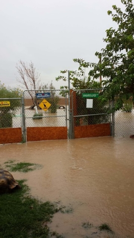
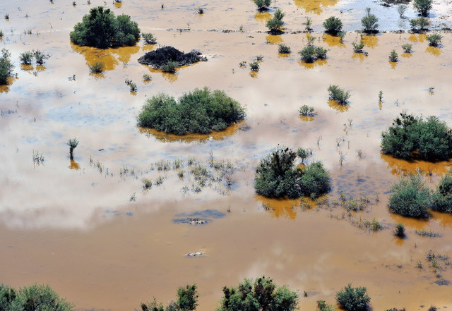
Upstream in the town of Moapa, the owners of the Roos-N-More Zoo and several of their neighbors in low-lying areas saw their yards fill with water Monday, leaving behind a sloppy mess Tuesday. Photos posted to the zoo’s Facebook page showed standing water on much of the property, but all of the animals were safe and accounted for.
Dozens of homes in the Moapa Valley were still without power Tuesday night.
The flood also washed out a stretch of railroad track in the area. A crew from Union Pacific worked all day Tuesday to replace the rocky bed beneath the rails and hoped to have the segment up and running today, said railroad spokesman Aaron Hunt.
Two freight trains headed for Salt Lake City were being held while the tracks were repaired.
Gov. Brian Sandoval declared a state of emergency Tuesday afternoon for the damaged areas, allowing Clark County and the Moapa Paiute Tribe Reservation to seek state and federal funds to help pay for the initial flood response and subsequent repairs.
The Clark County Commission said Tuesday it will consider a related resolution next week to declare a state of emergency in Moapa, Moapa Valley and Sandy Valley.
Assessment teams have been surveying damage to public infrastructure and private property. No damage estimates were available Tuesday.
For now, residents of Overton and Logandale are left with one way in and out of town: They will have to join the parade of vehicles on the I-15 detour route south through Valley of Fire or Lake Mead National Recreation Area and on to Las Vegas.
For those living on the west side of the damaged stretch of interstate — namely Moapa, Glendale and the Warm Springs area — the only way out is state Route 168, which leads west to U.S. 93.
Valley of Fire State Park and Lake Mead National Recreation Area are waiving their entrance fees while their roads are being used as detours.
Lake Mead spokesman Kevin Turner said the park’s roads really weren’t designed to carry an interstate’s worth of traffic, but there shouldn’t be any problems as long as motorists take it slow.
Review-Journal writers Kimber Laux, Ricardo Torres and Ben Botkin contributed to this report. Contact Justin Yurkanin at jyurkanin@reviewjournal.com or 702-477-3892. Find him on Twitter: @justyurkanin. Contact Colton Lochhead at clochhead@reviewjournal.com or 702-383-4638. Find him on Twitter: @coltonlochhead. Contact Henry Brean at hbrean@reviewjournal.com or 702-383-0350. Find him on Twitter: @RefriedBrean.
 Map:
Map:More information on the Interstate 15 story as it develops.
RELATED:
Crews begin repairs on I-15 damage north of Las Vegas
Drier weather moving into Las Vegas Valley