Drought reveals once-submerged St. Thomas


St. Thomas, located in Lake Mead National Recreation Area, was once a flourishing Mormon pioneer town. It was founded in 1865 near the confluence of the Muddy and Virgin Rivers. With the building of Boulder Dam (now Hoover Dam) and the resulting rising waters of the Colorado River that formed Lake Mead, the town had to be abandoned in 1938. But what remained of the town lay some 60 feet below water level for seven decades.
With our ongoing drought, this area of the Overton Arm area of the lake dried up a few years ago. This now affords visitors a great place to take an easy hike and see the remains of the town. St. Thomas was once home to a couple hundred people, who primarily mined or farmed the area. One of the important crops was cotton. The Arrowhead Trail, the main early auto route from Salt Lake City to Los Angeles, passed through St. Thomas, so a few businesses set up there to meet the needs of travelers - a hotel, restaurant and a good repair garage.
With construction of the dam, the federal government paid landowners for flooding their property, but money was poor compensation for the emotions attending the loss of homes, some of which had belonged to the same families since the 1880s. The graves of St. Thomas pioneers were moved to Overton, a few miles up the valley and above the high-water mark. Then the families left. One man, Hugh Lord, waited so long he had to leave town in a rowboat in June 1938.
The trailhead is at an elevation of about 1,227 feet. Depending on how many side trips along the various spur trails you take, plan on hiking approximately two miles round trip.
From the trailhead, follow the well-marked path down the hill and to the old lake bed. You will find plenty of trail markers along the way to guide you. After about 10 minutes, you will come to the first of more than a dozen ruins on your left. Just continue along the trail, and you will find them, the majority just old foundations in various shapes and sizes. Grated cisterns dot the landscape.
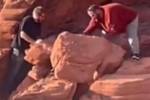
Two of the most interesting ruins are at the end of the straight area of the wide trail. On your left, you will find the remains of a house or possibly the post office because it has a flag pole, which is the tallest structure there. Although it was never a large structure, I would estimate one part - I presume to be the chimney - to be about 12 feet tall, which is amazing after so many years underwater.
The next and perhaps the most interesting ruin is across the trail, south about 25 yards along a spur path. This is the foundation of the old schoolhouse. I had thought this to be the hotel, but when I saw the shape of the building and the curve of the main schoolroom stairs, I matched that with a photo on the interpretive sign at the trailhead. It showed children standing in front of the two-story school. The foundation is about 60 by 70 feet in size and is in great shape, considering.
At various ruins you can find old pieces of metal, broken china and lots of rusted metal - all reminders of a once-vital town. Using metal detectors, or removing artifacts, metal or otherwise, is prohibited. Always avoid climbing on the fragile foundations.
If you wish to extend your hike a bit more, it's only a third of a mile to the Muddy River and a mile to the Virgin River. Getting to either will require you to fight your way through heavy growths of invasive tamarisk tree, but you'll have the chance to see hawks and numerous waterfowl, including the possibility to see the rare winter visitors, tundra swans, two of which I saw on a recent trip.
Deborah Wall is the author of "Great Hikes, A Cerca Country Guide" and "Base Camp Las Vegas: Hiking the Southwestern States," published by Stephens Press. She can be reached at deborabus@aol.com.
Directions
From North Las Vegas, take U.S. Highway 93/95 south to Lake Mead Drive in Henderson. Go east on state Route 146 for about 10 miles to the Lake Mead National Recreation Area’s fee/entrance station. Drive 0.2 miles and go left onto Northshore Road. Follow Northshore Road for about 43 miles to a right turn onto state Route 109. Drive 3.2 miles along the well-graded gravel road, staying right at the fork for St. Thomas Point and trailhead.