Flood prevention work starts on Mount Charleston


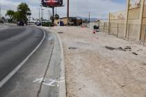
Work crews have converged near the Rainbow community on Mount Charleston to start a project with a singular goal: to avoid a repeat of the the July flood that washed mud and debris into yards and homes.
The Army Corps of Engineers and U.S. Forest Service last week started prep work for clearing trees and vegetation in advance of building a 2,200-foot-long flood diversion project that’s intended to protect homes from future floodwaters.
July marked the second time in less than a year that severe flash floods struck the area during monsoon season. The Carpenter 1 Fire in 2013 had chewed through vegetation and charred the higher mountainsides, making homes more prone to flooding. The area also flooded Labor Day weekend in 2013.
The earthen berm will divert and take water down the mountain to the Kyle Canyon Wash. It will be constructed from excavated dirt, with 36-inch rocks on the face of the project to protect the berm, which will also carry fast-moving debris downhill during floods.
The goal — after several days of clearing trees and vegetation to make way for the berm — is to get the project done as quickly as possible. That’s estimated to take at least 30 days after the clearing, officials said.
GETTING THERE
Getting to this point wasn’t quick.
The corps and Clark County officials were unable to get an agreement in place for the berm after the 2013 flood. County officials had concerns about being required to assume the legal liability for the project, which is being built on Forest Service land. County officials are willing to maintain the project and cover those costs, however.
After the second flood hit, Gov. Brian Sandoval and state officials reached an agreement with the corps to assume the ownership and liability for the $3 million project, which will be built with federal dollars.
Rainbow residents in the past have criticized the process, because the corps was ready to start a project in June and finish it before the monsoon season hit. The work was unable to start then because of the county’s legal concerns.
Now, residents are looking forward to protection from future flooding.
“Everybody’s very happy,” said Becky Grismanauskas, a resident in Rainbow.
In the meantime, the berm’s plans have grown in size. The corps retooled the plans after the second flood provided more data for planners to work with about how floods and debris flow down the mountain.
Initially, the length was to be 1,200 feet after the first flood. That increased to 1,700 feet and finally to about 2,200 feet.
The 2013 flood was roughly a 10-year event. However, the more recent flooding was a 20-year flood event.
The berm length was extended to protect more homes.
“The bottom line is that the second storm event actually provided some more information,” said Anne Hutton, chief of the corps’ Emergency Management Office for the Los Angeles District, which covers Mount Charleston.
One reason for the difference is that typically for projects, planners have years and years of rainfall and flood data. With this limited mountain area, there weren’t gauges to analyze.
Clark County Commissioner Larry Brown said the county’s message has been consistent throughout the process and it has always been willing to be a partner and handle the maintenance of the berm.
“I think we have a better project being built today because of some of the concerns that were raised, and that’s a good thing,” Brown said, noting how the berm plans have grown in scope and offer more protection.
THE FUTURE
The Forest Service estimates it will take seven to 10 years for the vegetation to grow back to a level thick enough to protect homes from rains. The plan is for state officials to start submitting reports about conditions to the corps five years from now.
When all the parties agree that conditions are suitable for removal, the berm comes out.
The berm is located on federal Forest Service land, and the agency provided a 10-year permit that allows the project. If the berm is still needed after 10 years, the permit can be extended.
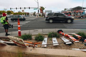
The Forest Service is constructing the berm, with oversight from the Army Corps of Engineers.
The work includes cutting down trees, removing the logs, cleaning the corridor and building the berm. They’re also adding an access road to the project.
Crews will be at the site at least 13 out of every 14 days.
“We will work full days, basically a dawn-to-dusk schedule,” said Randy Swick, area manager for the Spring Mountains National Recreation Area.
The days are getting shorter.
“We’re committed to staying on the mountain to get it done right and safely,” Swick said.
Under the agreement, the state, not the corps, will be responsible for the maintenance of the berm after its construction. The federal agency will provide an operations and maintenance manual to state officials with information about tasks like cleaning debris after storms and annual inspections.
However, county and state officials are in talks about reaching an agreement for Clark County Public Works to handle the maintenance for the state.
Brown said the governor’s office has been in contact with the county about drafting an agreement so the county can maintain the project. Preliminary estimates of the county’s costs of maintaining and removing the berm are upwards of about $1 million.
Contact reporter Ben Botkin at bbotkin@ reviewjournal.com or 702-405-9781. Follow him on Twitter @BenBotkin1.