Group unveils new trail plan for valley


Imagine hard-core hikers marching from Red Rock Canyon to Lake Mead and back again without having to retrace a single step.
Such is the vision of the Outside Las Vegas Foundation.
The nonprofit group is leading an effort to develop a 113-mile hiking and biking trail that would loop around the valley and link with other trails and outdoor attractions.
Call it Southern Nevada's version of the Tahoe Loop Trail.
"They've got the beautiful lake in the middle. We've got the neon in the middle," said Mauricia Baca, the foundation's executive director. "We're celebrating that."
Conceptual plans for the Vegas Valley Rim Trail will be unveiled today during a National Trails Day celebration at the Henderson Pavilion.
Right now, Baca said, the project is "pencil ready." It could take another two or three years for the Outside Las Vegas Foundation to oversee completion of the necessary studies, agreements and designs to make it "shovel ready," she said.
The trail most likely would be built a segment at a time and could take 10 to 15 years to complete.
Baca said they could probably develop it faster than that, but the foundation is committed to gathering input from the community every step of the way.
Even the name of the trail was decided with the public's help.
More than 500 people voted in an online survey that picked Vegas Valley Rim Trail from a list of other suggestions including Bighorn Circle, Mojave Gateway Trail and Tudinu Circle, which is an American Indian word meaning desert people.
Baca said actively involving the community in the project is the best way to keep it from becoming "a nifty idea that sits on a shelf."
The concept is being developed at the direction of the Southern Nevada Regional Planning Coalition, an urban planning agency that includes Clark County, the school district and the cities of Las Vegas, Henderson, North Las Vegas and Boulder City.
It also has won the support of the Southern Nevada Health District, which views it as a tool for combating obesity. After all, Baca said, hiking is something almost anyone can do. "If you can afford a pair of shoes, you can get yourself out there."
Backers of the project believe it could help put Las Vegas on the map as an outdoor playground as well as an indoor one.
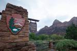
Alan O'Neill is the former superintendent of Lake Mead National Recreation Area and one of the founders of the Outside Las Vegas Foundation.
He said development of the Vegas Valley Rim Trail could shine a light on something few locals and even fewer tourists seem to know about the community: "We already have a world-class trail system."
O'Neill ought to know. He recently helped compile a complete inventory of the valley's existing trails, a six-month undertaking that required him to personally walk nearly every mile.
The final tally: 338 separate backcountry, regional, neighborhood and park trails totaling 750 miles.
And that doesn't include the roughly 345 miles of bike lanes and routes that make up the valley's so-called "on-street trail network." "It amazed me how much we had," O'Neill said.
The Outside Las Vegas Foundation, NV Energy and the Southern Nevada Regional Planning Coalition have provided about $280,000 in seed money for the Vegas Valley Rim Trail.
Wells Fargo chipped in another $25,000 to help pay for an economic analysis of the project.
Roughly $1 million more will be needed to shepherd the idea through the next phase, which involves securing rights of way, hammering out agreements over existing trails that may be incorporated into the loop, and developing solid cost estimates for construction, maintenance and oversight of the trail.
Only then will the project be ready for detailed engineering and design work, Baca said.
The entire rim trail could wind up costing $60 million to $100 million, depending on the total amount of interpretive signs, restrooms, parking lots and other "bells and whistles," she said.
The plan is to use a mix of private donations, public grants and in-kind contributions to pay for design and construction.
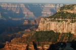
The exact alignment of the trail has not been decided, but conceptual plans call for it to string together the valley's outdoor treasures like a giant necklace -- Tule Springs and the Desert National Wildlife Refuge in the northwest; Nellis Dunes and Sunrise Mountain in the northeast; Lake Mead and the Las Vegas Wash and wetlands in the east; Sloan Canyon in the south; and Red Rock Canyon in the west.
Baca and company expect a few truly adventurous outdoor enthusiasts to try to complete the entire loop in a single trip . Most people will experience the trail a segment or two at a time .
Along the way, there will be opportunities to take in a variety of landscapes, both natural and urban, and learn about local wildlife, geology and paleontology.
"It's more than a trail. It's an open space corridor with a trail running through it," O'Neill said.
In the southwest valley, the trail would overlay a portion of the River Mountains Loop Trail, which forms a 35-mile ring around the range that separates Henderson from Boulder City and Lake Mead National Recreation Area.
The final segment of the River Mountains Loop Trail was completed two weeks ago, closing a circuit that was 15 years in the making.
"That's the inspiration here," Faiss said of the River Mountains loop. "That's how we know we can get this done."
Contact reporter Henry Brean at hbrean@review.journal .com or 702-383-0350.
TAKE A HIKE
What: National Trails Day celebration
When: 9 a.m. to 1 p.m. today
Where: Henderson Pavilion on Green Valley Parkway at Paseo Verde Parkway
The event features a one-mile family fun walk, a photo contest and a variety of exhibitors and vendors. Conceptual plans for the Vegas Valley Rim Trail will be officially unveiled at 10:30 a.m.