Route through western Death Valley reopens, many roads still closed

State Road 190 as visible from the Father Crowley vista, part of the few miles of road that have reopened. (National Park Service)

Los vehículos pasan por los daños de la carretera en la State Route 190 adyacente a The Inn at Death Valley en el parque nacional después de los daños de las inundaciones del monzón la semana pasada el martes 9 de agosto de 2022. (L.E. Baskow/Las Vegas Review-Journal) @Left_Eye_Images

Los autos permanecen atascados en los flujos de lodo en el estacionamiento de The Inn at Death Valley en el parque nacional después de los daños causados por las inundaciones del monzón la semana pasada el martes 9 de agosto de 2022. (L.E. Baskow/Las Vegas Review-Journal) @Left_Eye_Images

Una barricada permanece en la State Route 190 que conduce al Parque Nacional Death Valley tras los daños causados por las inundaciones del monzón la semana pasada, el martes 9 de agosto de 2022. (L.E. Baskow/Las Vegas Review-Journal) @Left_Eye_Images

Los autos permanecen atascados en los flujos de lodo en el estacionamiento de The Inn at Death Valley en el parque nacional después de los daños causados por las inundaciones del monzón la semana pasada el martes 9 de agosto de 2022. (L.E. Baskow/Las Vegas Review-Journal) @Left_Eye_Images

Graves daños en la carretera a lo largo de Daylight Pass Road cerrada temporalmente debido a los efectos de las recientes inundaciones dentro del Parque Nacional Death Valley el martes 9 de agosto de 2022. (L.E. Baskow/Las Vegas Review-Journal) @Left_Eye_Images

Severe road damage along Daylight Pass Road temporarily closed due to the effects of recent flooding within Death Valley National Park on Tuesday, Aug. 9, 2022. (L.E. Baskow/Las Vegas Review-Journal) @Left_Eye_Images

A roadblock remains on State Route 190 leading into Death Valley National Park following monsoon flood damage last week on Tuesday, Aug. 9, 2022. (L.E. Baskow/Las Vegas Review-Journal) @Left_Eye_Images

Dirt is piled high along State Road 190 near Beatty Road which is temporarily closed due to the effects of recent flooding within Death Valley National Park on Tuesday, Aug. 9, 2022. (L.E. Baskow/Las Vegas Review-Journal) @Left_Eye_Images

Severe road damage along Beatty Road has it temporarily closed due to the effects of recent flooding within Death Valley National Park on Tuesday, Aug. 9, 2022. (L.E. Baskow/Las Vegas Review-Journal) @Left_Eye_Images

Severe road damage along Daylight Pass Road currently closed due to the effects of recent flooding within Death Valley National Park on Tuesday, Aug. 9, 2022. (L.E. Baskow/Las Vegas Review-Journal) @Left_Eye_Images

Severe road damage along Daylight Pass Road temporarily closed due to the effects of recent flooding within Death Valley National Park on Tuesday, Aug. 9, 2022. (L.E. Baskow/Las Vegas Review-Journal) @Left_Eye_Images

Severe road damage along Daylight Pass Road temporarily closed due to the effects of recent flooding within Death Valley National Park on Tuesday, Aug. 9, 2022. (L.E. Baskow/Las Vegas Review-Journal) @Left_Eye_Images

Rocks and mud cover sections of Daylight Pass Road temporarily closed due to road damage within Death Valley National Park on Tuesday, Aug. 9, 2022. (L.E. Baskow/Las Vegas Review-Journal) @Left_Eye_Images

Severe road damage along Daylight Pass Road temporarily closed due to the effects of recent flooding within Death Valley National Park on Tuesday, Aug. 9, 2022. (L.E. Baskow/Las Vegas Review-Journal) @Left_Eye_Images

Sections of road are carried away from damaged Daylight Pass Road temporarily closed due to the effects of recent flooding within Death Valley National Park on Tuesday, Aug. 9, 2022. (L.E. Baskow/Las Vegas Review-Journal) @Left_Eye_Images

Richard Stephens/Special to the Pahrump Valley Times
On Tuesday, Highway 372 into Death Valley National Park remained closed about 8 miles west of Beatty. Park rangers remained at signs stationed in the area to make sure tourists didn't trespass.

Heavy equipment removes several feet of rocks and flood debris from a road in Death Valley on Saturday, Aug. 6, 2022, after flooding on Friday, Aug. 5, 2022. (CalTrans9 via Twitter)
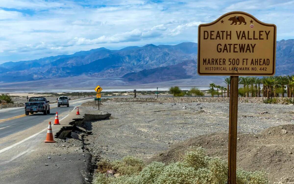
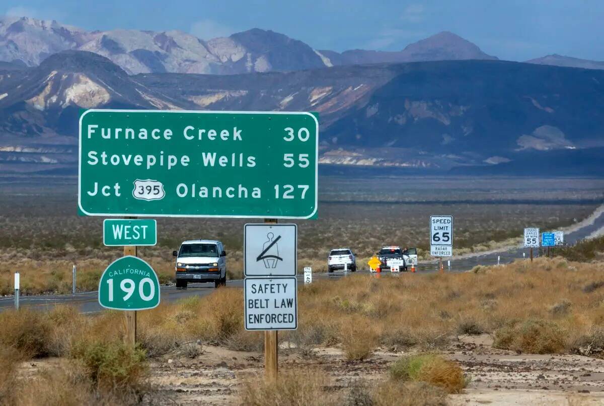
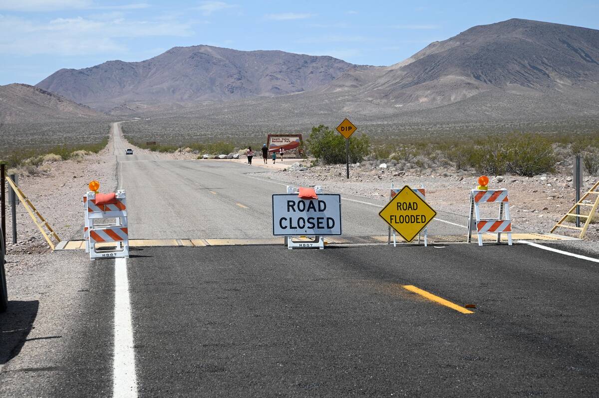
State Route 190, the main road through Death Valley National Park, has reopened on the western side of the park following extreme flooding last week.
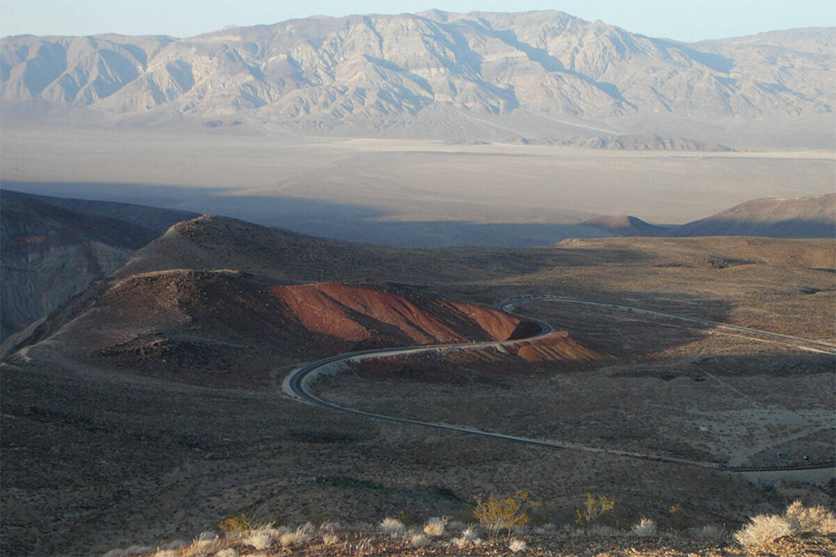
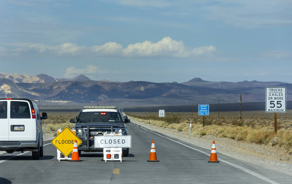
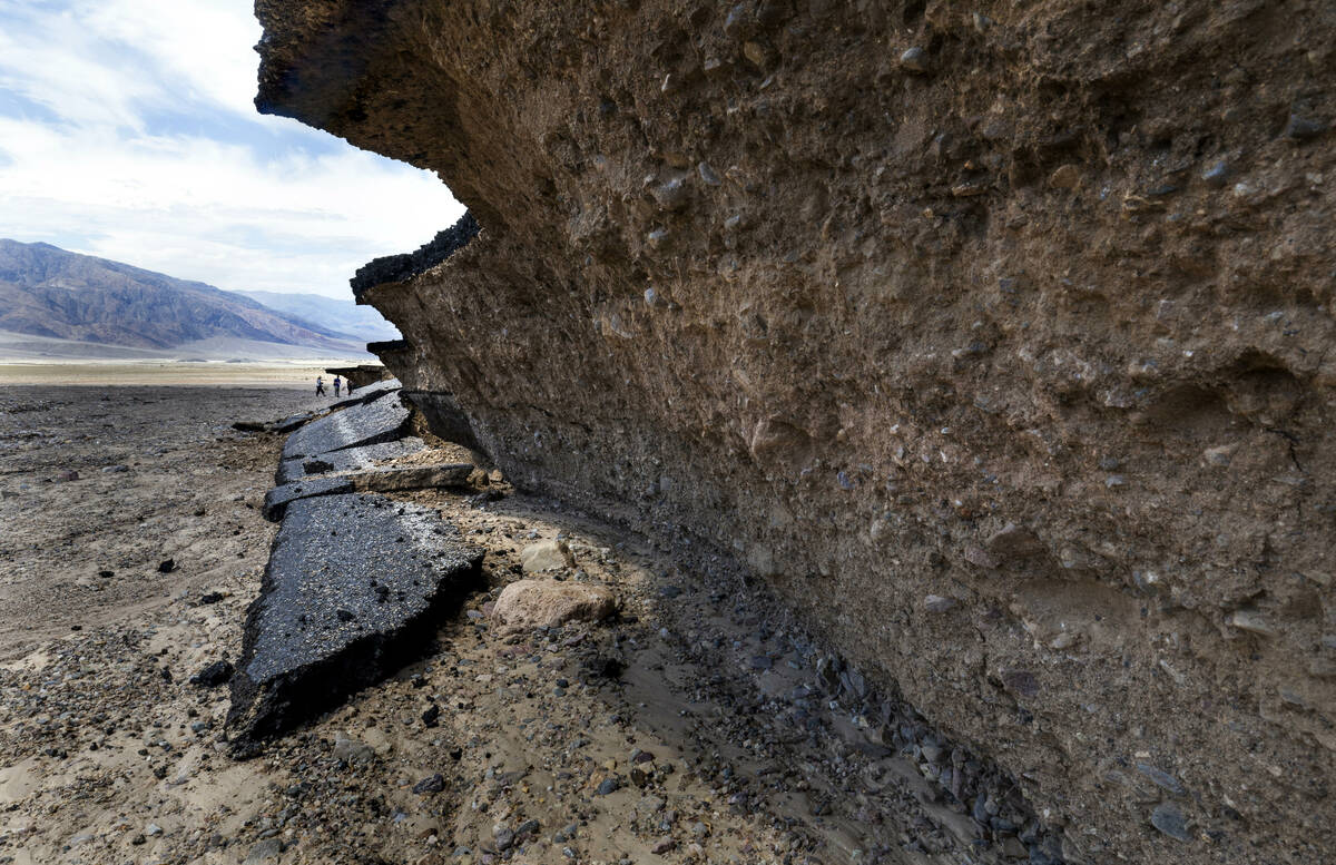
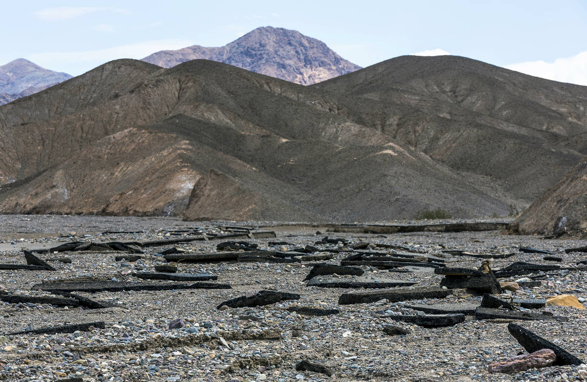
The highway is still closed from Trona/Wildrose Junction in Panamint Valley through Death Valley Junction. The road can currently take park visitors to Panamint Springs Resort, Father Crowley Overlook and Lee Flat, according to the National Park Service.
Satellite photos released by NASA Wednesday show the extent of the flooding from Friday’s storm in Furnace Creek compared with one month ago. The storm brought 1.46 inches of water to the park that on average receives 1.9 inches of rain in an entire year.
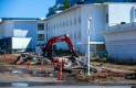
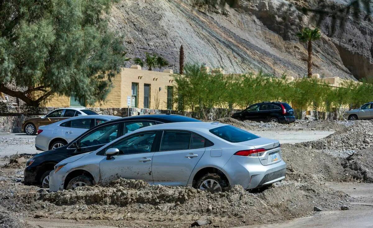
Furnace Creek Visitor Center, Dantes View, Zabriskie Point, Badwater Basin and the Mesquite Sand Dunes remain closed due to flood damage.
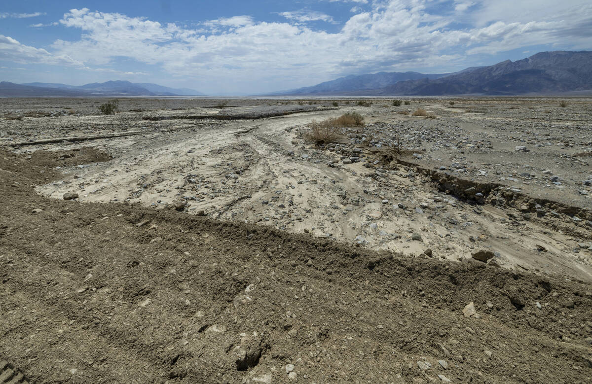
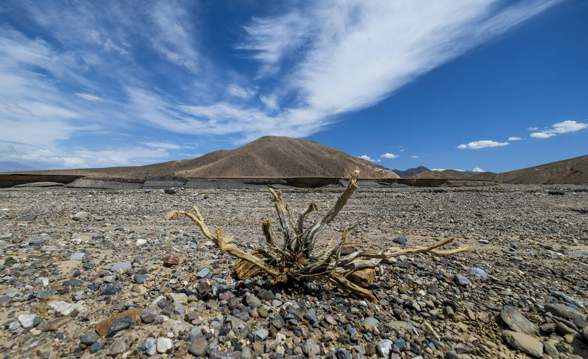
The park service warned visitors to avoid wet playas since foot and vehicle traffic can damage the environment and increase the amount of time it will take to repair certain areas after flooding.
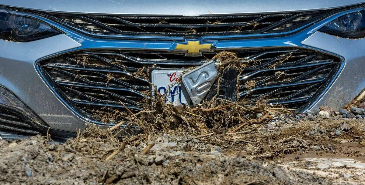
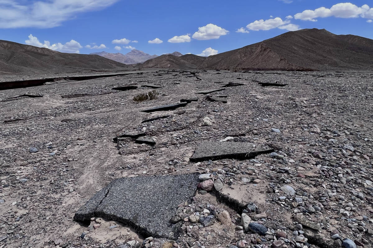
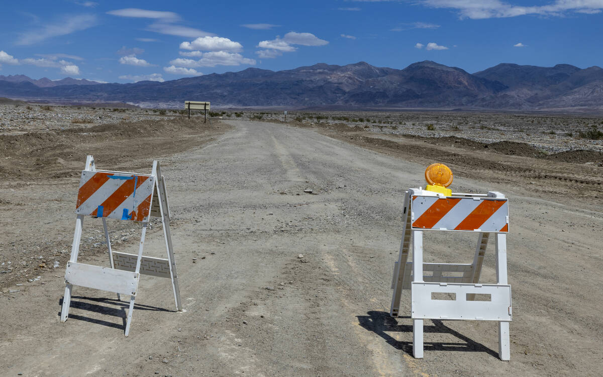
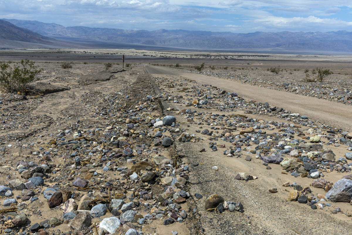
Park rangers are also advising visitors to avoid dirt roads in the park. Some visitors using navigation apps have been routed to dirt roads to access the park and ended stranded as a result. All dirt roads that have been inspected in Death Valley have been damaged by recent flooding, and some are impassible. Not all roads in the park have been assessed due to the intensity of flooding.
“We urge visitors to stay off dirt roads, even if apps are directing them there,” park superintendent Mike Reynolds said in a news release. “While we are working with various map platforms to report these issues, please be smarter than your smart phones.”
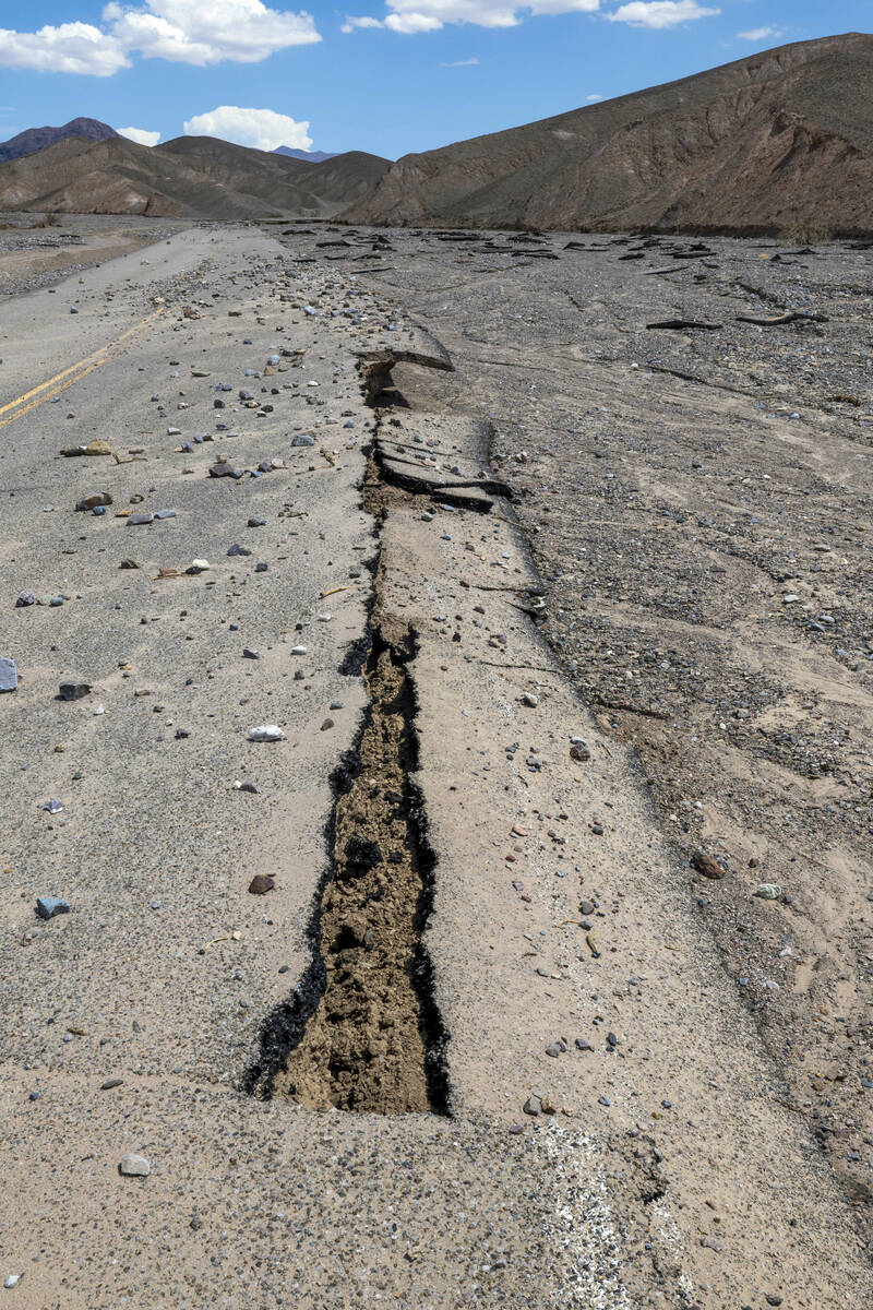
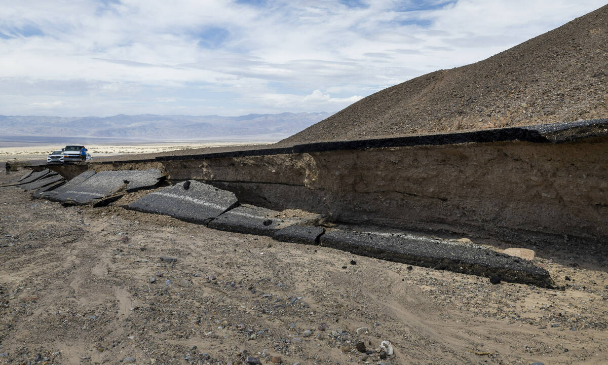
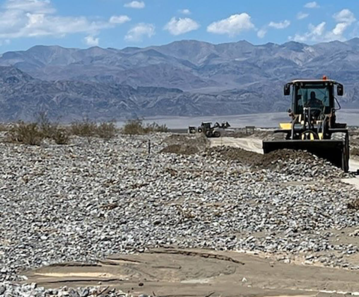
The California Department of Transportation expects most of State Route 190 through Death Valley to stay closed through Aug. 17. About 20 miles of road in the park has been cleared as of Tuesday.