Death Valley: Before and after flooding as seen from space — PHOTOS
Death Valley from space: before and after pictures
Updated August 10, 2022 - 8:22 pm

Furnace Creek in Death Valley, the driest place in North America, as seen from space on July 11, 2022, left, and Aug. 7, 2022, after flash flooding struck the area. (NASA Earth Observatory)

Furnace Creek in Death Valley, the driest place in North America, as seen from space on July 11, 2022. (NASA Earth Observatory)

Furnace Creek in Death Valley, the driest place in North America, as seen from space on Aug. 7, 2022, after flash flooding struck the area. (NASA Earth Observatory)

Severe road damage along Daylight Pass Road temporarily closed due to the effects of recent flooding within Death Valley National Park on Tuesday, Aug. 9, 2022. (L.E. Baskow/Las Vegas Review-Journal) @Left_Eye_Images

Cars remain stuck in mud flows in the parking lot of The Inn at Death Valley at the national park following monsoon flood damage last week on Tuesday, Aug. 9, 2022. (L.E. Baskow/Las Vegas Review-Journal) @Left_Eye_Images

A roadblock remains on State Route 190 leading into Death Valley National Park following monsoon flood damage last week on Tuesday, Aug. 9, 2022. (L.E. Baskow/Las Vegas Review-Journal) @Left_Eye_Images

Cars remain stuck in mud flows in the parking lot of The Inn at Death Valley at the national park following monsoon flood damage last week on Tuesday, Aug. 9, 2022. (L.E. Baskow/Las Vegas Review-Journal) @Left_Eye_Images

Vehicles pass road damage on State Route 190 adjacent to The Inn at Death Valley at the national park following monsoon flood damage last week on Tuesday, Aug. 9, 2022. (L.E. Baskow/Las Vegas Review-Journal) @Left_Eye_Images

Construction machinery continues to clear State Route 190 of mud flows within Death Valley National Park following monsoon flood damage last week on Tuesday, Aug. 9, 2022. (L.E. Baskow/Las Vegas Review-Journal) @Left_Eye_Images

Park Ranger Matthew Lamar stands atop part of the remaining road along Daylight Pass Road temporarily closed due to road damage within Death Valley National Park on Tuesday, Aug. 9, 2022. (L.E. Baskow/Las Vegas Review-Journal) @Left_Eye_Images

Severe road damage along Daylight Pass Road temporarily closed due to the effects of recent flooding within Death Valley National Park on Tuesday, Aug. 9, 2022. (L.E. Baskow/Las Vegas Review-Journal) @Left_Eye_Images

Severe road damage along Daylight Pass Road currently closed due to the effects of recent flooding within Death Valley National Park on Tuesday, Aug. 9, 2022. (L.E. Baskow/Las Vegas Review-Journal) @Left_Eye_Images

A map within Death Valley National Park at the Furnace Creek Visitor Center shows all of the temporarily closed locations there on Tuesday, Aug. 9, 2022. (L.E. Baskow/Las Vegas Review-Journal) @Left_Eye_Images

Sections of road are carried away from damaged Daylight Pass Road temporarily closed due to the effects of recent flooding within Death Valley National Park on Tuesday, Aug. 9, 2022. (L.E. Baskow/Las Vegas Review-Journal) @Left_Eye_Images

Severe road damage along Daylight Pass Road temporarily closed due to the effects of recent flooding within Death Valley National Park on Tuesday, Aug. 9, 2022. (L.E. Baskow/Las Vegas Review-Journal) @Left_Eye_Images

Rocks and mud cover sections of Daylight Pass Road temporarily closed due to road damage within Death Valley National Park on Tuesday, Aug. 9, 2022. (L.E. Baskow/Las Vegas Review-Journal) @Left_Eye_Images

Severe road damage along Daylight Pass Road temporarily closed due to the effects of recent flooding within Death Valley National Park on Tuesday, Aug. 9, 2022. (L.E. Baskow/Las Vegas Review-Journal) @Left_Eye_Images

Severe road damage along Daylight Pass Road temporarily closed due to the effects of recent flooding within Death Valley National Park on Tuesday, Aug. 9, 2022. (L.E. Baskow/Las Vegas Review-Journal) @Left_Eye_Images

Severe road damage along Daylight Pass Road currently closed due to the effects of recent flooding within Death Valley National Park on Tuesday, Aug. 9, 2022. (L.E. Baskow/Las Vegas Review-Journal) @Left_Eye_Images

Severe road damage along Beatty Road has it temporarily closed due to the effects of recent flooding within Death Valley National Park on Tuesday, Aug. 9, 2022. (L.E. Baskow/Las Vegas Review-Journal) @Left_Eye_Images

Dirt is piled high along State Road 190 near Beatty Road which is temporarily closed due to the effects of recent flooding within Death Valley National Park on Tuesday, Aug. 9, 2022. (L.E. Baskow/Las Vegas Review-Journal) @Left_Eye_Images

Water collects into a large pond about the lowest part of Death Valley National Park off on State Route 190 following monsoon flood damage last week on Tuesday, Aug. 9, 2022. (L.E. Baskow/Las Vegas Review-Journal) @Left_Eye_Images

Dirt is piled high along State Road 190 near Beatty Road which is temporarily closed due to the effects of recent flooding within Death Valley National Park on Tuesday, Aug. 9, 2022. (L.E. Baskow/Las Vegas Review-Journal) @Left_Eye_Images

A roadblock remains on State Route 190 leading into Death Valley National Park following monsoon flood damage last week on Tuesday, Aug. 9, 2022. (L.E. Baskow/Las Vegas Review-Journal) @Left_Eye_Images

Vehicles pass road damage on State Route 190 adjacent to The Inn at Death Valley at the national park following monsoon flood damage last week on Tuesday, Aug. 9, 2022. (L.E. Baskow/Las Vegas Review-Journal) @Left_Eye_Images
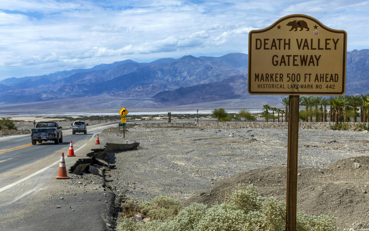
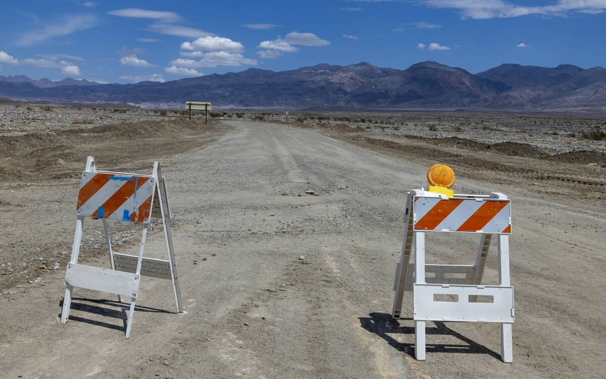
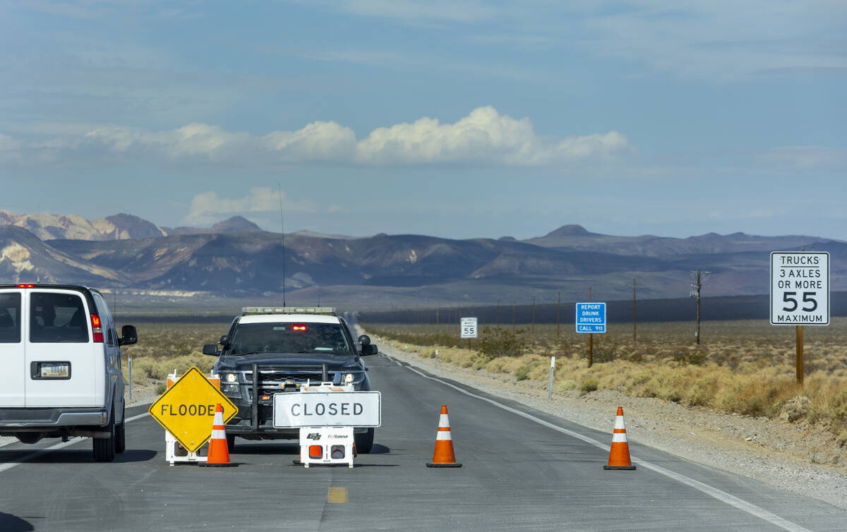
DEATH VALLEY NATIONAL PARK — Entry to the hottest place on Earth will remain closed to cars for at least another week after a rainstorm stranded 1,000 people and flushed dirt, rocks and debris over some of the normally arid desert basin’s 1,000 miles of roads.
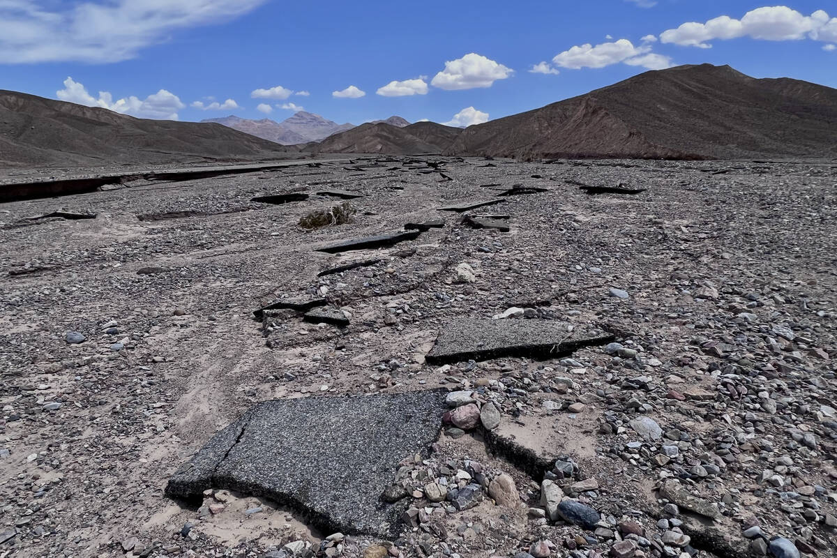
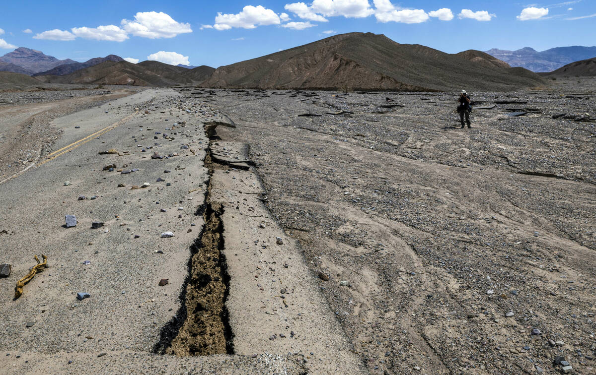
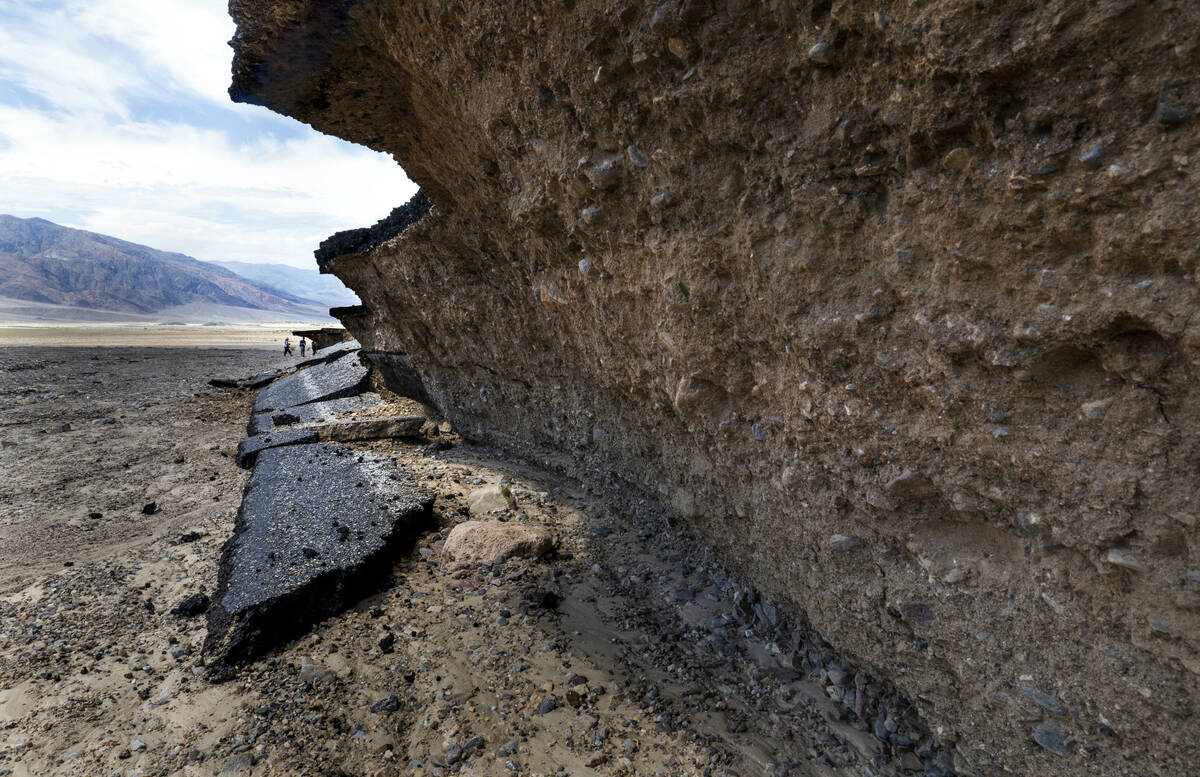
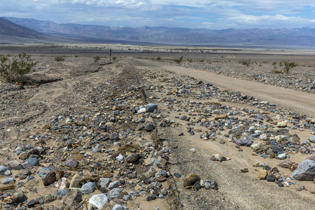
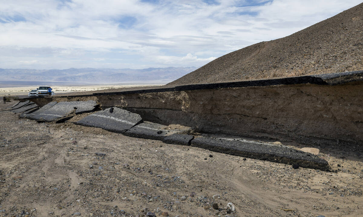
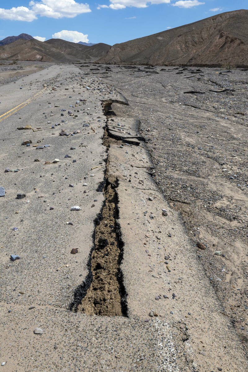
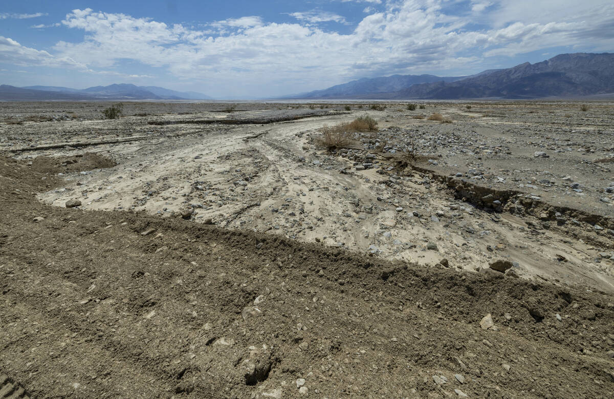
A storm Friday dumped 1.46 inches of water on Death Valley National Park. On Tuesday, reporters were given access for the first time to see some of the aftermath, which included large swaths of roads completely washed away.
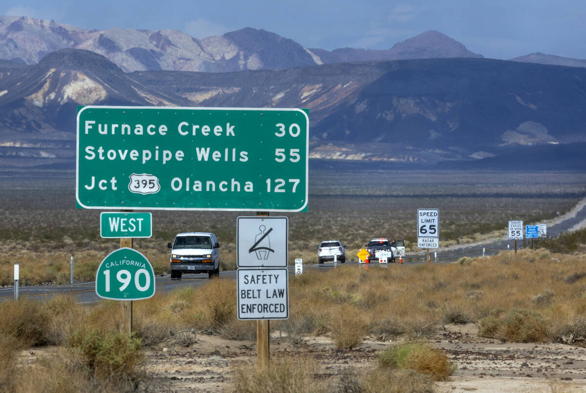
The main artery through Death Valley, state Route 190, is expected to reopen on Aug. 17, but other roads inside the park could take much longer, according to the California Department of Transportation.
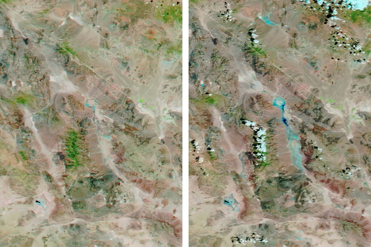
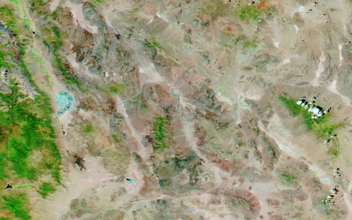
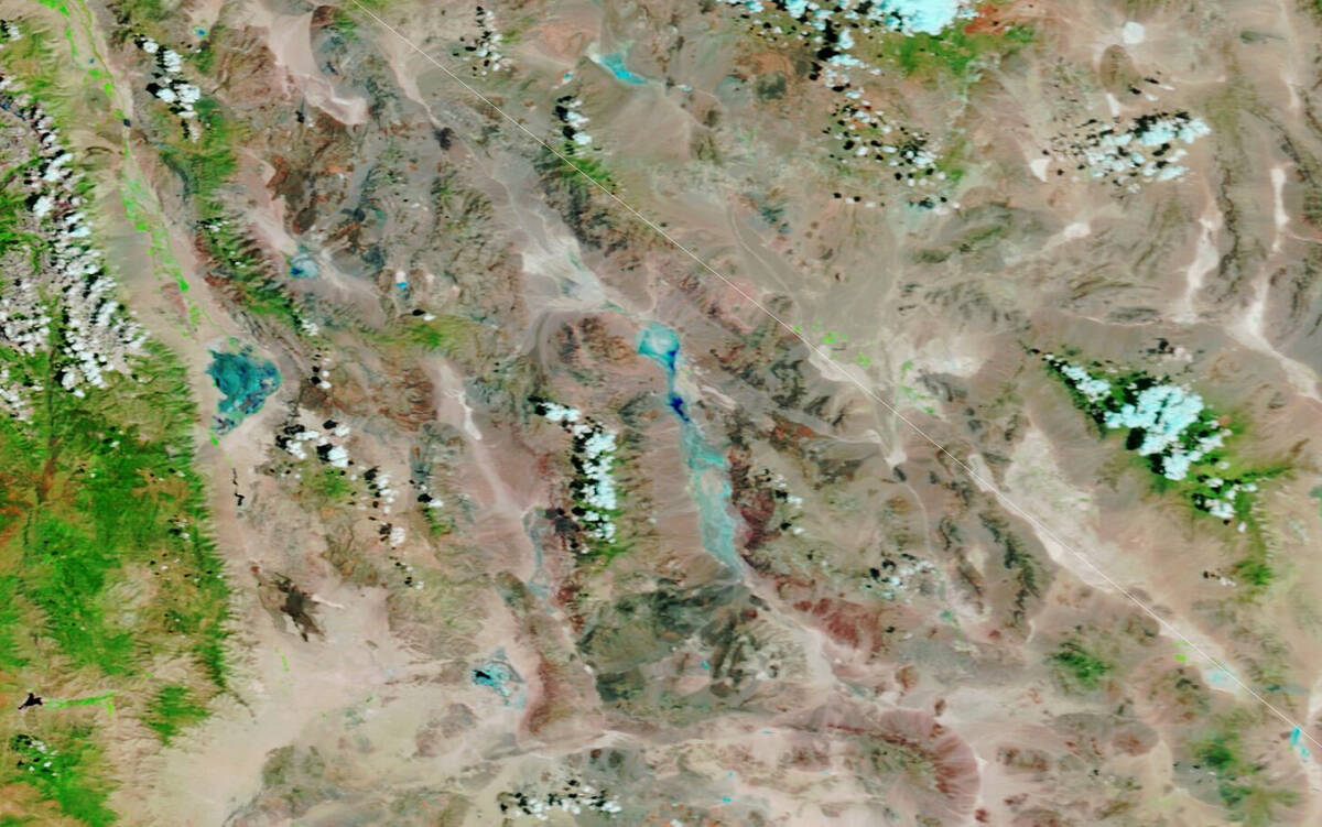
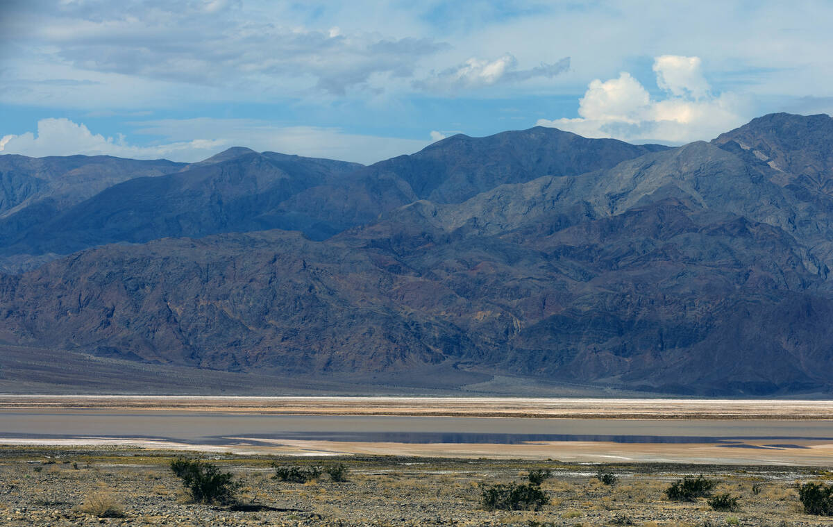
NASA released photos Wednesday showing Furnace Creek in Death Valley from July 11 and the after-effects of Friday’s flash flood.
Some of the flood water is visible in the latter of this pair of false-color images acquired by the Moderate Resolution Imaging Spectroradiometer on NASA’s Terra and Aqua satellites on July 11 and Sunday.
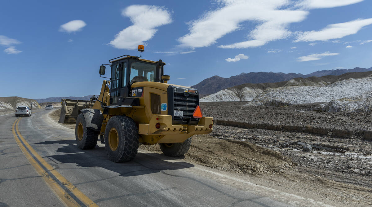
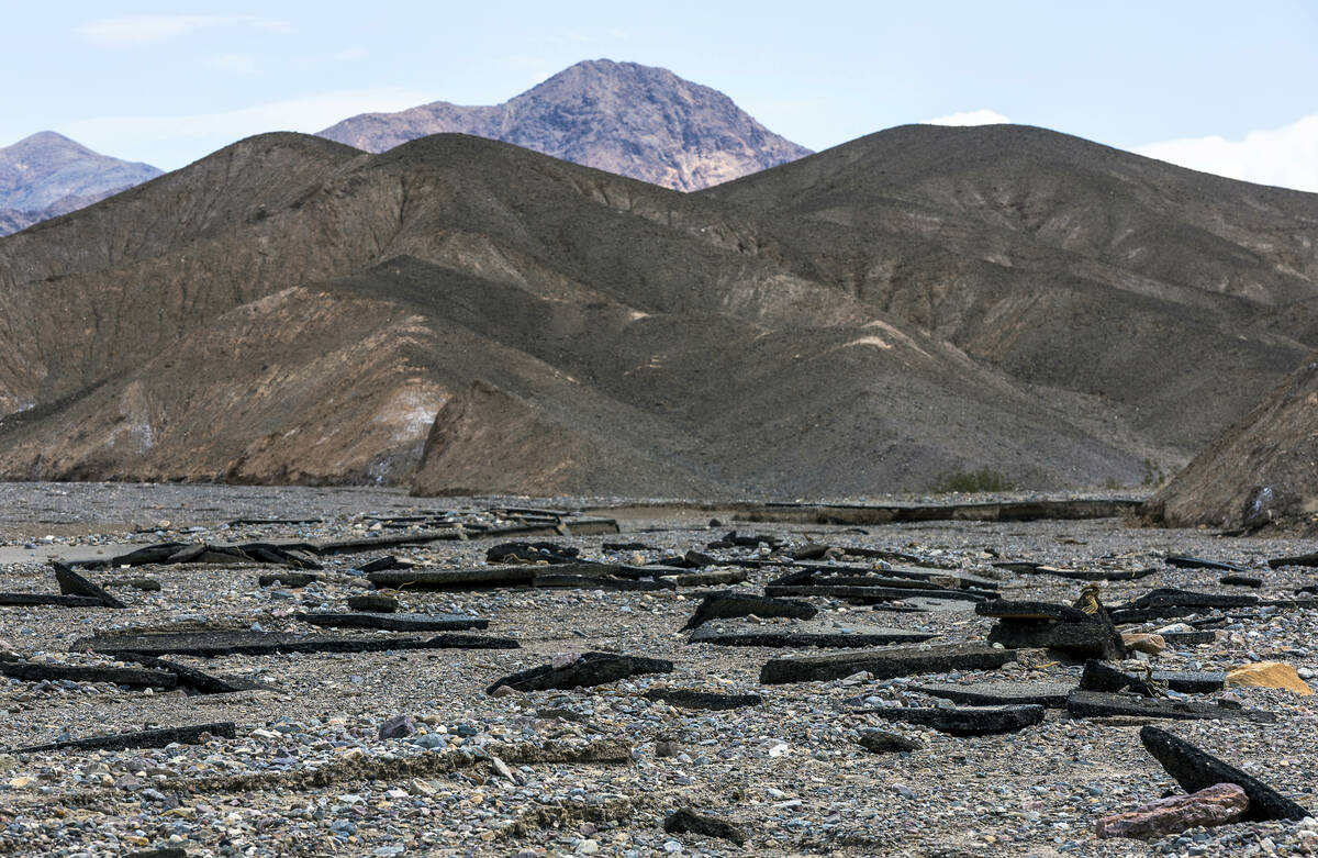
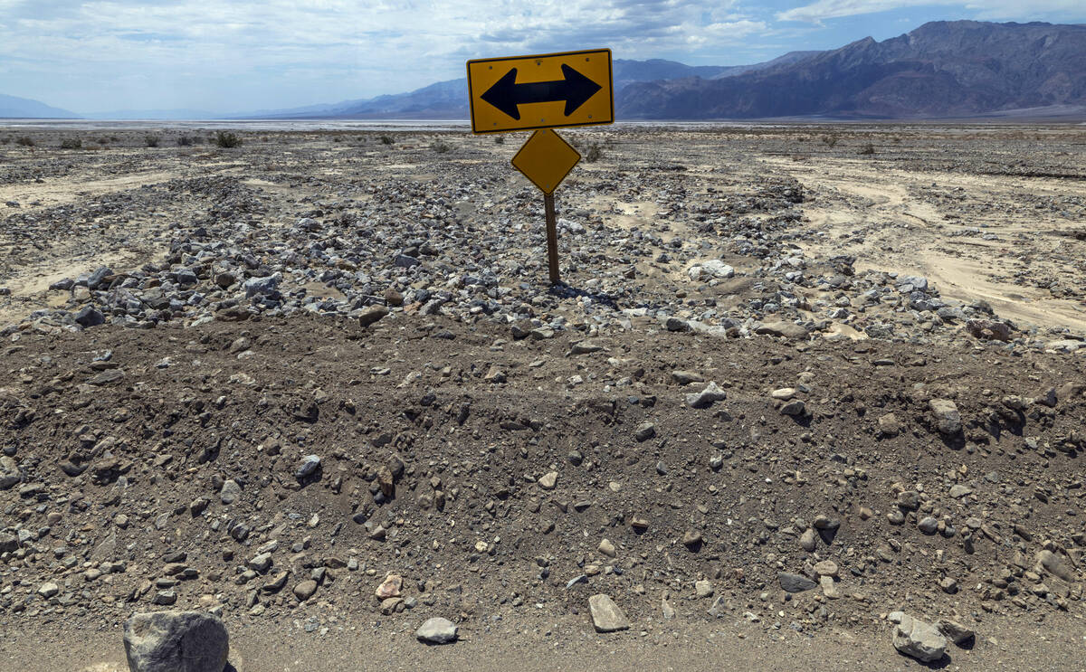
Initially, about 30 miles of Route 190 were partially or fully covered by debris. By Tuesday, crews had cleared 20 of those miles.
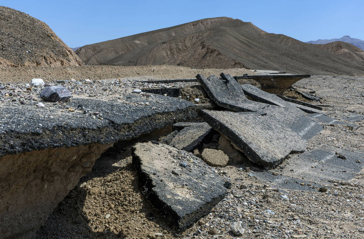
Some of those roads, such as the Beatty Cutoff Road, are still covered in debris or missing large portions. Daylight Pass Road, with large chunks of asphalt torn away, looked like a layer cake, with pieces cut out and scattered across the desert floor.
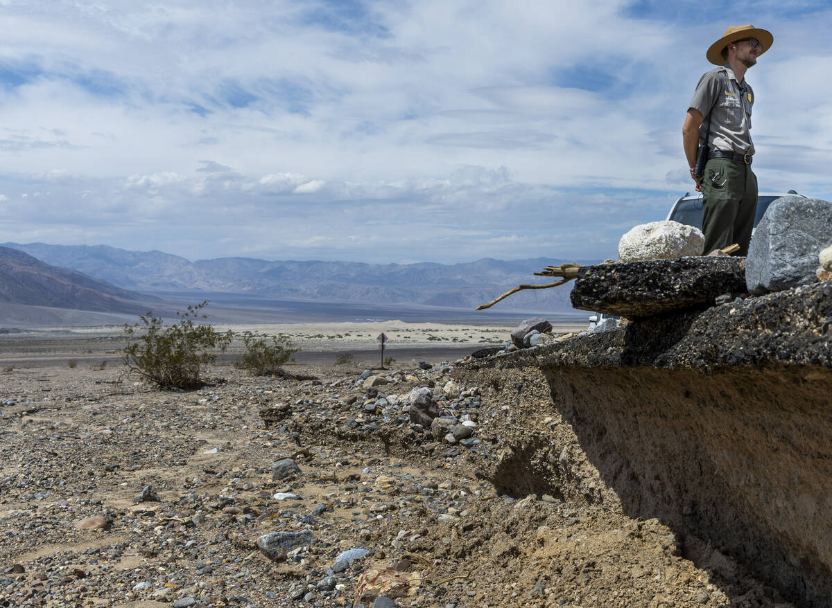
“We’re still in the assessment period,” said park ranger Matthew Lamar, when asked how long it might take to reopen all the roads and fix the damage. “We are 3.4 million acres — almost the size of Connecticut. We have 1,000 miles of roadway, both paved and unpaved.”
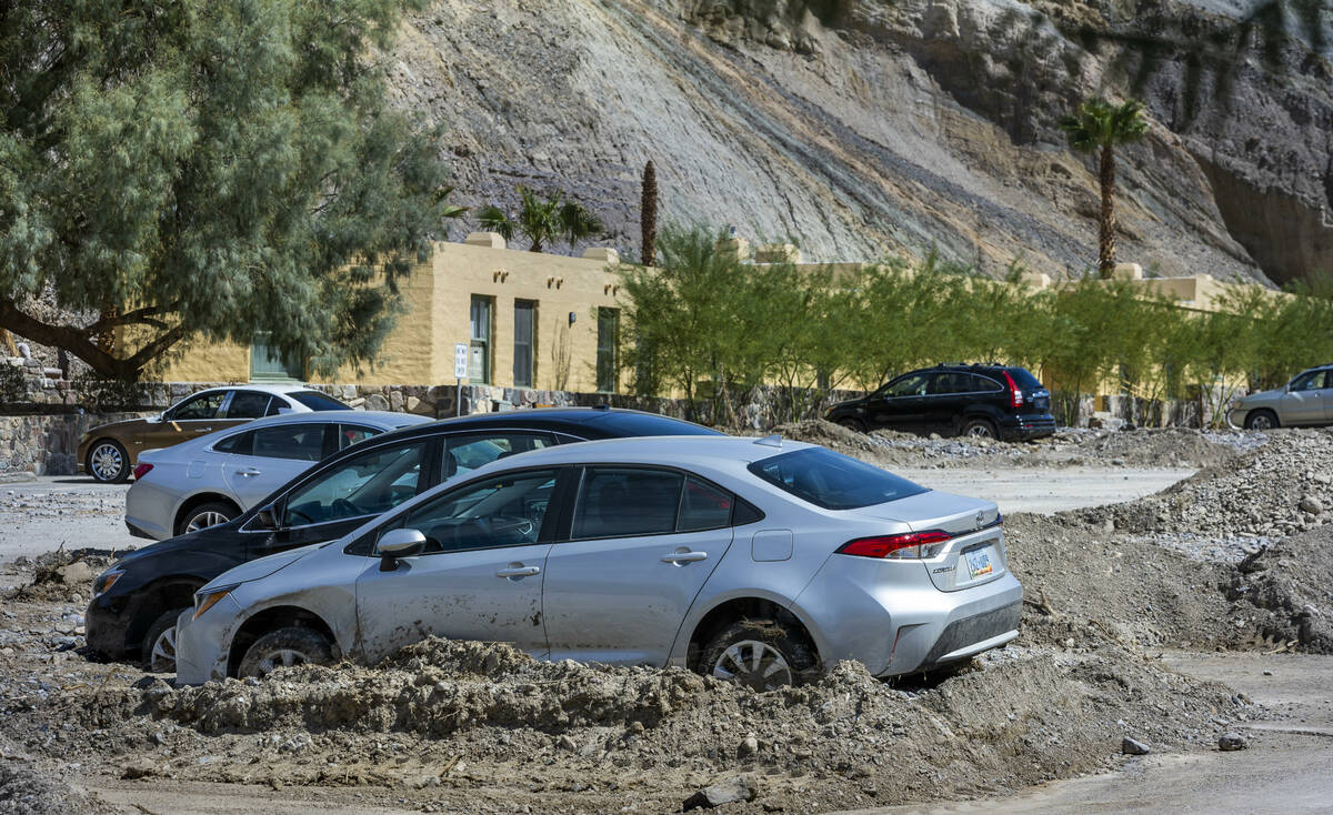
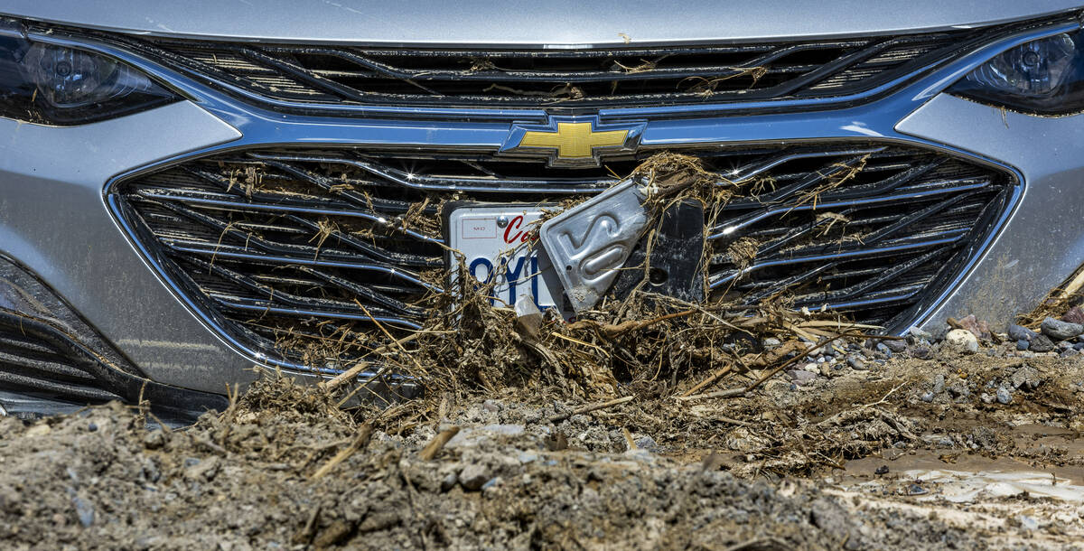
At the Inn at Death Valley hotel, cars were still stuck in the mud and being towed out.
After Friday morning’s storm, 1,000 people — about 500 visitors and 500 workers and staffers — were stranded inside the park for hours, including some overnight. The park normally gets about 1.9 inches of rain a year.
The park, while technically open if entered on foot, discourages visitors from doing so because of the dangerous heat. Death Valley set the record for the highest temperature ever recorded on the planet, at 134 degrees in 1913.
A California Highway Patrol helicopter and a Navy aircraft performed aerial searches following the latest storm, with no deaths or serious injuries reported.
“I was worried about people’s safety,” said Anastasia Roy, an education ranger with the park. “Then I was relieved to hear they were safe.”
Most visitors have left, while some — there isn’t an official count, but it could be 10, if that — have opted to stay, including a few who are camping.
“This is the worst I’ve seen it in 20 years,” David Blacker, the executive director of the Death Valley Natural History Association, which runs the gift store at the Furnace Creek Visitor Center, said of the storm.
Lamar said it’s too early to know if the recent deluge of rain will lead to a “superbloom” like in 2016, when yellow wildflowers blanketed the desert, because any bloom wouldn’t happen until the spring.
“We’ll find out,” Lamar said. “It’s hard to predict.”
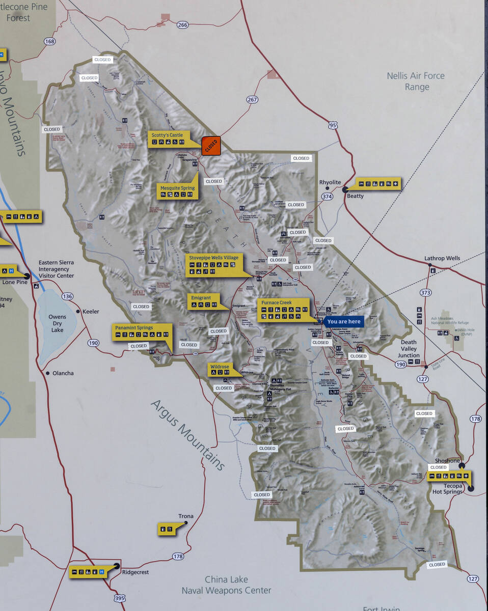
Road closures include:
— Route 190 from Trona Wildrose Road and Panamint Valley Road to state Route 127 in Death Valley Junction.
— State Route 178 from Shoshone to the Lower Badwater Gate in Death Valley.
— Paved roads into Mojave National Preserve, south of Death Valley, including Kelbaker, Cima, Essex, Zzxyz, Lanfair, Black Canyon, and Morning Star roads.
Contact Brett Clarkson at bclarkson@reviewjournal.com or 561-324-6421. Follow @BrettClarkson_ on Twitter.